MERIS Images : North America
 |
 |
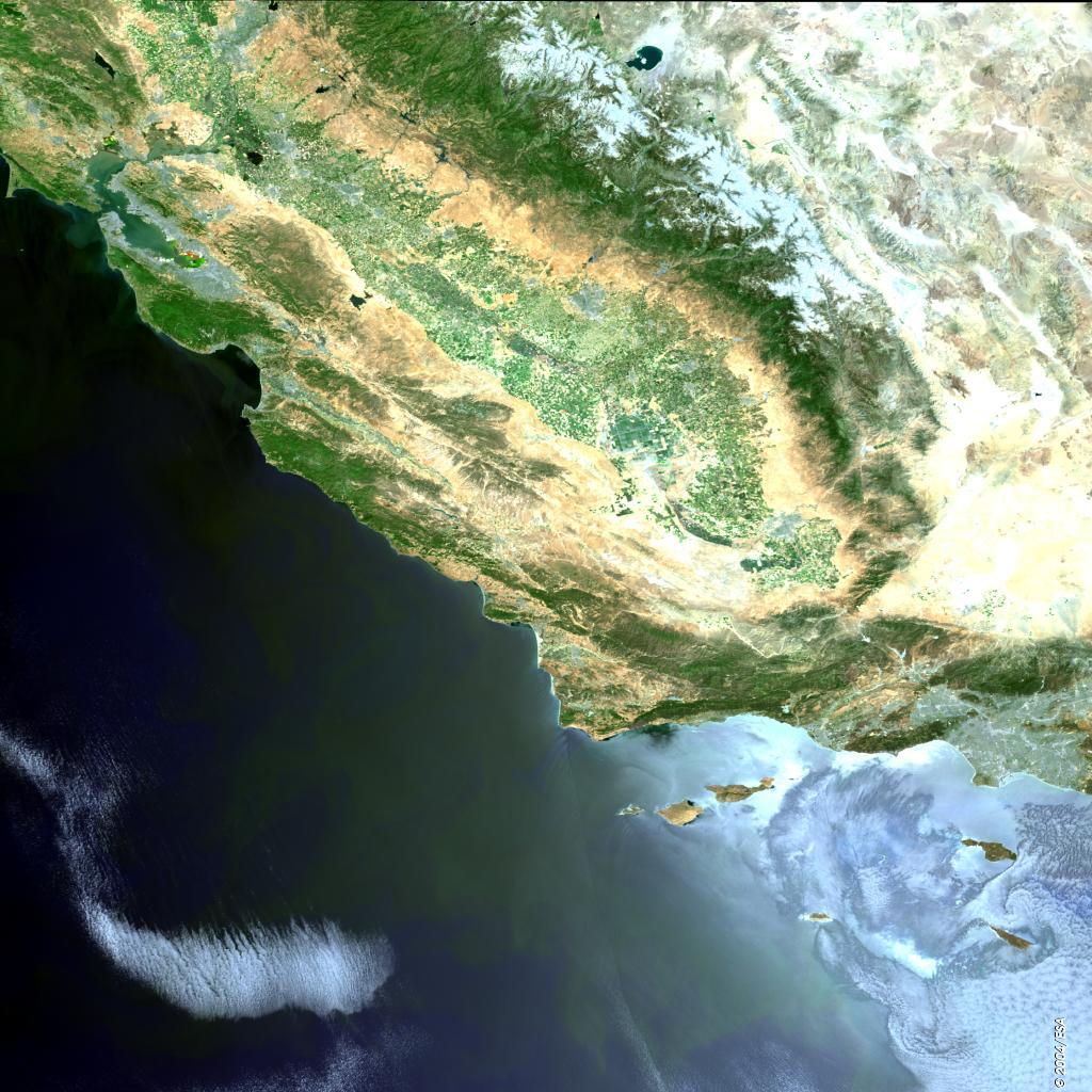
| Here is the coast of California; two cities appear as large grey areas in the image. The San Francisco metropolitan area is seen winding its way around the San Francisco Bay in the north, and Los Angeles lies to the south. Between the two cities we can see the mountains of the Coastal Ranges, separated from the ranges of the Sierra Nevada by the central valley. The valley is one of the most important agricultural areas in the USA, and on the image we can see in places a chequered pattern of farmed fields. |
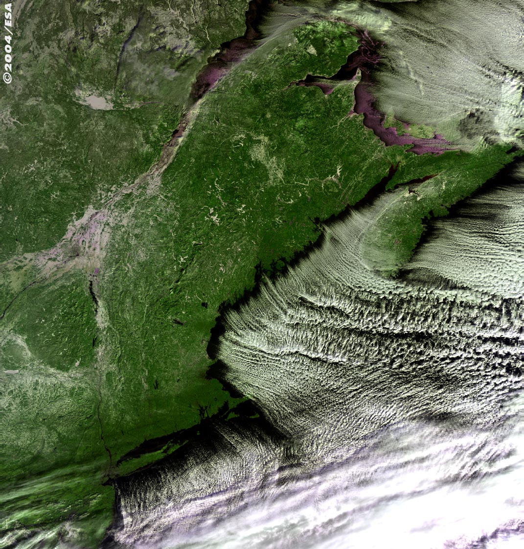
This MERIS false colour image shows a weather front encroaching
on the eastern North American seaboard. The clouds follow the shoreline;
the cities of Boston and New York can be seen. Further north is
Nova Scotia and on the east coast we can see Halifax. New Brunswick
appears across the Bay of Fundy, which is famed for having the highest
and most powerful tides in the world. At the top of the image lies the Gulf of St. Lawrence with the St. Lawrence River flowing into it. Along the river's banks, the cities of Quebec and Montreal are visible. |