MERIS Images : Oceania
 |
 |
|
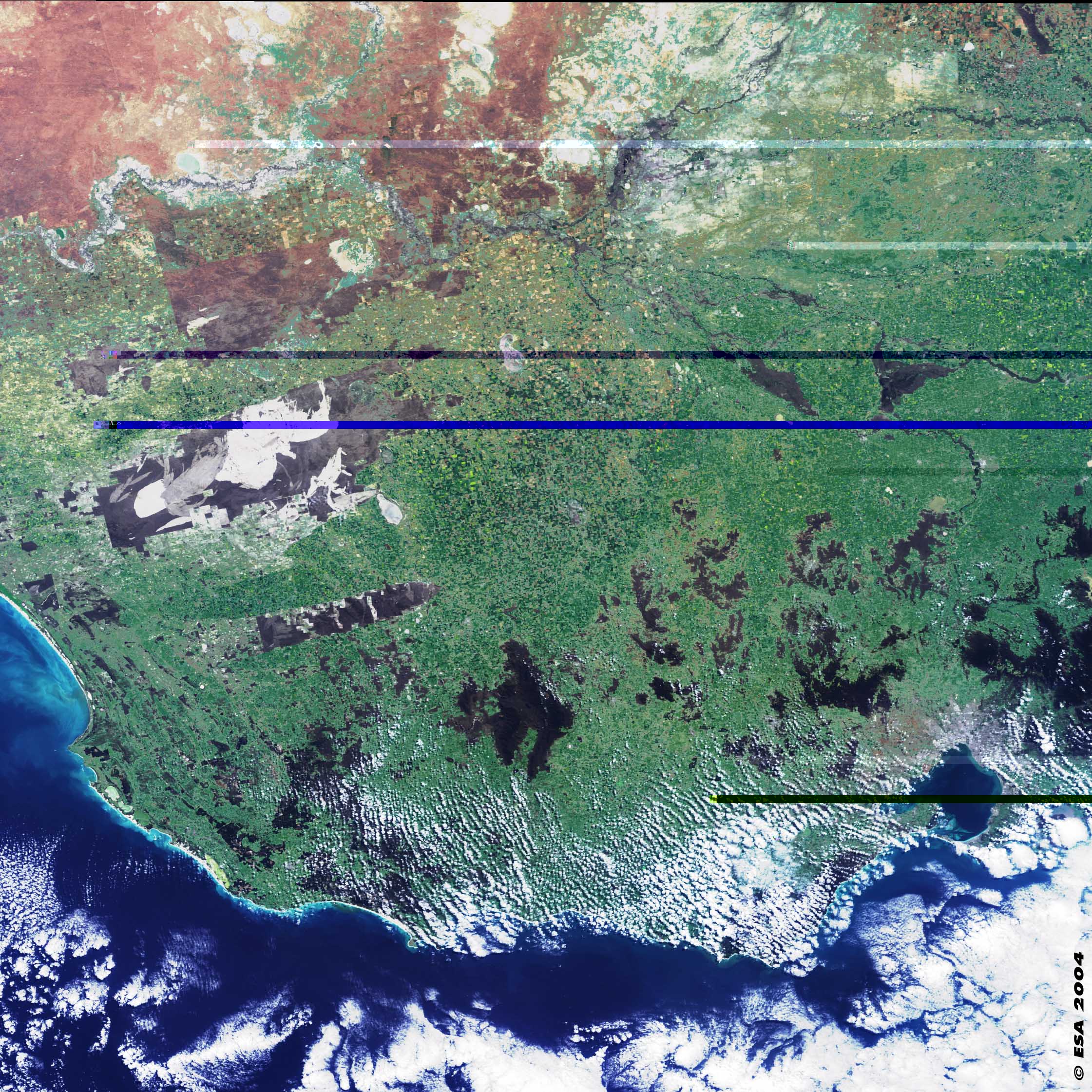
This MERIS image shows part of the state of Victoria in south Australia. The capital city, Melbourne, is seen in grey colour and partially covered with clouds in the bottom right part of the image. The marked contrast between the country's arid interior with salt lakes seen in bright white colour and the coastal regions more vegetated can be seen in the top left part of the image. The Murray River is in the top part of the image flowing towards the west where it empties into the Indian Ocean (its mouth is to the west of this image). The large dark areas (in grey colour) seen in the left part of the image surrounded by green vegetation are land-protected areas by national and state parks where the semi-arid natural vegetation is preserved. They are the Big Desert (top) and Little Desert (bottom) Parks. |
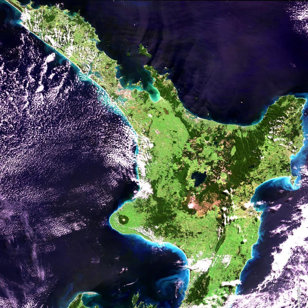
New Zealand's North Island appears here. To the northwest the cities of Auckland and Manukau can be seen in the browner shades. Much of the island is grasslands, shown in lighter green. The dark green is more forested areas, particular in the national parks of Urewera, to the east of the island and Tongariro in the centre. The circular feature in the southwestern part of the island is the forested flanks of the dormant volcano Mt. Taranaki situated in Egmont National Park. Around the island the lighter blue in the sea shows how the currents are transporting sediment. The greener area within the Bay of Plenty is also likely to be a response to the much shallower water in this area. |