MERIS Images : South America
Unless otherwise noted, all images derived from the European Space Agency's website
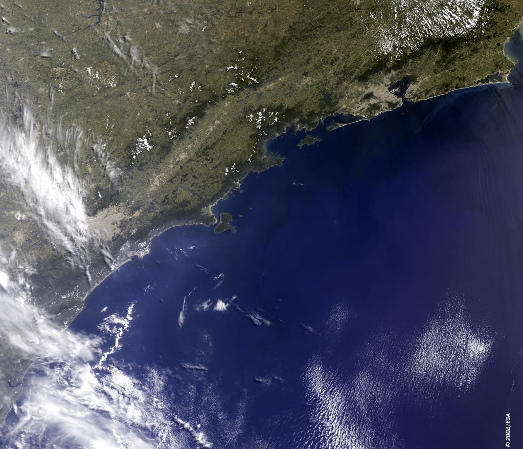 |
Here is the city of Sao Paulo (large bright brown area centre left on the image), in southeast Brazil. The city lies between the hills of the Serra Guasta on the Piratininga plain. The Tiete River flows between Sao Paulo and the more southern city of Port di Santos, located on the Atlantic coast. Sao Paulo extends along a large part of the coastal region of the southeastern Brazil. In the upper right portion of the image (light brown area) near the entrance to Guanabara Bay is the city of Rio de Janeiro. |
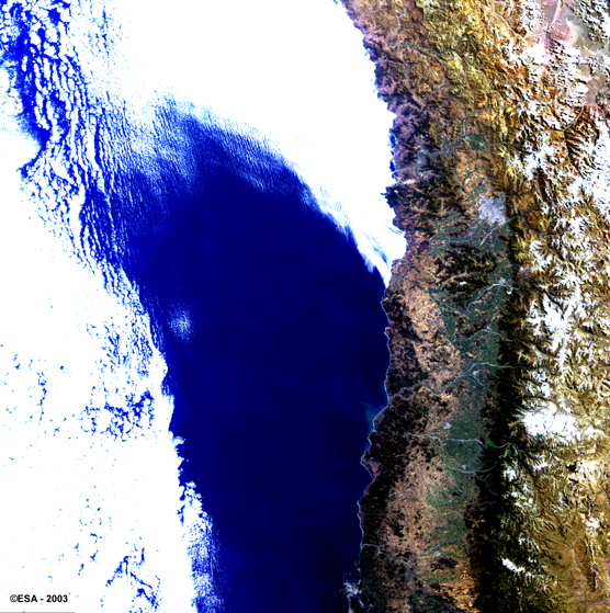 |
Most of the country of Chile can be observed on this MERIS image, particularly the area surrounding the capital, Santiago. |
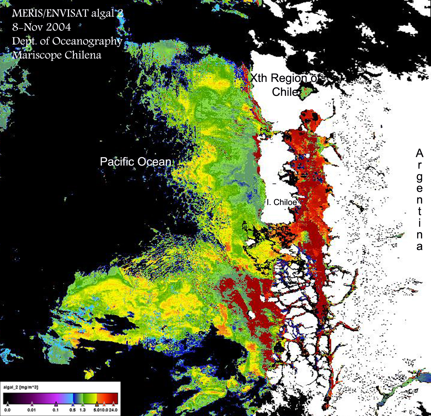 |
Ocean colour image off the coast of Chile, captured by the MERIS sensor on 10 November, 2004, showing extremely high concentrations of potentially harmful algal blooms. Image courtesy of Cristina Rodriguez, Department of Oceanography, Mariscope Chilena, Chile. |
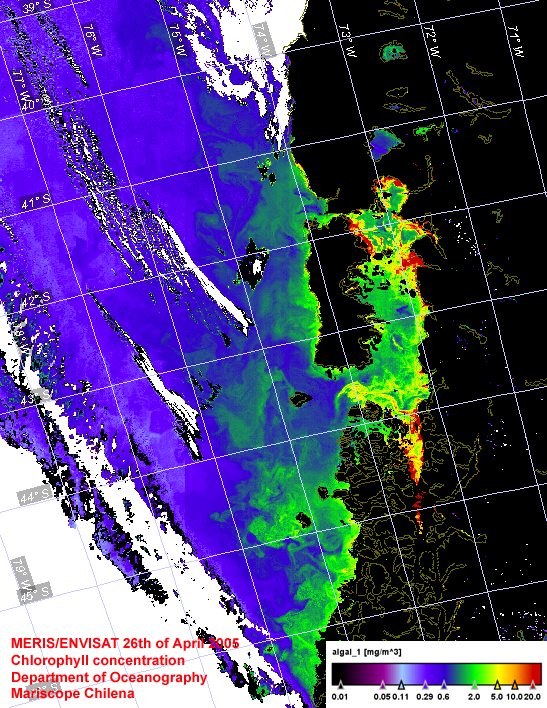 |
Algal blooms near Isla de Chiloé off the coast of Chile, captured by the MERIS sensor on 26 April 2005. Image courtesy of Cristina Rodriguez Benito, Department of Oceanography, Mariscope Chilena, Puerto Montt Chile. |