CZCS
Coastal Zone Colour Scanner
SOUTH AMERICA
Click on an image to see the full-sized version.
The Galapagos
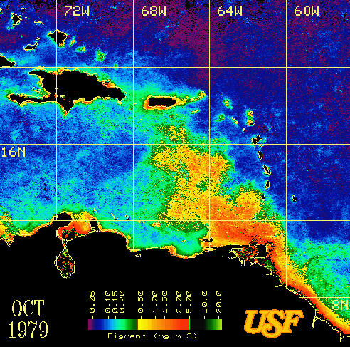 |
CZCS composite image of the eastern Caribbean Sea for October 1979, showing the spatial extent of the Orinoco River plume of induced high productivity that occurs during the summer rainy season. (Image courtesy of Dr. Frank Muller-Karger, University of South Florida Remote Sensing Laboratory.) | ||
Back | Ocean-Colour gallery | Ocean-Colour Sensors | Home