|
|
|
The minutes from the 13th IOCCG Committee meeting, which took place at the UNESCO Headquarters in in Paris, France from 12-14 February 2008, are now available on the IOCCG website at:
The SAFARI Project (Societal Applications in Fisheries & Aquaculture using Remotely-sensed Imagery) was established to accelerate the pace of assimilation of satellite Earth observation into fisheries research and ecosystem-based fisheries management on a world scale, and to address GEO Task AG-06-02. An international workshop on the Use of Remotely-Sensed Data as an Aid to Fisheries Research and Fisheries Management was recently held at the Bedford Institute of Oceanography, Canada (26-28 March 2008). Forty-four international experts in fisheries and Earth observation attended the workshop and presented lectures on remote sensing and its application to management of sustainable fisheries and aquaculture. In addition to the lecture sessions, participants exchanged views in two breakout sessions on i) Ecosystem Indicators, and ii) Information Systems for Fisheries Operations. An outline for an IOCCG monograph on this topic was drafted at the end of the workshop, with input from all invited participants. Please consult the SAFARI website for further information.
The IOCCG Committee undergoes a regular 3-year rotation of its scientific members. Dr. Mervyn Lynch (Curtin University, Australia) completed his term of service after the last IOCCG Committee meeting and will be succeeded by Dr. Scarla Weeks (University of Queensland, Australia). We thank Mervyn for his contributions over the years, and extend a warm welcome to Scarla, and look forward to her participation.
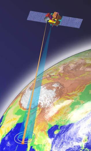
Oceansat-2 is the Indian Space Research Organization's second in the series of IRS satellites dedicated for ocean research. It will provide continuity to the services and applications of the Oceansat-1 Ocean Colour Monitor (OCM). Oceansat-2 is scheduled to be launched during third quarter of 2008. A revised Announcement of Opportunity was released in March 2008 and is open to the global scientific community for submitting research proposals towards utilization of data from Indian Payloads i.e., OCM-2 and Scatterometer in the following broad categories:
Data will be made available to the Principal Investigators (PIs) after the commissioning phase, which is expected to be around 6 months after launch. The data sets required for executing the AO projects will be provided at no cost after evaluation. Please consult the modified version of the OCEANSAT-2 Announcement of Opportunity for further information. Deadline for submission of proposals is 30 June 2008.
NASA's Ocean Biology Processing Group (OBPG) will be holding an IOP algorithm workshop in conjunction with the upcoming Ocean Optics XIX Conference (Italy, 3-4 October 2008). The long-term goal is to achieve community consensus on the most effective algorithmic approach for producing global scale, remotely-sensed IOP data products. The group will specifically review algorithm (1) parameterization, inversion, and optimization; (2) associated uncertainties; (3) spectral requirements; (4) applicable spatial and geophysical ranges; and (5) satellite inversion failure conditions (and their remediation). Workshop participants will conduct analyses on shared data sets from June to September 2008 and the Workshop itself will focus on interpretation and assimilation of the individual results.
Data from a new model run of the NASA Ocean Biogeochemical Model (NOBM) will soon be available in the NASA Giovanni system. The new period of data is now extended a year, January 1997 through December 2006. NOBM output provides daily Total Chlorophyll calculated with SeaWiFS data assimilation, and other biogeochemical data products. The spatial resolution of NOBM data is coarser than the 9km Level 3 global data products from SeaWiFS and MODIS. Data assimilation provides a model-based methodology to fill data gaps caused by cloud cover, scan swath spacing, and other observational limitations.
NASA has exercised its option for another year of global SeaWiFS data (GAC) starting on April 12, 2008.
Importing satellite data into ArcGIS just got easier! There is now an ArcGIS extension that allows users to browse THREDDS catalogs and connect directly to OPeNDAP servers to access large amounts of scientific data and ingest the data into ArcGIS desktop 9.2. This extension, called the Environmental Data Connector (EDC), uses a Java-based browser and leverages existing components from Unidata and NOAA/PMEL libraries so that users can filter large amounts of data in space and time. The user has a choice of importing the data into ArcGIS in either raster or feature format. The time stamped data can then be animated using a TimeSlider extension which is built into the EDC. A stand-alone version is also available, which provides a GUI to browse THREDDS catalogs or OPeNDAP directories, to subset the selected data in space and time, and to download the data as a netcdf file. The EDC was developed for NOAA Fisheries by Applied Science Associates, Inc. with funding from NOAA�s Satellite Research and Operation (R&O) project. The EDC is freely available and can be downloaded at www.pfeg.noaa.gov/products/EDC/. For further information please contact Cara Wilson at cara.wilson@noaa.gov.
Several new employment positions have been posted on the IOCCG website including a Marine Reseacher at the Royal Belgian Institute of Natural Sciences, an Executive Officer for IMBER in France and Project Officer for SOLAS in the UK. See http://www.ioccg.org/employment.html for further details on all job postings.
|
ESA is further expanding the Envisat dataset available free of charge on the Internet with the opening of a new service for MERIS Full Resolution data acquired over North America. This new service is established in collaboration with the Canadian Space Agency (CSA) and will provide access to all recent MERIS Full Resolution (FR) Level 1 products (MER_FRS_1P) and Level 2 products (MER_FRS_2P) covering North America (see coverage in JPG or Google Earth KML format). The new service is implemented in two phases:
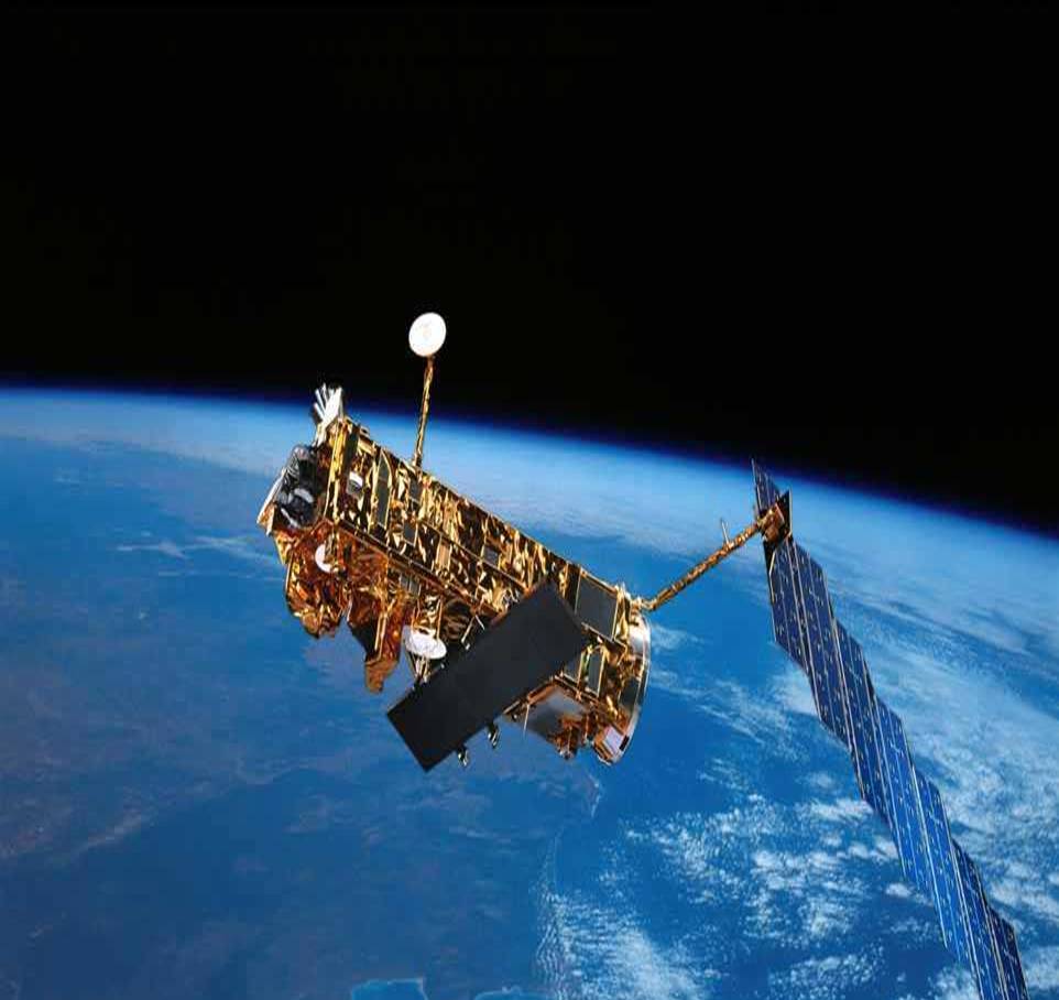
The European Space Agency recently signed a contract with prime contractor Thales Alenia Space, to provide the first Sentinel-3 Earth observation satellite, devoted to oceanography and land-vegetation monitoring, as part of the European Global Monitoring for Environment and Security (GMES) programme. ESA is responsible for the implementation of the GMES Space Component, which includes five families of Sentinel missions. The Sentinel-3 mission will produce a consistent, long-term data set of remotely-sensed marine and land products including sea/land surface temperature, ocean colour and land colour with high-end accuracy and reliability. For this purpose, it will carry an advanced radar altimeter as well as a multi-channel optical imaging instrument (Ocean Land Colour Instrument, OLCI). Sentinel-3 will be placed in a high-inclination, sun-synchronous polar orbit. Near-real time data processing and delivery will allow operational services to continuously profit from the mission. The launch of the first Sentinel-3 satellite is planned for late 2012
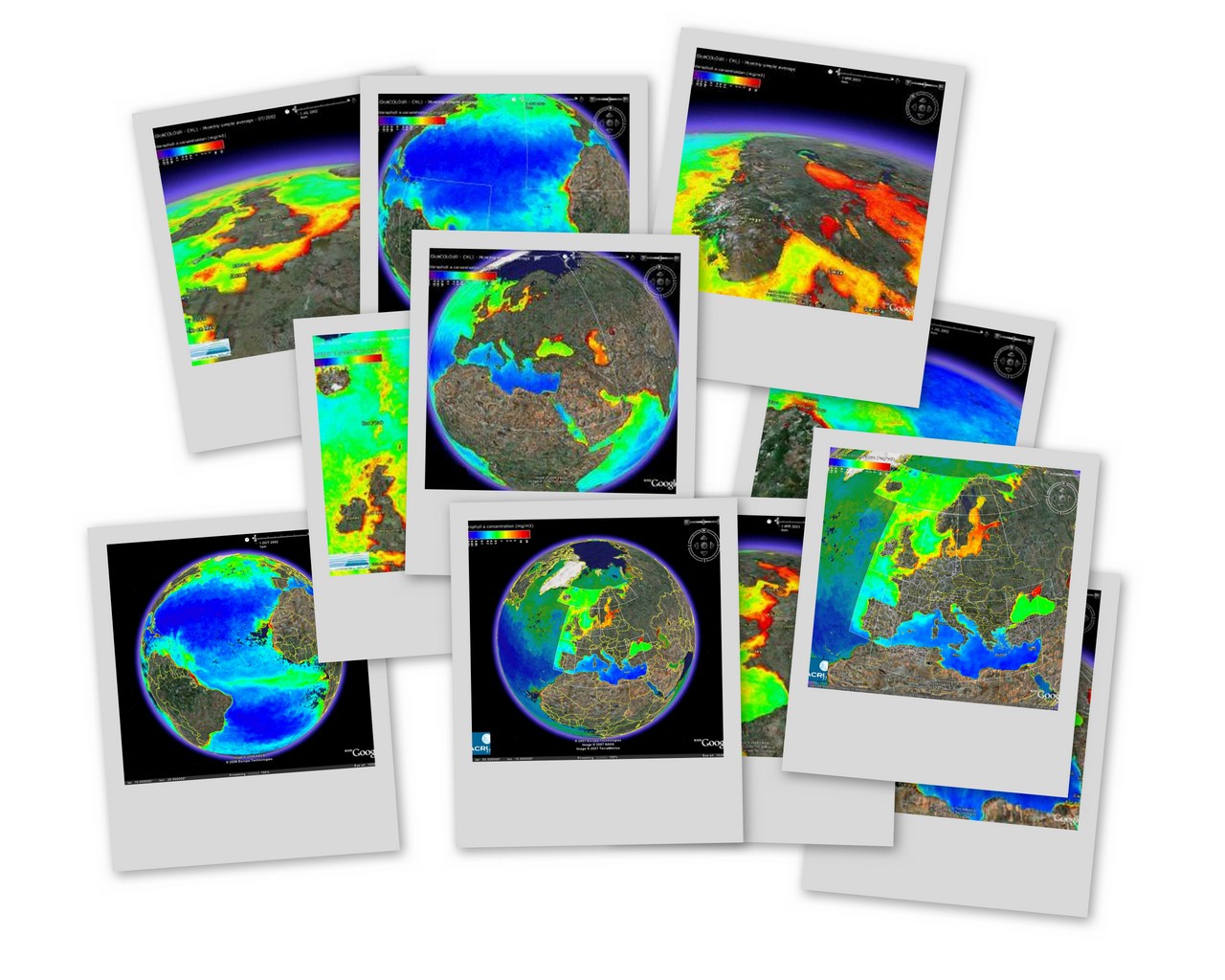
The Earth's oceans play a vital role in the global carbon cycle. Since phytoplankton take up CO2 during photosynthesis and convert it into carbohydrates, they are potentially important carbon sinks. To support ocean carbon studies and global carbon modelling, ESA's GlobColour project has merged ocean-colour data from MERIS, MODIS-Aqua and SeaWiFS to produce a 10-year dataset (1997- 2007). These ocean-colour datasets are freely available to the public via the GlobColour website. A new web portal called Hermes is now available to access the data sets. Users can select a time period, spatial region and product type and the system extracts the appropriate ocean-colour products for download. GlobColour will begin providing near-real time ocean-colour observations from mid-2008. Production of the GlobColour time-series will continue as part of the Marine Core Service of the GMES initiative from 2009.
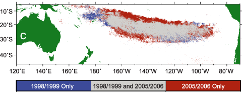
Several new references have been added to the IOCCG Recent References list, including a paper by Polovina et al. (2008) entitled "Ocean's Least Productive Waters are Expanding" which appeared in Geophysical Research Letters, Volume 35. Using a 9-year time series of SeaWiFS data, the authors demonstrated that in the North and South Pacific and North and South Atlantic, outside the equatorial zone, areas of low surface chlorophyll waters have expanded at average annual rates from 0.8 to 4.3% yr-1. They estimated that the low surface chlorophyll areas in these oceans combined have expanded by 6.6 million km2 or by about 15.0% from 1998 through 2006. The North Atlantic, which has the smallest oligotrophic gyre, is expanding most rapidly, both annually and seasonally. Mean sea surface temperature in each of these 4 subtropical gyres also increased over the 9-year period. The expansion of the low chlorophyll waters is consistent with global warming scenarios based on increased vertical stratification in the mid-latitudes, but the rates of expansion observed by these authors already greatly exceeds recent model predictions. Another recent publication by Wilson et al. (2008), which appeared in the Journal of Marine Systems, showed that the oligotrophic subtropical Pacific is often characterised by late summer blooms fuelled by endosymbiotic and unicellular nitrogen fixation as well as the vertical migration of Rhizosolenia diatom mats between the surface and the nutricline.
Abstracts are now due for the SPIE Asia-Pacific Remote Sensing Conference to be held in Noumea, New Caledonia (17 - 21 November 2008). Session AE103, entitled Remote Sensing of Inland, Coastal, and Oceanic Waters, will include technologies, methods, and applications, with a focus on the coastal environment, reef ecosystems, and lagoons. Emphasis will be placed on optically complex waters, signatures of climate change, disaster prediction, tracking, and management, and scientific analysis of properties and impacts for sustainable use of marine resources and conservation of biological diversity.
A special Fellowship for on-board training on an Atlantic Meridional Transect (AMT) Cruise is being offered by POGO and SCOR. This fellowship program is open to scientists, technicians, graduate students (PhD) and Post-doctoral Fellows involved in oceanographic work at centres in developing countries and countries with economies in transition. The selected candidate will have the opportunity to visit Plymouth Marine Laboratory (PML), in the UK, for one month prior to the start of the cruise and up to two months after the cruise. Total period of Fellowship: 5 September 2008 to 12 January 2009. Please consult the training and education section of the POGO website for further information. |
|
|
Material for possible inclusion in the IOCCG Newsletter should be submitted to the Project Scientist. Subscription to the IOCCG Mailing List.Participants receive a brief summary of the IOCCG Newsletter by e-mail (quarterly), as well as hard copies of IOCCG Reports as, and when, they become available.
|
|
|