
|
|
|
The European Space Agency’s new CoastColour project aims to increase the use of advanced information products from ESA's MERIS mission on a global scale by developing, demonstrating and validating the latest techniques for monitoring water constituents in coastal zones around the world. In particular, the project will address the user needs of scientists studying the bio- and geophysical processes in coastal waters, as well as agencies that specialize in providing water quality information. The first User Consultation Workshop will take place on 19-20 March 2009 in Cork, Ireland and will bring together users and experts to define the detailed set of user requirements for the project, including identifying the priority information types and priority regions of interest. For further information see: http://dup.esrin.esa.int/news/news174.asp
A new version of the BEAM toolbox (v4.5.1) was released on 29 January 2009. BEAM was originally developed to facilitate the viewing, analysis and processing of image data from Envisat's MERIS sensor, but it now supports a growing number of other raster data formats such as GeoTIFF and NetCDF as well as other sensors such as MODIS, PRISM and CHRIS/Proba. BEAM 4.5.1 is a maintenance release which fixes many problems users reported for version 4.5. Some important improvements regarding band arithmetic and colour palette handling have been introduced in this version.
If you work with ocean-colour data and utilize SeaDAS (the comprehensive image analysis package developed by NASA's OBPG), you probably need a way to batch process multiple files. Mike Brown of Cornell University and Jon Grant of Dalhousie University recently developed the “SeaBatch” software to facilitate batch processing of ocean-colour data derived from NASA's SeaWiFS and MODIS (Aqua and Terra) sensors. SeaBatch is a group of bash shell scripts that utilize SeaDAS. Notable functions include processing MODIS high-resolution bands, processing Level-1 to Level-2 files, spatial and temporal binning of Level-2 files, and output of Level-3 products as ascii, flat, hdf, png, etc. SeaBatch can be downloaded free of charge at http://seabatch.com/. If you are using runtime SeaDAS, an IDL license is not required. Please direct any questions, suggestions, etc. to Mike Brown (mike@seabatch.com).
See the Workshops and Conferences section of the IOCCG web site for upcoming events, including SPIE's Ocean Remote Sensing conference, to be held in San Diego, 2-6 August 2009, which includes a special programme on Ocean Remote Sensing: Methods and Applications (Conference OP510), and the 2009 ICES Annual Science Conference to be held in Berlin, Germany from 21 - 25 September 2009, which includes a theme session on “Trends in Chlorophyll and Primary Production in a warmer North Atlantic".
Cornell University is offering a two-week training course (29 May - 12 June 2009) intended to give participants the practical skills needed to work independently to acquire, analyze and visualize data sets from a wide variety of ocean satellite sensors (e.g., SeaWiFS, MODIS, MERIS, AVHRR etc.) The course will focus on developing IDL programming skills for effective data analysis. For more information visit www.geo.cornell.edu/ocean/satellite. POGO have announced three Fellowships for 2009: (1) POGO-SCOR Visiting Fellowships Programme, (2) AMT Visiting Fellowship for training on an Atlantic Meridional Transect (AMT) cruise and (3) POGO Visiting Professorship for 2009. Further information on these Fellowships can be found on the Training and Education section of the POGO website. |
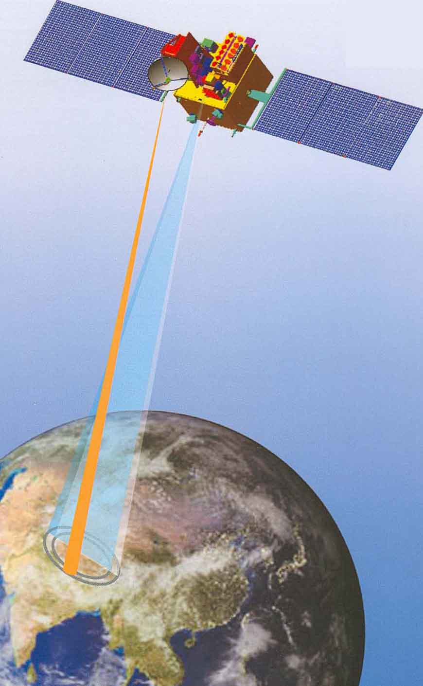
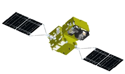
India's Oceansat-2 satellite is scheduled for launch at the end of April 2009. Oceansat-2 is ISRO’s second in the series of IRS satellites dedicated to ocean research, and will provide continuity to the applications of Oceansat-1 (launched in 1999). Oceansat-2 will carry three payloads including an Ocean Colour Monitor (OCM-2), similar to the device carried on Oceansat-1. Data from all instruments will be made available to the global scientific community after the post-launch sensor characterization, which is expected to be completed within 6 months from the launch. Many international AO proposals have also been approved for providing data. OCM data will be available at two spatial resolutions: Local Area Coverage (LAC) of 360 m, and Global Area Coverage (GAC) of 4 km. Real-time LAC data will be received routinely at the primary ground station in Hyderabad, India, while complete global coverage in GAC mode will available approximately every 4 days. OCM-2 will supplement data from the existing sensor, which has been functioning well since 1999. Data from both sensors will also be used to provide Potential Fishing Zone (PFZ) advisories to help the fishing industry (trawlers and gill-nets) reduce search time and thus lower costs, and increase their catch per unit effort.
The Japan Aerospace Exploration Agency (JAXA) recently released the first Research Announcement for the Global Change Observation Mission-Climate (GCOM-C1), along with the second announcement for GCOM-W&C. The research will focus on:
The deadline for submitting proposals is 31 March 2009. Instructions on how to apply (including a submission template) can be downloaded from the GCOM website. You can also download a PDF copy of the flyer entitled "Global Change Observation Mission 2nd Research Announcement (GCOM-C1 First RA)".
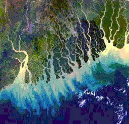
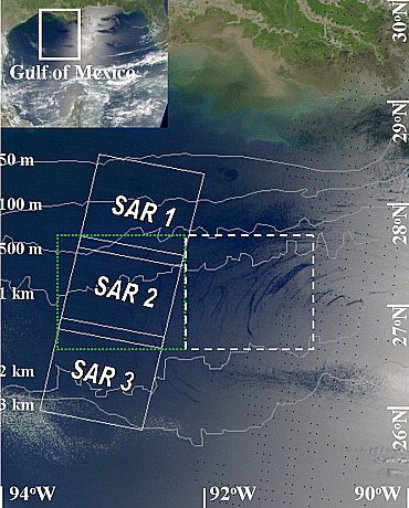
In the past, most of the estimates of oil slicks have relied on Synthetic Aperture Radar (SAR) data which are limited by coverage, revisit frequency, and cost. However, Hu et al. (2009) demonstrated that MODIS imagery can be used to detect oil slicks even in the clearest ocean water, based on the same backscattering principles of SAR. The authors used MODIS 250-m imagery to detect and quantify surface oil slicks the northwestern Gulf of Mexico, which they concluded were the result of natural seepage from the ocean floor. They found that natural oil seepage into the Gulf of Mexico could be higher than previously thought. One 250-m resolution MODIS image from May 2006 had 164 oil slicks covering a total area of 1900 km2. Inspection of over 200 images for the month of May between 2000 and 2008 revealed similar slicks on at least 50 images. The systematic and global application of MODIS 250-m imagery, with its near-daily revisit and wide sun glint coverage in the tropical and subtropical oceans, can complement SAR observations and help locate natural seeps and improve estimates of seepage rates in the world's ocean.
Several new positions have been added to the Employment Opportunities section of the IOCCG website, including a PhD Fellowship at LOV, France, a research post-doc position at NRL, and several others. |
|
|
Material for possible inclusion in the IOCCG Newsletter should be submitted to the Project Scientist. Subscription to the IOCCG Mailing List.Participants receive a brief summary of the IOCCG Newsletter by e-mail (quarterly), as well as hard copies of IOCCG Reports as, and when, they become available.
|
|
|

 Several new references have been added to the IOCCG