Twelvth IOCCG Committee Meeting
![]() 16-18 January 2007,
16-18 January 2007,
Swakopmund, Namibia
 ..
..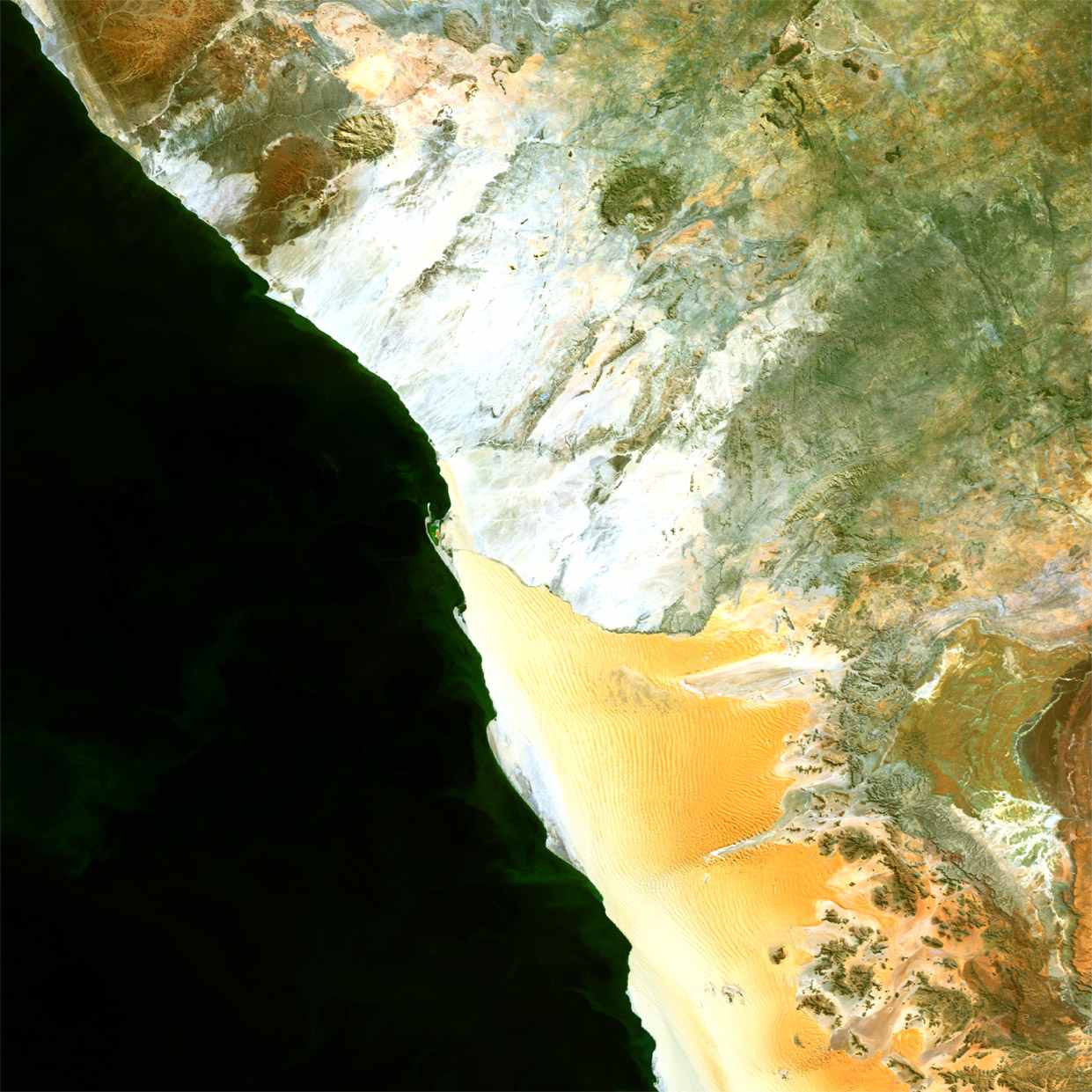
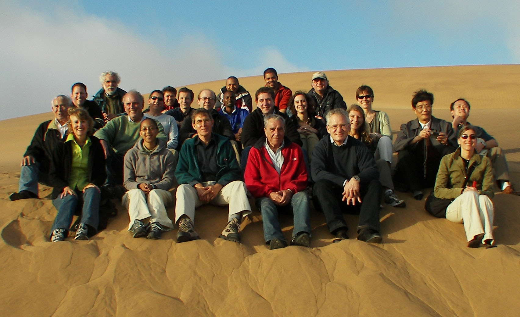
(Left) IOCCG-12 participants in the Namib desert, (right) MERIS image over the Namib Desert, captured on 22 August 2003. Credit ESA. Click on images for larger view
MINUTES
1. OPENING
1.1 Welcoming Address
The 12th Committee meeting of the IOCCG opened at 9h00 in the Hansa Hotel, Swakopmund, Namibia, and was chaired by Prof. James Yoder. Participants were warmly welcomed by the host, Dr. Neville Sweijd of the BENEFIT organisation, who wished everyone a successful and productive meeting. He noted that the Benguela upwellling region was an important ecosystem internationally, and had become the focus of numerous studies, including those dealing with remote sensing of ocean colour.
1.2 Adoption of Agenda
The agenda was adopted as stands.
1.3 Adoption of the minutes of the 11th Committee meeting
The final version of the minutes of the 11th Committee meeting were considered as adopted.
1.4 Status of action items arising from the 11th Committee meeting
The Chairman summarised the status of the 11th Committee meeting actions, most of which had either been completed, or would be addressed later in the meeting.
Action 11/1 – A new title for the “Why Ocean Colour?” report would be discussed.
Action 11/2 – Potential changes for the “Coastal Zone” working group would be discussed during
the meeting.
Action 11/3 – Data modelling issues were still open and would be discussed during the break. It was noted that Ian Robinson had produced a report about assimilation of ocean-colour data into models, in connection with the MERSEA Integrated Project.
Action 11/4 – Terms of reference for the PFT WG had been received and a report would be presented during the meeting.
Action 11/5 – IOCCG had submitted a copy of the data merging report to GlobCOLOUR.
Action 11/6 – Information on merging techniques had been conveyed to GlobCOLOUR.
Action 11/7 –Eric Thouvenot and Nick Hoepffner represented IOCCG at the 1st GlobCOLOUR User Workshop.
Action 11/8 – Lectures on ocean colour could be recorded at WHOI, but it would be very expensive. This item was still open, if anyone had any other ideas.
Action 11/9 – The wording about the ocean-colour component of the Global Climate Observing System (GCOS) had been changed through IOCCG representation at various GCOS meetings. Currently the situation regarding ocean-colour sensors was more accurately represented in the GCOS report.
Action 11/10 –NASA would ensure that IOCCG interests are conveyed at CEOS meetings.
2.0 IOCCG WORKING GROUPS 2.1 Ocean-Colour Algorithms
ZhongPing Lee (NRL) gave the final report of the Ocean Colour Algorithm working group. He noted that all of the proposed tasks had been completed i.e. an in situ dataset had been assembled, a dataset based on known information had been synthesized, algorithm cross-comparison and evaluation had been carried out, and storage of data and algorithms on the IOCCG webpage had been initiated. The final report was published in 2006. He was still waiting for algorithm software from some of the authors, and queried whether the IOCCG should also host algorithms that had not been evaluated in Report 5. The Chairman recommended that if the algorithms had been accepted or were used by a space agency, then the link to the agency webpage could be posted. Otherwise the IOCCG could accept peer-reviewed/published algorithms. Algorithms for inclusion on the IOCCG website should be submitted to the Project Scientist, Venetia Stuart.
Dr. Lee also suggested that the IOCCG consider constructing a web-based ocean-colour library that was categorized and searchable, and would also contain softcopies of all the references. Paula Bontempi noted that NASA had performed a literature search, just for NASA sensors, and that there were many thousands of publications. It would be an enormous job to maintain such a library, and would be very labour intensive. She suggested that it might be possible for IOCCG to link to other web-based publication lists, one of which was currently under review by NASA.
2.2 Co-ordination of Merged Data-Sets
Paula Bontempi (NASA) reported that the data merging working group had completed the final report, which was currently in press (edited by Watson Gregg). Working group members had come up with a number of recommendations including: the production of Level-3 data by all ocean-colour missions; updating links to international in situ data sets from the IOCCG website; merging efforts to emphasize chlorophyll (the primary derived geophysical product of ocean-colour sensors); knowledge of ocean-colour mission and sensor characteristics; a comprehensive set of merger evaluation criteria; merged data to be at the highest possible temporal frequency and spatial resolution; and a proposal to form an IOCCG working group to examine data set stability (frequent reprocessing improves data quality, but hampers the development of time series). The working group also queried the use of logarithms in statistical analysis and suggested that the IOCCG form a working group to address statistical analysis in remote sensing, and proposed Janet Campbell as the lead. Samantha Lavender noted that error analysis was essential for users, but would not be routinely produced by the GlobCOLOUR Project. Roland Doerffer suggested that the topic could be dealt with during, or after, the proposed training course/workshop at GKSS in 2008 (Item 6.6), and that a report could be prepared on the topic. Jeremy Werdell and Shaun Bailey were proposed as potential working group members. The Chair requested suggestions for other leads (should Janet not be able to take up this task) and other potential WG members.
ACTION 12/1: COMMITTEE MEMBERS TO SUBMIT TO ROLAND DOERFFER THE NAMES OF PEOPLE WHO MIGHT BE INTERESTED IN A WORKING GROUP ON ERROR ANALYSIS.
ACTION 12/2: ROLAND DOERFFER TO INITIATE THE PROCESS OF FORMING A WORKING GROUP TO ADDRESS ERROR ANALYSIS IN REMOTE SENSING.
2.3 Global Ecological Provinces
Mark Dowell (JRC) provided an update on the Global Ecological Provinces working group. The group was established at the end of 2004 to review the utility of ocean partitions as a tool for interpretation and application of ocean-colour data. In addition, the group would review the application of ocean-colour partitions to oceanographic problems such as the ocean carbon cycle, climate change and resource management. Activities in 2006 included Mark Dowell and Trevor Platt chairing a session on Ecological Provinces at the Oceans Science meeting (February 2006), final contributions for Chapters 3 and 6 received in May 2006, informal discussions with participants at the GOOS/GEO Chlorophyll workshop in Plymouth (September 2006), Trevor Platt and Shubha Sathyendranath participating in a GEO Ecosystem classification meeting in Paraguay (October 2006), and the text for new Chapter 5 revised. The report was more or less complete, apart from the final chapter on recommendations and conclusions. Chapter 5 on “Retrieval of phytoplankton biomass and primary productivity” would provide a brief overview of class-based algorithms, but it was suggested that the IOCCG also establish a working group to examine regional algorithms in more detail.
The Chair noted that the IOCCG had already published a report on different algorithms (although not regional) and suggested that this topic be postponed until the Global Ecological Provinces report was published. He also proposed that Mark Dowell present a short paper at the next IOCCG meeting on how this could be done.
ACTION 12/3: MARK DOWELL TO PRESENT A SHORT PAPER AT NEXT IOCCG MEETING ON THE TOPIC OF REGIONAL (CLASS-BASED) ALGORITHMS.
Several of the WG participants were interested in continuing the discussions on ecological provinces after completion of the report. It was suggested that an IMBER Research Project Endorsement could be a possibility, and perhaps a proposal to EU’s Seventh Framework Programme (FP7). In addition, a “live” Mapserver version of report could be hosted by JRC, using some of the datasets presented in the report. The complete version of the draft report would be sent out to working group members by June 2007, and it was hoped the report would be published this year. The Chair drew attention to the classification workshop in Paraguay that was attended by Trevor Platt. He noted that there was a task in GEO for classification of ecosystems and that there might be interest in ocean classification. Mark Dowell noted that the FP7 programme for research and technological development had taken the GEO 10-yr work plan and identified tasks for funding. Although there were no classification items, it might be possible to add some next time.
2.4 Operational Ocean Colour: “Why Ocean Colour?”
The Chairman updated the Committee on the history of this working group, which was initially proposed by Trevor Platt. The idea was to write a report aimed at policy makers interested in societal benefit areas, and to lay out the important applications of ocean colour, both real and potential. The working group had had a number of meetings (Rhode Island, September 2005 and JRC November 2005) under the leadership of Chris Brown, although not much activity was reported over the past year. Of the ten proposed chapters, five were in good shape, four were half complete and one (Ocean Colour as an Avenue to Exploration and Discovery) had only a rough outline. It was noted that there was much international interest in coordinating earth observations and that it was critical to have the report written. Nicolas Hoepffner (JRC) indicated that he was interested to help get the report finished, perhaps in consultation with Trevor Platt. Suggestions for possible new people to participate in group included Wayne Esaias and Cara Wilson.
The Committee agreed that the final product should be attractive with good figures. Yves Crevier noted that this type of report would be very important for CSA, and that they would be willing to support a consultant to provide the text. The Chairman proposed two final products: a relatively short report that reflects the outcomes in policy-making language, and a longer IOCCG report. Peter Regner pointed out that some information was summarised in the IGOS Oceans and Coastal Theme reports, which should also be incorporated.
ACTION 12/4: NICOLAS HOEPFFNER TO CONTACT TREVOR PLATT AND COME UP WITH RECOMMENDATIONS ON HOW TO PROCEED WITH THE “WHY OCEAN COLOUR” REPORT, INCLUDING POSSIBLE NEW MEMBERS FOR THE WORKING GROUP.
ACTION 12/5: JIM YODER TO OBTAIN EXISTING MATERIAL FOR THE REPORT FROM CHRIS BROWN.
2.5 Ocean-Colour Remote Sensing in the Coastal Zone
The Chairman reported that at last IOCCG meeting Curt Davis and Arnold Dekker were charged with leading a working group on ‘Requirements for Ocean Colour Remote Sensing for the Coastal Zone’. A number of recent publications and several initiatives with potential overlap had led the group to reconsider whether there should still be a working group on this topic. Dr. Davis proposed an alternative approach i.e. publishing three papers on three different aspects of coastal zone remote sensing:
- How best to use the data from current 1-km resolution sensors (MODIS, MERIS, SeaWiFS) to improve processing for coastal observations
- Use of a sensor in geosynchronous orbit for coastal zone studies; and
- High spectral and spatial resolution sampling of optically shallow waters for studying coral reefs and sea grasses.
After much debate, the Committee agreed that it was important for IOCCG to have a report on remote sensing in coastal waters, although there were some reservations about having three published papers versus an IOCCG report. It was recommended that an introduction into the topic of high spatial resolution data be written at the end of the “Why Ocean Colour?” report, and the Committee agreed that the science questions and scientific justification should be written before addressing the requirements. It was also pointed out that topic number (i) already been done with MERIS data, and that there was also some overlap with IOCCG Report 3. Mark Dowell and Roland Doerffer also suggested that there should be an activity on regional or class-based algorithms, and that the error should be quantified on a pixel by pixel basis.
The final consensus on this topic was that a new working group should be formed to address the issues related to ocean colour from a geostationary orbit, an area of interest for KARI (South Korea) as well. Because of funding limitations it was decided to postpone this working group until next year, and to look for a suitable Chair. High spatial resolution sensors were seen as less of a priority, since there was less chance of influencing design specifications at this stage.
ACTION 12/6: AT NEXT COMMITTEE MEETING, ADDRESS ISSUE OF FORMING A WORKING GROUP TO EXAMINE OCEAN COLOUR FROM A GEOSTATIONARY PLATFORM.
2.6 Phytoplankton Functional Types (PFTs)
Heidi Sosik (WHOI) presented an overview of the PFT working group on behalf of the Chair, Cyril Moulin. The first meeting of the group took place in July 2006 at CNES, with a follow up meeting held after the Ocean Optics meeting in Montreal (October 2006). A third meeting was tentatively scheduled for June 2007 to discuss the first draft of the report. The final draft of the report was scheduled to be circulated by October 2007. The terms of reference for the group included defining the major PFTs and proposing a common terminology, identifying PFTs from ocean-colour data, reviewing the techniques or algorithms to detect PFTs from marine reflectances, and making recommendations about which studies/measurements are required. Examples were given of some of the ways in which different sets of functional types have been used by various scientific disciplines. An outline of the report was presented, which included six chapters: Chapter 1 would be an introduction to PFTs, Chapter 2 would examine the mechanisms of possible retrieval of PFTs from remote sensing, focussing on the inherent optical properties of phytoplankton, Chapter 3 would deal with inverse models with specific examples, Chapter 4 would highlight existing remote sensing algorithms, Chapter 5 would include comparisons of existing algorithms while Chapter 6 would summarize the conclusions and recommendations.
The Chair noted that the WG had made much progress in a short time, and that they had a rigorous schedule. He recommended that a draft report be circulated to Committee members before the next WG meeting, and that the WG Chair communicate regularly with working group members. It was also recommended that only the leads for each chapter attend the next WG meeting.
ACTION 12/7: CHAIRMAN TO CONTACT CYRIL MOULIN TO ENCOURAGE FREQUENT COMMUNICATION WITH PFT WG MEMBERS.
2.7 Calibration of Ocean-Colour Sensors
The Chair of the working group, Robert Frouin (SIO), had submitted two chapters of the calibration report: Chapter 1 by Howard Gordon on “Definitions and Requirements”, and Chapter 3 by Bertrand Fougnie and Robert Frouin on “Calibration Using Natural Earth Targets”. The other two chapters would be submitted later this year (Chapter 2 on “Calibration Using On-board Devices”, and Chapter 4 on “Recommendations”). The Chair encouraged Committee members to read these two chapters and provide Robert Frouin with comments and/or suggestions.
ACTION 12/8: COMMITTEE MEMBERS TO READ THE TWO COMPLETED CHAPTERS FROM THE CALIBRATION WG REPORT, AND SUMBIT COMMENTS TO ROBERT FROUIN.
2.8 Atmospheric Correction Algorithms
The Chairman noted that this WG had been around for some time. The report from the working group Chair, Menghua Wang, stated that the atmospheric correction algorithms for the various sensors had been evaluated and compared using the common simulated data sets. A draft outline for the IOCCG working group report had been circulated to WG members, along with detailed results from algorithm comparison exercises. It was hoped to have the draft report ready this year. David Antoine noted that mission algorithms had evolved over the past 4-5 years, so if the results were presented as a comparison of operational algorithms they may not be valid. However, the report could be presented as a comparison of different approaches to the same problem, explaining in the introduction that the research was conducted a few years ago. The conclusions would still be valid and the data would be of interest to others. It was also recommended that the test data set be made freely available so that others could test their algorithms.
ACTION 12/9: JIM YODER TO CONTACT MENGHUA WANG TO ENCOURAGE HIM TO GO AHEAD WITH THE REPORT, AND TO SEE WHAT PROGRESS HAS BEEN MADE. ALSO INQUIRE ABOUT AVAILABILITY OF TEST DATA SET.
3.0 PROPOSALS FOR NEW IOCCG ACTIVITIES 3.1 Preparation of a Scoping Paper for a CEOS Ocean-Colour Constellation
The Chairman briefed the Committee on the background of GEO – the Group on Earth Observations. This was an international, high level, initiative to set up a system of earth observing systems to benefit societal needs. The IOCCG is an Associate Member of CEOS (Committee on Earth Observation Satellites) which is seen as the space component of GEO. CEOS established a task team called SIT (Strategic Implementation Team) to examine how space agencies can best participate in GEO and become relevant to the operational requirements of GEO. They proposed the concept of “CEOS Constellations” to better address space-based Earth observation needs on a global basis without eroding the independence of individual agencies. This would lead to better coordination of earth observing missions and combined outputs, which are relevant to specific applications and other societal benefit areas as defined by GEO. The Chairman considered submitting a scoping paper for an ocean-colour constellation.
An example was given for surface topography (altimetry) with various agencies participating. Something similar could be done for ocean colour, together with a time scale of various missions to describe the virtual constellation. The Chair outlined the various steps of the process, starting with the submission of a proposal to the Chair of SIT. He recommended that IOCCG participate in the first step, which might not get approval this year as CEOS was interested in completing the four prototype proposals first. Once the proposal had been accepted, a study team could be formed. At the last SIT meeting, Gregg Withee (NOAA) and Stephen Briggs (ESA) had encouraged IOCCG to submit a proposal. The general consensus was that the IOCCG should submit a short proposal directly to Mike Rast at the GEO Secretariat, outlining which GEO-defined tasks could be addressed by ocean colour, and which additional tasks could be accomplished with new technology (e.g. high spectral and spatial resolution sensors). Mark Dowell agreed to help with the initial proposal via email, and would use the timeline of ocean-colour missions from the ChlorOGIN workshop.
ACTION 12/10: JIM YODER AND MARK DOWELL TO PREPARE A SHORT PROPOSAL FOR AN “OCEAN COLOUR CONSTELLATION” FOR SUBMISSION TO THE GEO SECRETARIAT.
3.2 Implementing Argo Floats with Optical and Bio-optical Sensors
André Morel (LOV) presented a proposal to implement Argo floats with optical and bio-optical sensors. Argo floats are used for profiling temperature and salinity as they descend from the surface to 2,000 m, over a period of 6 hours. The floats drift for 10 days at 2,000m then ascend to communicate with the surface. Currently there are 2,768 floats in the global ocean, performing temperature and salinity profiles every 10 days. Data acquisition is near-real time and there is rigorous data control in a well organised system.
Prof. Morel noted that it would be a valuable approach to implement Argo floats with bio-optical sensors for an extension of Cal/Val activities, and for bio-optical/bio-geochemical interpretations. Examples were given of a number of initiatives to implement Argo floats with various instruments e.g. fluorometers, oxygen probes and radiometers. The PROBIO project, headed by Hervé Claustre (PI), planned to equip Argo floats (to be deployed in 2007) with various optical sensors. Another initiative by IOCCP was to implement Argo floats with oxygen probes. The advantages to space agencies would include validation at a relatively low cost, access to remote areas of the ocean, and long-term monitoring with almost real-time response. In addition, data could be obtained in high latitudes or under cloudy conditions.
IOCCG could encourage space agencies and oceanographic institutes to support initiatives for implementing such sensors on Argo floats, and could also contact Argo (and IOCCP) for authorisation and coordination. In addition,IOCCG could help define the technical requirements for the sensors as well as standard protocols, data availability, and storage facilities. Furthermore, IOCCG could facilitate international cooperation for the best use of these data.
The Committee noted that this was a very important and timely issue, and they were supportive of forming an IOCCG working group to address the deployment of bio-optical sensors on Argo floats. Stewart Bernard recommended that the working group also address the issue of autonomous underwater measurements in the coastal zone (e.g. gliders, AUVs). Hervé Claustre was proposed as a potential chair of the working group. Nominations for other potential members of the working group included Mary Jane Perry, Oscar Schofield, Heidi Dierssen, Stewart Bernard, Mark Moline, Ian Barton, Bob Arnone, Kevin Ruddick, Kai Sřrenson, Ruediger Roettgers, Gregg Mitchell, plus a representative from China and Japan.
ACTION 12/11: CHAIRMAN TO CONTACT ARGO PROJECT FOR AUTHORISATION TO IMPLEMENT BUOYS WITH BIO-OPTICAL INSTRUMENTS.
4.0 AGENCY REPORTS 4.1 NASA (USA)
Paula Bontempi (NASA) presented an update on the SeaWiFS and MODIS missions. Since the last IOCCG meeting, a MODIS HiRes module had been released in SeaDAS, the Chesapeake Bay demonstration study had been initiated to try and fine-turn products, and the NO2 absorption correction algorithm had been completed (submitted to Applied Optics for review). In addition, the reprocessed CZCS (800 m resolution) and OCTS (4-km resolution) data sets were now available on the OceanColor Web (http://oceancolor.gsfc.nasa.gov/). The on-going debate is whether a consistently-processed, merged, data set is better than a climate quality data set. Qualitative MODIS-Terra ocean-colour products were being produced in the forward stream (January 2007 onwards) and are available online. The Calcite and Fluorescence Line Height evaluation products have been initiated and are available for use and download.
For SeaWiFS, global data acquisition, processing, calibration, and distribution will continue till April 2007. Access to US Coastal LAC data will continue till September 2007 via a NOAA/GeoEye contract. SeaWiFS is now 10 years old (nominal 5 year life span) and is employing several back-up features (GPS receiver, momentum wheel, secondary battery charge regulator). MODIS-Terra, Level-1 data for standard ocean colour and SST processing are available from January 2005 to present, while MODIS-Aqua, Level-1 data are available from July 2002 to present. Mirror side differences are still a problem with MODIS-Terra data.
NASA’s OceanColor Web provides consolidated data access, information and support. Numerous enhancements to SeaDAS have been carried out over the past few years, and SeaDAS training sessions would start again. Committee members were encouraged to contact Gene Feldman with ideas/suggestions. Research campaigns were supported by making global ocean-colour and SST data available for distribution within 3-4 hours of acquisition by the spacecraft. Web/FTP-based data access and distribution was also done through the OceanColor Web.
Future activities included MODIS-Terra ocean colour evaluations and processing, aerosol model revision/update, evaluation of MODIS cloud mask, re-evaluation of the standard product suite, alternate binning methodologies, and preparation for SeaWiFS, MODIS-Aqua and perhaps MODIS-Terra reprocessing (possibly Spring/Summer 2007).
4.2 NOAA (USA): NPP and NPOESS Missions, HES-CW Update
Paula Bontempi presented NASA’s portion of the NPP project, which was a risk reduction activity for NPOESS and for which NASA played a minor role. The main players were NOAA and the Department of Defence. NASA’s concern is data continuity and Climate Data Records (CDRs); NASA's mission objective is to evaluate Environmental Data Records for CDRs. Recently the NPOESS project went extremely over budget resulting in a reduction of the number of space craft as well as a number of instruments being removed from the programme. Launch schedules had been postponed - NPP was now scheduled for launch on 30 September, 2009, C1 for January 2013 and C2 for January 2016. The VIIRS ocean-colour sensor would be carried on all platforms, and would consist of a multi-spectral scanning radiometer with 22 bands (between 0.4 µm and 12 µm) and a swath width of 3000 km. Testing was still on-going and a review was planned for summer 2007.
Jim Yoder gave a brief overview of the proposed Hyperspectral Environmental Suite (HES), an ocean-colour sensor for US coastal waters, to be carried on the GOES-R geostationary satellite. Unfortunately in October 2006, NOAA announced it would not pursue a contract to build HES, citing lack of technical maturity and increased programmatic risk. Other possibilities were currently being investigated although it was not clear if the US would have an ocean-colour satellite in geostationary orbit this decade.
4.3 ESA (European Union)
MERIS Mission
Peter Regner (ESA/ESRIN) updated the Committee on the Envisat mission, which would reach 5 years of operation on 1 March 2007. The mission was proceeding very satisfactorily and continued to provide excellent Earth science results. The satellite had about four more years of operating capability, assuming the same orbit control strategies. MERIS instrument performance was stable and excellent, and onboard calibration devices were very stable. The second reprocessing had been completed, and the coherent MERIS data set (2002 – present) is available through the MERCI web interface (http://merci-srv.eo.esa.int/merci/). Continuous quality control and product improvement was carried out through two working groups. There were still some discrepancies in water-leaving reflectances and atmospheric correction above Case-2 waters, and retrieval of water constituents needed to be improved. A Case-2 regional processor was being developed (see Roland Doerffer’s presentation below). A third reprocessing of MERIS data may be initiated this year/early next year. MERIS data could be obtained through the rolling archive (http://oa-es.eo.esa.int), a web file server (http://ewfs.eo.esa.int), or through the MERCI web interface (http://merci-srv.eo.esa.int/merci/). In addition EOLI (http://earth.esa.int/services/catalogues) provided standard multi-mission catalogues for downloading data from MERIS as well as 27 other current and retired satellites. ESA was currently generating monthly MERIS Level-3 demonstration products (9 km resolution), and daily 4.6 km resolution products would be available soon. The ENVISAT symposium would take place from 23-27 April 2007, and the second advanced training course in ocean remote sensing would take place in October 2007, in China.
GMES Sentinel 3 Mission
GMES (Global Monitoring for Environment and Security) is a joint ESA/EC programme, politically led by the EC. The GMES space component is based on ESA operated missions, and 5 different types of Sentinels have been identified. Sentinel-3 (two satellites) would be the ocean sentinel, and would carry a MERIS-type instrument called the Ocean and Land Colour Instrument (OLCI). The instrument would provide fundamental data products needed to support forecasting models of ocean biogeochemical processes (Chl-a, TSM, diffuse attenuation, PAR) and would also provide low-resolution land observations for vegetation monitoring related services. The Sentinel programme was on track and was likely to meet the launch schedule (2012 for Sentinel-3). ESA hoped to operate Envisat till 2010, so there would be a gap before Sentinel-3. It was also noted that ESA was working on putting MERIS data onto an FTP server so that researchers could download the data they required.
ESA’s GlobColour Project
Samantha Lavender (U. of Plymouth) outlined the timeline of ESA’s GlobCOLOUR Project which started in November 2005. The requirement baseline document had been defined, the validation protocols had been agreed upon and the final selection of the merging method was accomplished at a joint meeting with Medspiration. PARASOL data were not included at present, but may be included at a later stage. Merging recommendations included use of the weighted average for normalized water leaving radiances, and the GSM01 algorithm for chlorophyll, therefore two chlorophyll products would be available: CHL1 (GSM) and CHL2 (AVG). A number of other parameters would be distributed to end-users including fully normalised water leaving radiances at a number of wavebands, CDM, Kd490, bbp, TSM and PAR. GlobCOLOUR was moving into Phase 2 and would hold a progress meeting in the UK (15 March 2007) followed by a series of meetings, and the publication of a full validation report. One of the outcomes of the first user workshop was that there was a lot of interest in error statistics, and also in the development of an integrated data set (e.g. SST and ocean colour). There was also a need to prepare for the probable gap between Envisat and Sentinel-3 data supply. The GlobCOLOUR Project recommended that the IOCCG form a working group to address current and future product requirements of the ocean-colour user community.
Regional Case 2 Water Processor in BEAM Software for MERIS
Roland Doerffer (GKSS) gave a brief overview of the MERIS BEAM plug-in processor for retrieval of constituents in Case 2 waters. Users could define the type of products required, and could also apply their own algorithms. Atmospheric correction and retrieval of water IOPs and concentrations of constituents were based on neural network analysis. Currently a large number of products were provided, including IOPs (total absorption and scattering, absorption of phytoplankton pigments and yellow substance), concentrations of TSM and chlorophyll, plus an error index. Version 1.1 of this software was available from the Envisat website http://envisat.esa.int (tools -> BEAM -> plug ins). The next version should be available by May 2007 with improved cloud detection and extensive error validation.
4.4 ISRO/INCOIS (India)
Srinivasa Kumar (INCOIS) submitted an update on the Indian OCM sensor, as well as the scheduled OCM-II on Oceansat-II. It was noted that test L-3 products (weekly and monthly averages of chlorophyll, suspended sediments, diffuse attenuation coefficients and aerosol optical depth) were being generated on a trail basis, implying that these test L-3 products would be freely distributed, as opposed to L-2 data which could only be acquired upon payment. The OCM mission was functioning normally and data was being received at four ground stations (India, Germany, USA, North. Korea).
The Oceansat-II mission would carry a scatterometer plus an OCM sensor with 8 spectral bands between 400-900 nm, and on-board recording for global coverage (1- 4 km). Oceansat-II was scheduled for launch in early 2008, and might be able to fill the gap in operational ocean-colour missions. Paula Bontempi informed the Committee that NASA and ISRO were discussing a bilateral initiative for NASA to receive OCM-II data for processing with SeaDAS. There was some chance that global data from new OCM instrument could be distributed without cost. Data distribution issues still needed to be resolved (NASA required unrestricted data distribution).
4.5 KORDI/KARI (South Korea)
Yu-Hwan Ahn (KORDI) reported on Korean ocean-colour missions and noted that the OSMI sensor was still in orbit, but was not used anymore. The agency was focussing its attention on the Geostationary Ocean Color Imager (GOCI), which would be able to detect, monitor and predict short-term biophysical phenomena and harmful algal blooms, and could be used for coastal zone and resource management. The instrument would have 8 spectral bands, including three for chlorophyll fluorescence, with a high ground resolution (sufficient for coastal monitoring), a very long focal length, and a relatively high signal-to-noise ratio. GOCI had undergone a design modification for ghost reduction.
Data would be processed using the GOCI Data Processing System (GDPS). Algorithms were being developed for atmospheric correction (standard and regional algorithms), fluorescence, chlorophyll (spectral ratio of remote sensing reflectance), suspended sediments, aDOM(412), Tide Index (RTI), horizontal and vertical visibility, primary productivity, water quality, and Fishery Ground Index (FGI). A homepage for GOCI would be released in February 2007 and the instrument was scheduled for launch in 2009. Dr. Ahn requested input from the IOCCG for user requirements for the next generation GOCI. There was renewed discussion about forming an IOCCG working group to address hyperspectral, high spatial resolution ocean-colour sensors versus a working group to examine geostationary sensors. David Antoine suggested that it might be better to address geostationary sensors, since there were approved plans for this type of sensor, and there was enough lead time to influence their design.
4.6 CNES (France)
Eric Thouvenot (CNES) had submitted a brief update on the Parasol mission, which continues to perform very well with respect to its main application within the framework of the Aqua Train. For ocean colour, the main source of calibration instability had been identified, and the correction model improved, but the products were still not being widely distributed. David Antoine pointed out that the mission was designed for aerosol processing, so could not reach the same levels of accuracy as required for ocean colour. The products may nevertheless be useful for fisheries applications that do not require the same level of accuracy.
CNES had also begun studies on ocean-colour instruments in a geostationary orbit over European waters. The results were excellent, with a very good complementarity of geo- and leo-satellites. The study concluded that there was a need for simultaneous sensors in both low-earth and geostationary orbits. CNES was in favour of having an inter-agency working group dedicated to ocean-colour observation from a geostationary orbit. The issue of forming an IOCCG working group to examine ocean-colour sensors on a geostationary platform would be discussed further at the Executive meeting.
4.7 JAXA (Japan)
Hiroshi Murakami (JAXA) submitted a presentation on the status of the S-GLI mission. The launch date of the first GCOM-C satellite, which would carry S-GLI, was scheduled for 2011. The S-GLI sensor would be a mature sensor with low risk, a long life and wide applicability. The mission would consist of a series of three satellites flying for a total of 13 years. S-GLI would continue almost all of the GLI observations including SST, ocean colour, aerosols, cloud, vegetation and snow/ice. The new S-GLI would have a 250 m spatial resolution and would feature two 250m (VN) and 500m (T) channels, and two polarization/multi-directional channels, to enable improvement of land and coastal monitoring, and retrieval of land aerosols. The 250 m resolution of S-GLI would enable detection of fine structures in the coastal region e.g. river outflow, regional blooms, and small currents. S-GLI needed to undergo an evaluation of mission approval before the engineering model and pre-flight models could be developed. The target launch date of 2011 would probably be delayed to 2012 due to financial constraints. S-GLI would provide a number of standard products (NWRL, PAR, CHLA, CDOM, SST) as well as a range of research products including IOP, Ocean Net Primary Productivity, Red Tide Definition and Phytoplankton Functional Type. JAXA was looking to operational agencies or user groups such as the IOCCG, for data requirements, plus a commitment to use S-GLI data, and examples of data use, in order to make a decision on the mission approval. It was hoped that the proposed S-GLI science project could count on the support of IOCCG to promote application and merger of S-GLI ocean-colour products.
ACTION 12/12: CHAIRMAN TO CONTACT JAXA REGARDING IOCCG SUPPORT FOR THE S-GLI MISSION.
4.8 CSA (Canada)
Yves Crevier (CSA) informed the Committee that the IOCCG had been supported under the Government-Related Initiatives Program (GRIP) since 2003, which fosters the use of Canada’s space resources by Canadian federal government departments. CSA supports ocean-colour research although it does not have any direct activities. CSA’s goal is to enable operational end-users to exploit the large amount of ocean-colour data that is available for use with programmes on fisheries management, ecosystem protection, coastal zone management, and climate change. CSA invests in Canadian science groups examining Wealth of Water (management of watersheds, lakes, and river systems), Ocean Pulse (water quality), MERIS FR image evaluation and use in GEO-related activities, and NRT information from various moderate resolution imaging sensors.
CSA also funds end-user focused missions, such as the new Joint Hyperspectral Mission (JHM) with the Italian Space Agency. JHM would carry a HERO-like hyperspectral payload (400-2500 nm spectral range, 30 m ground sampling distance) for sampling in the coastal environment. In addition, CSA focuses on empowering the service providers and end-users, e.g. supporting the availability of FR, near-real-time MERIS data in Canada by upgrading Canadian ground infrastructure for the reception and processing of MERIS data, and the development of science projects and operational implementation. CSA thereby ensures data continuity by developing a critical mass of routine end-users for Sentinel-3 products. CSA would conduct a workshop on low/medium resolution sensors in 2008 to stimulate the interest of potential users, and to identify the development axis for new GRIP investments.
4.9 CNSA (China)
Pan Delu (SIO) reported on the Chinese HY-1B satellite, which was scheduled for launch in April 2007. The specifications were the same as for HY-1A, and the payload would contain the Chinese Ocean Color and Temperature Scanner (COCTS), which would have 10 wavebands and a spatial resolution of 1.1 km, and the Coastal Zone Imager (CZI) with 4 wavebands and a spatial resolution of 250 m. Over the next three years, bio-optical measurements would be carried out for coastal area validation and algorithm development for HY-1B data.
Three key techniques were being developed to monitor water quality in the Yangtze Delta coastal environment using ocean colour: quantitative remote sensing assessment techniques, multi-satellite data merging and compound applications, and software module development and integration techniques. A number of parameters could be measured in near-real time by remote sensing to assess water quality (Chl, suspended sediments, colour etc.) and significant progress had been made in monitoring water quality in the Yangtze Delta.
4.10 INPE (Brazil)
Milton Kampel introduced INPE’s proposed medium-resolution mission with the MAUVE/SWIPE concept to monitor aerosols, ocean colour, vegetation and clouds. It was envisaged that the instrument would have the combined capabilities of POLDER, MISR, MODIS and TOMS. A new concept in the instrument design was to split the total field of view into four sub-fields of view using 4 cameras (this allows better radiometry and less stray light compared with a single wide-field-of-view camera). Mission requirements would include daily, global measurements with a ground resolution of 1-km or better in the UV, VIS, NIR, and short-wave infrared, measurements at multi-angles, and measurements of the polarized state of the incident light. The concept of this mission was currently under review by INPE with potential collaboration with the US.
INPE were also involved in other ocean related activities including the ANTARES network, the PIRATA (Pilot Research Moored Array in the Tropical Atlantic) project, and various capacity building programmes (graduate courses in remote sensing, Nippon Foundation-POGO Visiting Professorship programme with Dr. Robert Frouin, and development of a GIS and remote sensing image processing system called SPRING).
4.11 JRC (European Commission)
Mark Dowell (JRC) reported on the European Commission initiatives on GMES, GEO and the Framework Program 7. The objectives of GMES are to provide reliable and timely information services related to environmental and security issues. GMES is an EU initiative, where ESA implements the space component and the Commission identifies and develops services. GMES is also the European contribution to GEO and GEOSS, and its components include space and in situ observing systems, as well as data integration and information management. Fast track services include land monitoring, marine core services and rapid mapping in support of crisis management. Deliverables for the marine core services include systematic reference information on the state of the ocean (observational and model data, real time predictions, re-analyses and ocean scenario simulations) at the resolution required by intermediate users and service providers.
Regarding the Framework Programme 7 (FP7), priorities for the first call (2007) included development and validation of pre-operational GMES Fast Track Services and support to the coordinated procurement of space-based data for GMES related projects. Research activities would be devoted to the development and integration of the Global Earth Observation System of Systems (GEOSS) for environment and sustainable development issues in the framework of the GEO initiative (e.g. monitoring the carbon cycle at global level). Paula Bontempi inquired whether there was any type data sharing, and suggested that this issue be addressed by IOCCG, or perhaps within the GEO framework.
5.0 REMOTE SENSING ACTIVITIES IN SOUTH AFRICA AND AUSTRALIA 5.1 Remote Sensing Server for Providing Satellite Products
Ray Barlow (MCM) briefed the Committee on some of the remote sensing activities in southern Africa. A remote sensing server had been developed by the remote sensing unit of the University of Cape Town, as a public resource for marine remote sensing data and imagery for the southern African region. The server currently provides archived and near-real time 1-km SST and Chlorophyll-a data from MODIS (using default NASA algorithms), for the entire southern African coastline including Namibia and Madagascar. Data could be manipulated using Seasat, a free visualization tool. Wind driven upwelling on the west coast resulted in very high chlorophyll concentrations, which are overestimated by MODIS as a result of atmospheric correction problems. Further developments may include the use of regional algorithms, and the incorporation of in situ data from the ChlorOGIN network.
5.2 Bio-optical Buoy for Validating Satellite Data
Stewart Bernard (UCT) reported on ocean-colour validation and algorithm development in the southern Benguela, using multi-sensor moorings and satellites. The main focus of the moorings was on real-time HAB detection, but they were also used for ocean colour validation. Hyperspectral radiometers provided validation data and real-time detection of algal assemblage change, while temperature and current sensors provided data on water column structure and transport. Bio-fouling was a problem for the moorings which required frequent servicing. For validation of MODIS and MERIS, approximately ten full match-ups (radiometry, HPLC etc.) were obtained per year with dedicated field work. Sampling in high biomass patchy waters was very difficult so protocols needed to be established for both radiometric buoy data processing and buoy/satellite match-up criteria. Examples were given of an analytical reflectance algorithm based on the representation of the optical properties of algal cells using two layered spheres, and a simple backscattering-based reflectance algorithm for high biomass application.
5.3 Satellite Data and Resource Management in Namibia
Nande Nickanor (MFMR) reported on satellite data and resource management in Namibia. The Benguela ecosystem exhibited large seasonal, inter-annual and decadal variability with major environmental events such widespread hypoxia/anoxia, sulphur eruptions and decadal ecosystem shifts. These have impacts on the biomass annual yield of principal harvested resources in the Namibian EEZ. Environmental monitoring of major physical, chemical and biological properties was carried out to provide a resource for management of the fish stocks. Satellite data (Chl-a from MODIS and SeaWiFS, SST and wind) were obtained from the University of Cape Town and were used for time-series analysis as well as the State of the Ecosystem Information System (SEIS). Satellite data were used to prepare monthly and annual Sate of the Environment reports for management purposes, as well as cruise reports, total allowable catches for various fish resources (related to SST) and information to the public. Challenges for the country included quantifying resources versus environmental linkages, absence of a comprehensive early warning system in the region, and limited technical and personnel capacity. Namibia required support from the international community for in situ data collection, especially for quantifying the sulphur eruptions.
5.4 The BENEFIT Programme
Neville Sweijd informed the Committee about the BENEFIT programme (Benguela Environment Fisheries Interaction and Training Programme), which is a joint project between three national research institutions in Angola, Namibia and South Africa responsible for fisheries and environment. This "virtual" research institute coordinates co-operative research and associated management of regional/trans-boundary marine issues with country contributions and donor aid. One of the important political outcomes was that BENEFIT has contributed immensely to improving the regional integration, and has also provided high quality scientific advice useful to regional management of ecosystems. BENEFIT has also provided comprehensive training programmes to meet the technical, scientific and management needs of the region, and supplied research excellence and infrastructure for improved understanding of the dynamics of the Benguela and Angolan marine ecosystems. BENEFIT operates through three working groups (Environment, Resources and Training) and covers the area from northern Angola to Cape Town. Many national research and academic institutions are involved, as well as several international partners (Norway, Germany, France). Much of the work is ship-based, but also includes lab-based experimental work, data analysis, remote sensing and workshops. The main goal was to apply the standard operation procedures (SOPs), developed by BENEFIT, in all three participating national marine research institutions by 2008, and to produce an integrated State of Environment report, emanating from the system-wide seasonal, oceanographic monitoring programme, on an annual basis.
5.5 Ocean Colour Research Activities in Australia
Mervyn Lynch (Curtin Univ.) gave a brief presentation on Australian ocean-colour activities. There were three major marine research institutions in Australia with satellite-receiving stations (AIMS, CSIRO and Leewin Centre). The main focus of research was on SST, chlorophyll, suspended sediments, impact of excess nutrients on coral reefs, rivers and coastal studies, and multi- and hyperspectral sensing. Examples were given of depth retrieval and benthic classification from hyperspectral imagery over the Ningaloo Marine Park.
6.0 CAPACITY BUILDING 6.1 Report on GEO/GOOS Chl workshop in Plymouth
Ray Barlow reported on the Plymouth Chlorophyll meeting and workshops (18-22 September 2006), on behalf of Trevor Platt. The meeting consisted of three components: a plenary planning meeting, a satellite remote sensing technical workshop and an in situ observations workshop, and was attended by 44 participants from Latin America, Africa and Asia. The aim of workshop was to develop a network (referred to as ChlorOGIN) to deliver various products (maps of ocean chlorophyll, SST, and light penetration) required for ecosystem and fisheries management, and to calculate primary production. One of the recommendations from the workshop was that the network should have three principal regional centres, in Latin America, southern Africa, and India linked by good communications to three northern centres in UK, the European Commission, and USA. During the first five-year phase, the infrastructure at the centres would be improved and personnel trained, and during the second five-year phase, the existing centres would become fully operational with a range of products suited to local needs, and new centres developed. One of the principal recommendations was that the ChlorOGIN network be implemented with immediate effect, linking existing national and regional centres.
Mark Dowell noted that there were two recommendations from ChlorOGIN that were relevant to IOCCG: (i) requirement for an initiative on uncertainty estimates for ocean colour, and (ii) requirement for the development and assemblage of regional algorithms. The Chairman agreed that the IOCCG should endorse the ChlorOGIN network, but cautioned about circular funding routes.
6.2 Indian Ocean GOOS Capacity Building Activities
Mervyn Lynch reported on some of the IOGOOS capacity building activities. A proposal had been received from Robert Frouin to link an ocean-colour training course to the 2008 SPIE conference. There was also a suggestion to link IOCCG training efforts to the NSF PIRE (Partnerships in Research and Education) Wisconsin proposal. So far they have trained ~400 international participants in the field of remote sensing of the Earth-system. One of the proposed partners was Curtin University of Technology (Australia) who would be responsible for remote sensing of the coastal ocean.
6.3 Ocean-Colour Remote Sensing Entry for Wikipedia
Mark Dowell suggested that it would be a good idea to have an ocean colour entry in "Wikipedia", the on-line encyclopaedia collaboratively written by its readers. There was a lot of material that could be linked to internally, and external links could also be created e.g. to the NASA OceanColor web or the IOCCG webpage. The IOCCG could help coordinate an initial entry which would then be open to public domain editing under the Creative Commons license. Once an initial entry had been made, the IOCCG could solicit for translations into additional languages. The content of the entry could come from text book definitions, information from the NASA Ocean Color web or IOCCG reports. Mark Dowell agreed to make a start on the entry, with help from Mervyn Lynch, Samantha Lavender, Paula Bontempi and Stewart Bernard. The entry would be posted before the next IOCCG meeting.
ACTION 12/13: MARK DOWELL TO DRAFT AN ENTRY FOR "OCEAN COLOUR" IN WIKIPEDIA WITH THE HELP OF IOCCG COMMITTEE MEMBERS.
6.4 CSA-Sponsored Training Course in Canada
Venetia Stuart reported that at the last meeting, the Canadian Space Agency agreed to sponsor an intensive ocean-colour training course in Canada, to be conducted by the IOCCG. Initially the course was scheduled to be held after the Ocean Optics meeting in Montreal (October 2006), but had to be postponed. The course was now scheduled to take place from 7-11 May 2007 at Memorial University, (St John's Newfoundland) in conjunction with Dr. Jim Helbig (DFO, Canada). The course would consist of lectures by specialists, hands-on practical sessions in the analysis of satellite data, and small projects to be executed by the participants, with special emphasis on applications of ocean-colour relevant to Canadian waters. A number of lecturers had been contacted, the venue had been booked and several applications had already been received.
Roland Doerffer raised the issue of having a standard curriculum for IOCCG-approved courses, especially if a certificate was provided. Others preferred to leave more flexibility to the organizers, based on the specific expertise of the lecturers. This issue would be discussed at a later date.
6.5 UN/Morocco/ESA workshop on Use of Space Technology for Sustainable Development
It was pointed out that this workshop would take place at the same time at the ESA Envisat Symposium, and that it would focus mainly on land applications, so would not benefit from IOCCG involvement.
6.6 Proposed Advanced Training Course on Inversion Modelling and Other Methods
..... to Retrieve Useful Parameters
Roland Doerffer presented a proposal to conduct an advanced training course/workshop on inversion modelling and other advanced methods to retrieve useful parameters from sea surface reflectances. He gave a comprehensive outline of such a training course which would include statistical analysis of measured and simulated reflectance spectra, forward modelling, optimization techniques and neural networks, amongst others. The course would take place at the Lauenburg Academy (~ 50 km from Hamburg) which had seminar rooms as well as accommodation. It was proposed that the course be conducted sometime between May to October 2008, over a period of 4 days, and that a brainstorming workshop perhaps be included. There was unanimous agreement that the course was desirable, and that the IOCCG should provide financial support. Dr. Doerffer agreed to proceed with arrangements and would provide a more detailed plan for the training course at the next meeting.
ACTION 12/14: ROLAND DOERFFER TO PROCEED WITH ARRANGEMENTS FOR AN ADVANCED TRAINING COURSE IN GERMANY, AND PROVIDE A DETAILED PLAN AT THE NEXT IOCCG MEETING.
6.7 Proposed JRC Ocean-Colour Remote Sensing Training Course in Africa
Nicolas Hoepffner (JRC) presented a proposal by JRC to conduct a training course on "Methods and Applications of Ocean Colour Remote Sensing in African Coastal and Regional Seas" either in Kenya, or Tanzania, from 24 September - 5 October 2007. The eastern African scientific community had expressed increasing interest in remote sensing techniques. Approximately 16-20 students from African and western Indian Ocean countries could be trained. There were two potential venues: the Broglio Space Centre in Kenya (managed by the Italian Space Agency) which had facilities for acquiring satellite imagery but could not accommodate all the students, or the Institute of Marine Science in Zanzibar. In both cases computers would have to be rented.
The training module would consist of a standard 2-week training course including models, fundamentals in ocean colour, sensors, and image processing (SeaDAS and BEAM software) with an emphasis on applications (coral reefs, use of ocean colour for fisheries, coastal zone management). In terms of resources, JRC had allocated ~25K euro but additional resources were required to optimize the number of students. The general consensus was that the IOCCG should support this training course - the details would be discussed in the Executive meeting. Stewart Bernard offered to contribute technically to the course and also to the lectures.
6.8 Video: "The Science of Ocean Colour"
Roland Doerffer showed four more chapters of his promotional DVD on "The Science of Ocean Colour", which also included an educational component. Topics covered by the video included the of determination ocean colour, techniques used on board a research vessel during an ocean optics cruise, ocean colour from space, processing satellite data, and the role of the IOCCG. The DVD could potentially be reproduced in different languages and could also be used in training courses. The Committee commended Dr. Doerffer on a job well done and encouraged him to complete the last chapter.
6.9 Request for IOCCG Support for Students to Attend the Chapman Conference
The Chairman pointed out that the focus of this conference was on phytoplankton in situ data (not satellite), but would include some talks on remotely sensed data. Trevor Platt had asked whether the IOCCG should consider paying for a few students to attend conference. Committee members were not opposed, but it was not a high priority since the focus was not on ocean-colour remote sensing.
7.0 NEW APPROACHES TO SATELLITE OCEAN-
COLOUR REMOTE SENSING
7.1 New Concepts in Ocean-Colour Remote Sensing
Paula Bontempi updated the Committee about some of NASA's long-term plans relating to ocean colour. Four key science questions in ocean biology and biogeochemistry research would be addressed under NASA's new agenda on "Earth's Living Ocean: The Unseen World". They would address the following broad categories: (i) ecosystems and diversity, (ii) carbon and biogeochemistry, (iii) habitats, and (iv) hazards. Science requirements included global separation of in-water constituents and advanced atmospheric corrections, high temporal and spatial resolution coastal measurements, active assessments of plant physiology and functional composition, and mixed layer depth. NASA was studying four advanced sensors to address these requirements: a global hyperspectral imaging radiometer, geostationary hyperspectral imaging radiometer(s), a multi-spectral high spatial resolution imager and portable sensors from suborbital platforms.
A sample mission concept study called GOCECP (Global Ocean Carbon, Ecosystems, and Coastal Processes), could address all four scientific questions identified in the advanced plan. GOCECP would have an unprecedented spectral range and resolution of ocean measurements to quantify key missing ocean biogeochemical and ecosystem components that heritage missions cannot supply. Products would include parameters such as phytoplankton pigments, functional groups, particle sizes, physiology and atmospheric correction for clear and coastal waters. The GOCECP mission would represent a giant step forwards in terms of measurement quality and maturity. GOCECP should be able to provide the measurements necessary to advance ocean research and would enable climate data record continuation. It was hoped that the mission would be approved in a year or two, with the earliest launch in November 2013. Unfortunately there would still be a gap in the ocean-colour data record.
The Chairman noted that geostationary hyperspectral sensors and multi-spectral high spatial resolution imagers had come up several times during the meeting and inquired whether it would be useful to have an IOCCG working group to examine geostationary missions. Dr. Bontempi replied that NASA had looked at planned launchers, and how to coordinate data exchange to maximise international community investment, but because the plans were so far in the future, an IOCCG report might have some impact. She also noted it was important to work on the issue of free data exchange among all space agencies.
8.0 OTHER BUSINESS 8.1 New Name for Ocean Colour
The Chairman opened a discussion about whether IOCCG should endorse the use of another name, in addition to that of "ocean colour". A few years ago there was some discussion about using the term Visible Spectral Radiometry (VSR), but there was not much support by Committee members as it did not imply oceans, and wavelengths other than visible were also used. It was agreed that there was nothing wrong with the term ocean colour, but it was unfamiliar to the layman, and was often misused as representing one product (Chl). After discussing a number of other proposals, the Committee agreed on the use of the term "Ocean- Colour Radiometry" (OCR), which had the advantage of mixing the discipline with the measurement, and also retaining the term ocean colour. The Committee agreed that it was important to converge, and to urge researchers to employ the term OCR for the general area of ocean-colour research. The Chairman agreed to write up a descriptor of the new name and to circulate it to Committee members for comment.
ACTION 12/15: JIM YODER TO WRITE UP A DESCRIPTOR OF THE TERM OCR, AND CIRCULATE IT TO COMMITTEE MEMBERS.
Roland Doerffer pointed out that the translation of IOCCG was also important and he suggested inserting the word "research" i.e. International Ocean-Colour research Coordinating Group (IOCCG).
8.2 Next NASA Ocean Colour Research Team Meeting
Paula Bontempi noted that issues frequently arose at the ocean-colour research team meetings that were often assigned to the IOCCG, so it would be useful to have an IOCCG representative at future NASA meetings, to discuss these issues. The Committee agreed that there should be an IOCCG representative at upcoming NASA meetings, as well as other meetings (e.g. MERIS, JAXA).
ACTION 12/16: IOCCG TO SEND A REPRESENTATIVE TO NEXT NASA OCEAN COLOUR RESEARCH TEAM MEETING.
8.3 International Calibration and Validation Effort
The Chairman pointed out that the IOCCG should be doing something about encouraging an international calibration/validation effort. One place where this point could be made would be in the ocean-colour constellation scoping paper that IOCCG would prepare for GEO. André Morel noted that the instruments on Argo floats would also require the same type of coordination. It was also noted that NASA provided the SeaBASS data set, as well as the high quality NOMAD data set, free of charge. Mark Dowell drew attention to the Aeronet ocean-colour network, which also had publicly available data (http://aeronet.gsfc.nasa.gov).
8.4 Any Other Business
Peter Regner noted that there were a few people at the meeting who would like to download an entire year of global MERIS data, and suggested that IOCCG write a letter to mission management office, addressed to Henri Laur, recommending that ESA provide a FTP site to allow free access to MERIS RR data (Level 1 and Level 2 and perhaps remapped L3 data).
ACTION 12/17: JIM YODER TO WRITE A LETTER TO HENRI LAUR, MERIS MISSION MANAGEMENT OFFICE, RECOMMENDING THAT THEY PROVIDE A FTP SITE TO ALLOW FREE ACCESS TO MERIS RR DATA.
9.0 ORGANIZATION AND MEMBERSHIP 9.1 Call for Nomination of New Committee Members
A number of proposals for new Committee members were submitted, and would be discussed during the Executive meeting.
9.2 2008 Committee Meeting
Prof Pan Delu (SIO) proposed holding the next IOCCG Committee meeting in Hangzhou, China, to be organised by the State Key Laboratory of Satellite Ocean Environment Dynamics (SOED), SIO, SOA and the IOCCG. He suggested incorporating a two-day workshop after the meeting, as well as one day for tourism. He proposed holding the meeting in May, as the weather was unpredictable in January.
Milton Kampel mentioned that INPE would also welcome hosting an IOCCG meeting in Brazil, either in Rio de Janeiro, or in Natal, in the north east of Brazil. The Chairman expressed his appreciation of these offers, and noted that the Committee would need to consider the costs and logistics for the meeting next year, which would be discussed during the Executive meeting.
9.3 Closing Comments
The Chairman thanked the host, and was pleased to note that the meeting went off very well, with extensive discussions on all topics, and very informative talks on the Benguela system. He also thanked Ray Barlow and Venetia Stuart for helping to organise the meeting. In closing, the Chair announced that the award for the most valuable contributor to the meeting would go to Roland Doerffer, for his professional DVD on ocean colour, his intelligent comments, and for successfully evading the local wildlife.
12th IOCCG Meeting, Swakopmund, Namibia, 16-18 January 2007
| IOCCG Members | Affiliation |
| Ahn, Yu-Hwan | KORDI, Korea |
| Antoine, David | LOV, Villefranche, France |
| Barlow, Ray | MCM, Cape Town, South Africa |
| Bontempi, Paula | NASA HQ, USA |
| Crevier, Yves | Canadian Space Agency, Canada | Delu, Pan | State Oceanic Administration, China |
| Doerffer, Roland | GKSS, Germany |
| Dowell, Mark | JRC, Italy |
| Hoepffner, Nicholas | JRC, Italy |
| Kampel, Milton | INPE, Brazil |
| Lavender, Samantha | University of Plymouth, UK |
| Lynch, Mervyn | Curtin University, Australia |
| Regner, Peter | ESA/ESRIN, Itlaly |
| Sosik, Heidi | Woods Hole Oceanographic Institution, USA |
| Yoder, James (Chair) | Woods Hole Oceanographic Institution, USA |
| Invited Participants | Affiliation |
| Bartholomae, Chris | NATMIRC, Namibia |
| Bernard, Stewart | University of Cape Town, South Africa |
| De Cauwer, Vera | Polytechnic of Namibia, Namibia |
| Lamont, Tarron | University of Cape Town, South Africa |
| Lee, ZhongPing | Naval Research Laboratory, USA |
| Louw, Deon | NATMIRC, Namibia |
| Morel, André | LOV, France |
| Nickanor, Nande | MFMR, Namibia |
| Stuart, Venetia | IOCCG Project Office, BIO, Canada |
| Sweijd, Neville | BENEFIT, Swakopmund, Namibia |
| Whittle, Christo | University of Cape Town, South Africa |
| Apologies | Affiliation |
| Brown, Chris | NOAA-NESDIS, USA |
| Davis, Curtiss | Oregon State University, USA |
| Frouin, Robert | Scripps Institution of Oceanography, USA |
| Gregg, Watson | NASA/Goddard Space Flight Center, USA |
| Ishizaka, Joji | Nagasaki University, Japan |
| Kumar, Srinivasa | INCOIS, India |
| Moulin, Cyril | LSCE, France |
| Murakami, Hiroshi | JAXA/EORC |
| Platt, Trevor (Past Chair) | Bedford Institute of Oceanography, Canada |
| Sathyendranath, Shubha | POGO, Canada |
| Thouvenot, Eric | CNES, France |
| Wang, Menghua | JCET, GSFC, USA |