Eighth IOCCG Committee Meeting
Florence, Italy, 24-26 February, 2003
MINUTES
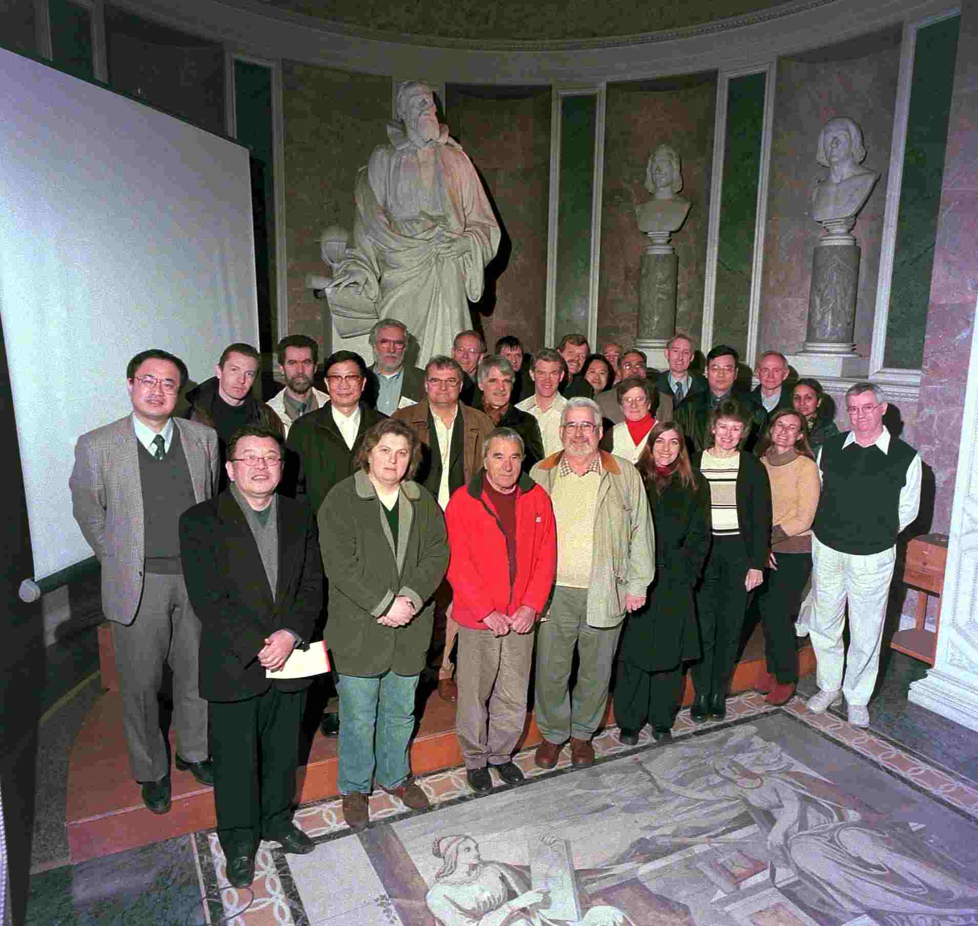
The 8th IOCCG Committee meeting took place in the Department of Animal Biology and Genetics at the University of Florence, Italy, from 24-26 February 2003. The meeting was attended by 27 participants (see Appendix I for list of participants).
1. Welcome Address and Logistics
Dr. Trevor Platt, Chairman of the IOCCG, welcomed the participants and noted that it was already the eighth time that the IOCCG Committee had met. He thanked Dr. Luigi Lazzara for hosting the meeting and commented on the beautiful meeting room. Prof. Delphino, Director of the Institute, briefly addressed the participants, and noted that the historic meeting room (Tribuna di Galileo) celebrated the life of the famous scientist, Galileo Galilei. Dr. Luigi Lazzara then expressed his pleasure in contributing towards the organisation of the meeting and wished participants a very "productive" meeting.
The Chairman expressly welcomed the new members rotating onto the Committee including Dr. Curtiss Davis, Dr. Nicholas Hoepffner (replacing Dr. Peter Schlittenhardt), Dr. Vivian Lutz, Prof. Ian Robinson, Dr. Eric Thouvenot (replacing Dr. Alain Podaire) and Dr. Ron Zaneveld. He also noted that the NASA representative, Dr. Chuck Trees, would be replaced by Dr. Paula Bontempi, and that apologies were received from three Committee members (see Appendix I).
2. Adoption of the Agenda
The agenda was adopted with one minor modification: a presentation from Dr. Tanaka was included under Agenda item 12 (Proposals for New Training Initiatives).
3. Record of the 7th Committee Meeting (Trevor Platt)
The minutes of the 7th IOCCG meeting were accepted without change. The Chair reviewed the list of action items arising from this meeting and comments were made on the following action items:
Action 7/1 - Dr. Giulietta Fargion noted that, in principle, MERIS data had been collected over all the diagnostic data sites, but that the SIMBIOS Project had only received data over the MOBY site. She speculated that there was a backlog in processing and distribution with the reduced ground segment.
Action 7/3 - Dr. Chuck Trees commented that he had not had much response to the proposed data merging meeting (only three US participants) so he did not follow up on this action item. This issue would be addressed again in Agenda Item 4(a).
Action 7/5 - Dr. Shailesh Nayak reported that Dr George Joseph had received another assignment, so he was not able to co-ordinate the working group on "Sensor Characterisation", but he was still very keen to take this up at a later date.
Action 7/8 - Dr. Mervyn Lynch stated that report on the New Caledonia workshop would be forwarded to the Project Office. He commented that an article on the workshop had been published in one of the local newspapers, and that it was a very successful meeting.
Action 7/9 - The Chairman noted that a letter had been sent to UNESCO regarding future co-operation in the area of capacity building, and a reply had been received from Dr. Colin Summerhayes. The Chairman later met with Dr. Summerhayes in Paris and he expressed an interest in using the IOCCG's expertise in ocean colour to contribute towards IOC's capacity building efforts.
Action 7/11 - The draft terms of reference for Associate Membership were reviewed. The Chairman drew attention to the fact that, since there was an in-built term for rotation of Committee Members, there was a need to recognise and formalise the contributions of those who were not formal members of the Committee, but who had contributed substantially to IOCCG activities. Associate members did not have to be former members of the IOCCG Committee and would be eligible to attend all IOCCG meetings, but not always at the expense of the IOCCG. The term of appointment would be for a nominal period of 3 years. The general feeling was that the IOCCG relied upon expertise and rotation was seen as a healthy component of the Committee. Appointment of Associate Members would therefore be good compromise. The draft terms of reference were accepted, and the Chairman requested specific nominations for new associate members.
4. Progress of Current IOCCG Working Groups
The Chairman pointed out that discussions on two of the current working groups, the Calibration working group (Dr. Robert Frouin) and the Sensor Characterisation working group (Dr. George Joseph) would be deferred, since the Chairs of these groups were unable to attend the meeting.
a) Co-ordination of merged data-sets
Dr. Platt emphasised that the context of data merging was becoming more acute with
the end of SeaWiFS in sight. Dr. Giulietta Fargion agreed that it would be
beneficial to hold a meeting before the NASA contract with Orbimage
expired, and noted that an on-line merger of Terra and SeaWiFS data was now
available.
Dr. Trees remarked that there was still a lot of interest in forming a data-merging working group, maybe in conjunction with data assimilation, but a good mix of participants from various Agencies was required. A lengthy discussion took place on various aspects of data-merging and a number of issues emerged from the deliberations. Since the oceanographic community had clearly stated the need for a high-quality, continuous ocean-colour record at a global scale to investigate long-term tends and variability, it was essential to communicate this requirement to Space Agencies. Discussions also took place on the best level to merge data. Dr. Curtiss Davis suggested that, in coastal environments, data sets should be merged at the level of remote sensing reflectance rather than the chlorophyll product. Dr. Roland Doerffer pointed out that clouds could introduce a bias into long time series, which should be included in the discussions. Furthermore, Prof. Pan Delu advised that it was essential to develop regional merging techniques, and Prof. Ian Robinson agreed that the successful merging of SST was based on the regional development of a data set feeding into a global data set.
Other issues that should be addressed by the working group included the question of whether data should be merged for chlorophyll alone, or chlorophyll plus other geophysical variables with synergistic implications, as well as the issue of operational versus climate quality data.
Dr. Trees proposed scheduling a meeting in late summer/fall since it was clear that the ocean-colour community needed to reach a consensus about how ocean-colour data should be merged. Proposals for the meeting location included Goddard (Dr. Giulietta Fargion), JRC in Italy (Dr. Nicholas Hoepffner) or Ahmedabad, India (Dr. Shailesh Nayak). Suggestions for participants included Dr. Prakash Chauhan (ISRO), Dr. Chris Brown (NOAA), Dr. Watson Gregg, Dr. Stephan Maritorena, Dr. Dave Siegel, Prof. André Morel and perhaps a modeller such as Dr. Neville Smith. Dr. Nicholas Hoepffner was proposed as a co-chair of the working group.
ACTION 8/1: DR. TREES TO ORGANISE A DATA-MERGING MEETING IN LATE SUMMER/FALL 2003.
b) Comparison of atmospheric correction algorithms
Dr. Menghua Wang presented a status report on the
atmospheric correction working group. The main objectives of the working
group were to:
- quantify the performance of existing atmospheric correction algorithms used by various ocean-colour satellite sensors;
- determine how the derived products from various ocean-colour missions could be meaningfully compared and possibly merged and to;
- determine how derived ocean-colour products from one sensor could best be compared with those from other sensors.
During testing it was realised that two fundamentally different approaches were used for computing the atmospheric diffuse transmittance, which could affect the atmospheric correction. For this reason, a simple correction was applied to the POLDER results. Dr. Wang then presented some preliminary comparison results for open-ocean Case 1 waters and also for Case 2 waters. Ratios (443/555) performed better than radiances in the case of chlorophyll for Case 2 waters. Results for yellow substances were generally poor since the signal was so small.
Dr. Wang also presented an outline of the IOCCG report, which should be completed this year. The report would consist of an introduction (objectives, members, overview of atmospheric corrections), description of algorithms, simulated data set, results (Case 1 and 2 waters with maritime and urban aerosols), discussion (errors from various algorithms, influence of errors on chl retrieval), recommendations and conclusions. Regarding the problem of absorbing aerosols, Dr. Mervyn Lynch pointed out that the analysis of results would only be able to explain part of the observed differences, and suggested that recommendations should be made to address the unexplained differences.
The Chairman congratulated Dr. Wang on his accomplishments and expressed his hope that the report would be completed this year, as there was a great deal of interest in the work.
c) Operational Ocean Colour
Dr. Christopher Brown reviewed the goals of the Operational Ocean-Colour Working Group. These were to promote the use of near real-time ocean-colour products; to facilitate the exchange of
ocean-colour applications; and to assist in the exchange of ideas and
approaches among agencies that currently possess or will establish an
operational ocean-colour mission. The components and attributes of
operational ocean colour were also outlined. The group accepted the
following definition of an operational ocean-colour system: Providing
useful data products and information derived from satellite ocean-colour
sensors on a continued basis for use in routine applications related to
resources, environment and climate studies by local, state and federal
governments, commercial entities, academic institutes, non-governmental
agencies and public at large.
The first working group meeting was convened on 17 November, 2002 in Sante Fe. A major outcome of this meeting was to assign the highest priority to the publication of the report entitled "Why Ocean Colour", and to redraft the outline of the report. The report would be divided into three sections: (i) Introduction (Operational Oceanography, Operational Ocean Colour, Background and Categories of Use); (ii) Uses of Satellite Ocean Colour (Climate Research, Operational) and; (iii) Elements of Operational Ocean Colour. Dr. Brown mentioned that authors would be assigned to the various components and specific case studies were required for the report.
The Chairman remarked that considerable progress had been made and that Dr. Brown should encourage contributors to sign on. A recommendation from Dr. Trees was to include a section in the report on how in situ measurements feed into operational ocean colour. During the discussions that followed, participants gave a number of examples of case studies in which operational ocean colour had been used. Dr. Kawamura noted that OCTS data had been used in almost real-time in the ILAC project for fisheries purposes, and Dr. Frank Shillington mentioned that the discovery of sulphur outputs in the Benguela system resulted from the use of near real-time ocean-colour data. In addition, Dr. Shailesh Nayak mentioned that ISRO routinely used operational ocean-colour data for coastal zone management, examining sediment transport, HAB's, mangroves, corals as well as fisheries applications (recruitment management, reduction of fishing effort).
Dr. Tasuku Tanaka recommended that the text of the report also reflect the synergistic side of remote sensing e.g. the combined use of SST and ocean colour for fisheries applications and Prof. Pan suggested that the report also include dynamic studies such as upwelling and transportation of suspended material. Dr. Mervyn Lynch gave further examples of the potential use of operational ocean colour including monitoring the recovery of coral systems, pearl farm protection and ocean eddies. Prof. Robinson cautioned against making an account of a few case studies, and recommended that the report focus on sustainable, operational use, as well as highlighting the problems that exist.
d) Ocean colour data-binning issues
Dr. David Antoine presented the list of members for this working group and outlined the
rationale for setting up the group. Several ocean-colour missions are
currently in orbit and all are producing Level 3 products. One of the
goals is to build a multi-sensor, multi-year ocean-colour archive to
examine mid- to long-term changes in phytoplankton biomass. A number of
issues needed to be addressed before this could be done including
calibration of each sensor, inter-calibration between different
instruments, algorithm differences and also data-binning. Dr. Antoine
outlined the terms of reference for the group and summarised the different
normalised water-leaving radiance products issued by the various
ocean-colour missions. He also reviewed the temporal and spatial averaging
schemes used by these missions.
Since the last IOCCG meeting (January 2002), the group had been revising the draft report that was presented at that meeting. A near-final version of the report should be ready by April 2003. The report would be entitled "Guide to the Use of Ocean-Colour Level-3 Data: A Report from an IOCCG Working Group on Ocean-Colour Data-Binning Issues". Dr. Antoine outlined the structure of the report and gave some examples of the impact of using different averaging methods and different spatial grids. A difference of up to 20% was found in primary production estimates when using different spatial and temporal scales. The group would try to recommend one or more specific binning schemes to be used for ocean-colour satellites as well as other satellites. The report would also stress the importance of the requirement to reprocess archives.
In response to a question from Dr. Trees on how the data-binning group differed from the data-merging group, Dr. Antoine replied that his group was only concerned with the problem of merging data from one sensor. The data-merging group, on the other hand, was concerned with merging data from different missions and would also address issues raised when trying to generate a long-term data record. It was suggested that a representative from the data-binning group join the data-merging group.
Prof. Morel suggested that the report recommend merging at the level of radiances, since chlorophyll was just a by-product. Dr. Sathyendranath replied that radiance was indeed the more fundamental property, but pointed out that there could be technical problems in binning radiances.
e) Standardising the extraterrestrial solar flux spectrum
Prof. Morel summarised the background of this working group. He noted that there are
small, but significant, differences between the various determinations of
the solar spectral irradiance at the top of the atmosphere,
F0(l), as measured by Neckel and Labs
(1984) and Thullier et al. (1998). Maximal differences (3-5%)
occur in the blue part of the spectrum (445-510 nm), and various agencies
use either the old values or the new ones (see Minutes, IOCCG-7). The
consequences of these differences are that:
i) The top of the atmosphere radiances recorded by several instruments are not directly
comparable (they are calibrated with reference to the moon or a diffusing
plate, and then by assuming an F0(l) spectrum).
ii) This problem could be solved if one knew the F0(l) values adopted by the various agencies (by accounting for the ratio between the two F0(l) spectra; the comparison is always valid in terms of reflectance).
iii) The normalised water-leaving radiance produced from sensor measurements are
independent of the choice of F0(l) adopted (by virtue of ratios, which cancels the spectrum).
iv) For in situ measurements, the situation is different. Top of atmosphere radiances cannot be compared directly since the results are dependent on the choice of F0(l).
Prof. Morel suggested that the solution to the problem would be to recommend that all agencies publish (on their web-site) the F0(l) spectrum adopted by their mission, as well as the convolution of this spectrum with the spectral profile of each channel of their sensor. This would be relatively easy to do, and would solve all the above problems with a minimum computational load. Furthermore, the Chair of the IVOS (Infrared and Visible Optical Sensors) subgroup of CEOS, Dr. Michael Rast, had reported that the subgroup had agreed on the importance of documentation in the derivation of the F0(l)spectrum used for data processing. Prof. Robinson suggested that perhaps Prof. Morel's recommendation should be made through IVOS.
ACTION 8/2: PROF. MOREL TO DRAFT A LETTER TO ALL AGENCIES (CC. DR. TREES) REQUESTING THAT THEY MAKE AVAILABLE (ON THEIR WEB-SITES) THE F0(l) SPECTRUM USED.
5. Proposals for New IOCCG Working Groups
a) Ocean Colour Algorithm Working Group (OCAG)
Dr. ZhongPing Lee gave a presentation on the proposed working group on ocean-colour
algorithms. The objectives of this group were to perform algorithm
cross-comparisons, to recommend certain algorithms and to report on
algorithm progress. Some of the issues regarding current algorithms are
that there is a variety of different algorithms in use today, many of which
are empirical or have only one component (chl) and many are only partially
tested/validated. At the preliminary meeting of this working group (17
November, 2002, Sante Fe), most participants expressed an interest in a
more fundamental analytical approach (rather than empirical). This working
group plans to: i) Assemble a broad in situ database for systematic
comparison of IOP retrieval. More attention would be paid to published
data, which were quality controlled and contained minimal errors. ii)
Synthesise a data set, based on known information, probably using the
HYDROLIGHT platform (working group to decide on details). iii) Algorithm
cross comparison and algorithm recommendation. iv) Find a place to store
data and algorithm software - probably the IOCCG webpage. Links would also
be provided to data and software.
Dr. Fargion drew attention to the SeaBASS database, which was available to the entire ocean-colour community. Data were collected using strict protocols and the database was constantly updated and quality controlled. At least half the data sets contain IOP's, which is what Dr. Lee requires. According to Dr. Trees, NASA is proposing to maintain the database after SIMBIOS is disbanded, although it might not be at the same level.
Following the presentation there was a lengthy discussion about the algorithm database, what type of model to use, and the fundamental approach (IOP's to ocean colour or the other way around). Prof. Morel suggested that, to begin with, a synthesised data set should be used. However, Dr. Sathyendranath pointed out that it should be carried one step further: several algorithms are in existence today and it was important to carry out a community evaluation of the algorithms and their performance under certain conditions. Dr. Doerffer stressed that one of the most important parts of the working group was to obtain different bio-optical models for different areas.
Dr. Lynch agreed with Dr. Lee's approach and said it would be beneficial to have reference data sets generated from HYDROLIGHT to test data before using in situ data sets. Prof. Robinson pointed out that another problem was to relate IOP's to biogeochemical products. Dr. Sathyendranath noted that item number 2 was based on known bio-optical properties, and that, in this kind of approach where one converts bio-optical properties to ocean colour, it was important to make a distinction between the various sources of error for results of comparisons to be useful. Dr. Doerffer drew attention to the REVAMP Project (Regional Validation of MERIS Chl Products in North Sea Coastal Water), the scope of which is to examine different areas in the North Sea with different optical properties, and to make a comparison of the different algorithms. Dr. Doerffer agreed to keep Dr. Lee informed of this projects recommendations.
There was strong support from all IOCCG members for this working group. It was agreed that a database would be useful to test the different water types and properties, but it would not have to be a very large database (~10 good data sets) since SeaBASS was already available. The priority would be to start with the simulated data set. It was proposed that Drs. Roland Doerffer, Ron Zaneveld and Marcel Babin also be included in the working group.
The Chair thanked Dr. Lee for agreeing to accept this initiative and requested him to submit the draft terms of reference for the group.
ACTION 8/3: DR. ZHONGPING LEE TO SUBMIT DRAFT TERMS OF REFERENCE FOR OCEAN-COLOUR ALGORITHM WORKING GROUP.
b) Working Group on Biogeographical Methods
The Committee reviewed a proposal submitted by Dr. Mark Dowell for the formation of a working group on biogeographical methods. Biogeographical provinces are commonly used for
computation of large-scale primary production from ocean-colour data. It
was believed that this field was advanced enough that it would merit a
review or synthesis in the form of an IOCCG report. The proposal also
incorporated a tentative outline of the report which included the uses of
biogeographies in ocean-colour related applications, examples of
applications in climate and fisheries modelling, and recommendations.
A general comment was that previous IOCCG working groups had addressed problems linked directly to ocean colour, and there was some concern that this group might not be in line with the IOCCG's Terms of Reference. The Chair pointed out that biogeographical methods were indeed highly specific to ocean-colour applications and were considered one of the advancing applications of ocean colour. Biogeographical methods were also relevant to what Dr. Brown was undertaking with the "Why Ocean Colour" report. Prof. Robinson agreed that if anyone was to produce a report on this topic, it should be the IOCCG. Dr. Doerffer suggested that the report focus on ocean provinces (and seasons) with similar optical properties, so that the correct algorithm could be applied with some certainty. The provinces should also include information on auxiliary data necessary to compute primary production (e.g. stratification, PI parameters). Elizabeth Gross suggested that the proposal might make an excellent SCOR working group or perhaps a joint IOCCG/SCOR working group. The Chair would convey the comments of the group to Dr. Dowell and request that he revise the proposal in light of the Committee's comments.
ACTION 8/4. CHAIRMAN TO NOTIFY DR. MARK DOWELL OF THE IOCCG COMMITTEE'S COMMENTS AND REQUEST THAT HE REVISE THE PROPOSAL AND RE-SUBMIT.
6. Status of Current Ocean-Colour Missions
a) MOS
Dr. Doerffer reported that the MOS project would be completed by end of this year, after 8 years in orbit. DLR had announced that they would no longer be active in ocean colour and no
follow on ocean-colour sensor for MOS had been planned. Dr. Trees noted
that there was little demand for MOS data, so Goddard had decided not to
renew the MOU.
b) SeaWiFS
Dr. Fargion reported that the SeaWiFS mission had been working extremely well for over 5 years and that the instrument was still remarkably stable (long-term calibration stability
better than 1%). SeaWiFS is currently the only mission that can provide
stable measurements to help validate current and future Earth observation
measurements. The SeaWiFS project has a very large user community, with
approximately 2000 authorised research data users. Data are downloaded to
the SeaWiFS Project twice per day and are processed and available for
browse via the internet within hours. A network of 127 real-time stations
also deliver data to the Project via the internet. In addition, the
SeaWiFS Project has a comprehensive calibration and validation program
closely coupled to the data processing and quality control system.
Unfortunately, the NASA data-buy contract with ORBIMAGE (including the
licences for high-resolution data) ends on 20 December 2003. The SeaWiFS
Project will undertake one final reprocessing of the complete mission
record starting January 2004 and the Project is currently scheduled to
cease operation at the end of March 2004.
Dr. Trees commented that there was very little wear and tear of the sensor and that it was capable of producing high-quality data for several more years (according to ORBIMAGE it could be extended for another 5 years). However, NASA did not have the funding to cover both the SeaWiFS and MODIS missions and it was likely that SeaWiFS high-resolution data would be lost forever if the project was not funded. This would be very unfortunate since SeaWiFS is currently the only long-term, consistent ocean-colour data set.
The Chairman noted that there was a high interest that the SeaWiFS mission should be extended and suggested that one solution might be to establish a Foundation to keep the mission operating (similar to the Sir Alister Hardy Foundation that operates the Continuous Plankton Recorder survey). Interested users, especially those with HRPT stations, could subscribe a fixed amount per annum to pay for the data and manpower. Dr. Trees was of the opinion that NASA HQ might support the Mission Operations and Data Analysis (MO and DA) if this went ahead. ORBIMAGE could then make one contract with the Foundation and subscribers could pay the Foundation directly. These discussions would be continued after the meeting by email and telephone.
c) MODIS (Terra and Aqua)
Dr. Trees gave a presentation on the current status of MODIS Terra and Aqua. He noted that
MODIS-T (tilt) would not continue because of lack of funding. Combined
orbits of MODIS Terra and Aqua could nearly eliminate swath gaps, providing
almost complete, single-day global coverage. A wide variety of MODIS
products was available including 36 ocean-colour parameters, 4 SST
parameters and 8 primary productivity parameters. The next reprocessing of
the Terra Collection 4 was scheduled for May 2003. Sun-glint was a problem
as there is no tilting mechanism. The project was aiming to generate good,
validated, Terra products before reprocessing the Aqua data set to climate
quality. A lot of work needed to be done to get a good data set because of
calibration changes. A reasonable agreement was obtained between the MODIS
chl-a-3 (semi-analytical) product and SeaWiFS chl. However, for ocean
productivity, the MODIS semi-analytical chlorophyll yielded a two-fold
greater production in the Southern Ocean regions, which still needs to be
validated and verified by the ocean community. The fluorescence line
height product tracked chlorophyll fluorescence well in coastal regions,
but more work was still required. The Ocean Colour Research Team meeting
would be held in Miami, 15-17 April, 2003. Discussions would take place on
how the community could become more supportive of MODIS products, and how
MODIS data compare to SeaWIFS. In general, MODIS has greater sensitivity
to low chlorophyll than SeaWiFS, but calibration was a problem with both
MODIS Terra and Aqua instruments.
d) MERIS
Dr. Michael Rast submitted a status report on MERIS, noting that the instrument was
performing better than specifications (radiometrically stable to better
than 0.2%). Vicarious calibration and validation activities had started,
and the first results (presented at the validation workshop in December
2002) looked promising, but more match-up data sets were required.
Recommendations from the calibration team included repeat spectral
characterisation campaigns every 6 months, the use of a pixel-wise
degradation model in the Level 1b processing, improving the BRDF model
based on in-flight data and the systematic acquisition of data over
designated targets.
e) OCM
Dr. Shailesh Nayak reported on the status of the Indian OCM sensor, which was launched in May 1999. Four ground stations had been set up to receive IRS-P4 data, located in India,
USA, Germany and North Korea. OCM data products for the Indian Ocean
region consisted of Level 1 products (geometrically and
radiometrically-corrected radiances for various scene sizes), Level 2
standard products (chlorophyll, suspended sediments, yellow substances,
diffuse attenuation coefficients, aerosol optical depth and normalised
water leaving radiances), and Level 3 products (weekly and monthly
averages). The Level 3 products were being generated on a trial basis.
Level 1 and 2 data could be acquired directly from NRSA, upon payment.
Validation experiments had been carried out on several cruises in the Eastern Arabian Sea, Bay of Bengal and on a cruise from Chennai to Mauritius. SeaWiFS protocols were used for optical measurements and JGOFS protocols were used for oceanographic observations. Comparisons were made of SeaWiFS- and OCM-derived chlorophyll and no major difference were found. The SeaDAS software was also compared to the SAC developed software, and the only major differences were in the case 2 water mask thresholds. Future plans for ocean colour validation included the development of a cal/val site near Lakshadweep Islands, and the deployment of a data buoy/platform to measure optical parameters several times a day.
One of major applications of OCM data was short-term forecasts for marine fisheries (using SST and chlorophyll), which had a 70-90% success rate and yielded catch increases of 70-200%. Forecasts are generated every 3 days, and are valid for 3-4 days. The forecasts help in reducing catch per unit effort and contain information about distance, direction and depth of potential fishing zones from the nearest fishing harbour. Forecasts are provided free of charge by INCOIS (Indian National Centre for Ocean Information Services). OCM data has also been used to track Trichodesmium blooms and to understand the dynamics of sediment transport.
f) OSMI
Dr. Yongseung Kim submitted an overview of the OSMI sensor, which was
launched onboard KOMPSAT-1 on December 21, 1999. KARI distributes OSMI
data to government agencies, government-supported research institutes and
universities for scientific use, while Korea Aerospace Industries (KAI)
disseminates the data for commercial use. KARI has been collaborating with
three research groups, representing land, marine,
and meteorological applications, to promote the development of remote
sensing technology using KOMPSAT-1 data.
The SIMBIOS Project successfully undertook a joint effort with KARI to characterise the OSMI mission and to cross calibrate the sensor with SeaWiFS. OSMI data has been successfully used to monitor yellow dust, forest fire, red tides and typhoons. Anyone interested in using OSMI data for research purpose should contact Dr. Yongseung Kim at yskim@kari.re.kr.
Future plans include the development of a High Resolution Visible and IR Sensor (tentatively called HiRVIS) on a geostationary satellite, for ocean observation. The mission goals would be to detect, monitor and predict short-term marine natural hazards (e.g. toxic algal blooms, turbid water, low saline water, oil spills etc.), monitor the marine ecosystem, manage coastal resources and provide marine fishery information for fisherman. The instrument is scheduled to be launched in 2008 and will have a spatial resolution of 250 m x 250 m, a field of view > 500 km, and a spectral coverage of 0.4 - 12 mm. This would be the first ocean-colour sensor on a geostationary platform.
g) Chinese Ocean Colour Program
Prof. Pan outlined the satellite programs for marine remote sensing in
China. The most recent instrument to be launched was CMODIS on board the
SZ-3 spaceship, which was launched in March 2002. The instrument was
developed by the Shanghai Institute of Science and Technology and has 20
channels in the visible and near-infrared. The Yellow Sea, East China Sea
and South China Sea were used as test areas, and data from SeaWiFS, MODIS,
AVHRR and FY-1D were used for comparison and cross-calibration. Results
from most of the channels were good apart from channel number 16 which had
problems. Top of the atmosphere radiance data for CMODIS was somewhat
higher than SeaWiFS for four different test areas, so CMODIS data would be
corrected for these differences. Water-leaving radiances for the two
sensors were also compared with in situ data, which indicated that the
pre-launch calibration was not optimal and the sensor would have to be
re-calibrated.
China's first ocean-colour satellite was the HY-1 satellite, launched piggyback-style on the FY-1D satellite in May, 2002. The HY-1 payload was the Chinese Ocean Colour and Temperature Scanner (COCTS) and the Coastal Zone Imager (CZI). The channels of COCTS are similar to those of SeaWiFS and data is processed at the SIO remote sensing centre in Hangzou. Cross calibration of COCTS had been carried out with SeaWiFS. Plans for 2003 include two cruises to the Yellow Sea and East China Sea for validation.
In conclusion, the results of the satellite to satellite cross-calibration techniques applied to CMODIS and COCTS indicate that this method is an economical and practical way to calibrate the instruments, especially for developing countries. It would therefore be extremely unfortunate if SeaWiFS data were no longer available. Reasonable results were obtained for mapped chlorophyll, suspended material and temperature data for CMODIS and COCTS, but the algorithms for processing this data needed to be improved before integrating the data with other remote-sensing data. Data from all Chinese ocean-colour sensors were available only in China.
h) GLI
Dr. Tanaka reported that NASDA had successfully launched the ADEOS-II satellite on 14 December 2002. Spectacular new images of the first processed data from the GLI sensor
(chlorophyll a concentration and SST) were shown. The initial check-out
phase was still in progress and the cal/val phase would continue from April
to 14 December 2003. During this period, Level 1, 2 and 3 non-validated
products would be provided to PI's for improvement and validation of the
products, and algorithms would be updated. Public release of validated
standard products would take place after 14 December 2003. Data would be
distributed by EOC (operational system). The latest images and information
on ADEOS-II could be found on the EORC website at
http://www.eorc.nasda.go.jp
Dr. Hiroshi Kawamura noted that several sensors were onboard ADEOS-II including SeaWinds, POLDER, AMRS and GLI. The first test image of GLI, which has a spatial resolution of 250 m, was received on 25 January 2003 and many detailed features could be observed. There was still some concern about channels saturating over the oceans, but alternative bands were available. Data products would be delivered to PI's starting in April 2003.
i) POLDER-II
Dr. Eric Thouvenot reported on CNES's ocean-colour related programmes and activities. The
POLDER-II instrument was integrated on ADEOS-II, and has a 2400-km swath,
and 6 x 7 km pixel size (at nadir). The first light image from POLDER-II,
acquired on 1 February 2003 over Spain and North Africa, indicated that the
instrument was working perfectly. POLDER-II has a rotating wheel carrying
spectral and polarised filters. Because of the instrument's wide
field-of-view, the same site could be viewed from different viewing angles.
POLDER-II bio-optical algorithms would retrieve 5 parameters including chl1
(chl estimated from SeaWiFS OC2v4 algorithm), chl2 (new empirical
algorithm, should be more accurate especially at low concentrations), the
absorption coefficients at 443 and 490 nm and the backscattering
coefficient at 565 nm. Continuous acquisition of POLDER-II data would
start in April 2003, with a six-month calibration phase. Validation of
scientific products (Level 1 and 2) would start in June 2003, and Level 1
product distribution would begin in October 2003. Final Level 1 and 2
products would be distributed by CPP/CNES in 2004.
Cal/val activities included SIMBADA radiometers and the BOUSSOLE Project. SIMBADA radiometers were used for characterisation of atmospheric and ocean optical properties, and could be used for multi-sensor cal/val (MERIS, POLDER, SeaWiFS etc.). Vicarious calibration with SIMBADA radiometers showed good agreement of results, but more MERIS data were required to increase the number of match-ups and the accuracy of the calibration. Work would continue in 2003 with a view to sensor comparison (POLDER-II, SeaWiFS etc.). The general objectives of the BOUSSOLE Project were to acquire a large number of optical measurements for the calibration/validation of ocean-colour satellite sensors (MERIS, SeaWiFS, POLDER-II). Data were collected by an optical mooring, specifically-designed to collect radiometric data in deep-ocean, Case 1 waters. The original mooring, deployed in the Mediterranean Sea, sank in June 2002 but a newly-designed optical mooring would be deployed in 3-4 months time.
Dr. Thouvenot also mentioned the MERCATOR mission, which was pursuing three main goals: to develop an operational oceanographic system, to develop downstream oceanography applications and to contribute to the international GODAE project. An example of a value added product was CATSAT, a world wide satellite system to support the fishing industry. CATSAT offers oceanographic and meteorological data acquired by satellites to help fishermen locate favourable fishing grounds and reduce operating costs.
7. Future Ocean-Colour Missions
a) S-GLI
Dr. Kawamura outlined the GCOM mission concept, the goal of which was continuity and advancement of
observations from ADEOS-II (a 15-year, long-term data set starting with
ADEOS-II) and contributing to research on climate change prediction. The
GCOM mission consists of an A- (mostly atmospheric) and a B-series of
satellites, each with different orbits. GCOM-B1, which is scheduled for
launch in 2007, will carry three instruments including S-GLI (ocean colour
and SST), AlphaScat (ocean winds) and AMSR (water vapour and
precipitation). S-GLI has three major components: OCI for ocean colour
observations, ALI for atmospheric observations and IRI for SST. In the
near future, GLI principle investigators would be requested to review the
proposed specifications of S-GLI. In addition, a special session on S-GLI
would be held during a GLI workshop. The Chief Scientist for S-GLI ocean
applications was Dr. Joji Ishizaka.
b) OCM-II on IRS-P7
Dr. Shailesh Nayak reported on the plans for the OCM-II sensor. He noted that
a single sensor could not satisfy all application demands, so it was
essential to identify an optimal configuration for the new OCM sensor in
terms of minimal band set, band widths, SNR, spatial resolution etc. The
main thrust of OCM-II, scheduled for launch in 2005/2006, would be the
continuation of the Potential Fishing Zone identification programme. It
was suggested that a minimum of 12 bands was essential for the detection of
the important ocean constituents (including chlorophyll fluorescence), but
the final decision on the number of bands was still pending (8 bands have
also been proposed). One of the major concerns was the accurate correction
for atmospheric effects, with a more stringent NESR (Noise Equivalent
Spectral Radiance) requirement for atmospheric correction bands. OCM-II
would have an onboard recording facility for global coverage at a spatial
resolution of 1 to 4 km. PI's would be given data at cost.
c) NPP and NPOESS
Dr. Trees reported that NPP (NPOESS Preparatory Project)
was the precursor to NPOESS (National Polar-Orbiting Operational
Environmental Satellite System), and was scheduled to be launched in 2007
(NPOESS would be launched in 2010). NPP would provide continuity of certain
environmental data sets that were initiated with the Terra and Aqua
sensors, thus maintaining a climate-quality data record. Initially, MODIS
data would be used as input to the data system to help set up a system for
processing NPP. The original charter for NPP and NPOESS had no data
reprocessing due to budgetary constraints, but ideally this should be
changed for NPOESS.
The VIIRS instrument would be installed on both the NPP and NPOESS missions to measure ocean colour. VIIRS is a multi-channel sensor, less sensitive than MODIS and with no tilting capability (sun glint problems). NPP would have a total of 40 operational data products, but only 5 ocean products, and there was some concern about the quality of the data (unclear calibration plan, algorithm concerns and questions about the sensor). The sensor was designed to meet reasonable ocean-colour requirements (no fluorescence bands) and should meet the IOCCG minimum requirements. It has the potential to provide a good long-term record.
8. SIMBIOS Program
Dr. Giulietta Fargion gave a presentation on SIMBIOS support of ocean-colour missions and community infrastructure. The SIMBIOS Program has two main thrusts. Firstly, working with US missions, supporting match-ups and providing images at sea, and secondly, providing international co-operation with different missions e.g. POLDER and MERIS. SIMBIOS is a very successful project with several different components including a calibration component (pre- and post-launch, solar and lunar calibration, vicarious calibration with MOBY) and an in situ data component (bio-optical and atmospheric measurements, data collection protocols, SeaBASS data archive). In addition, the program also examines validation of products and algorithms (match-up analysis) and has developed the SeaDAS satellite data processing software for use with CZCS, MOS, SeaWiFS, POLDER, OCTS, OSMI and MODIS data. The project receives considerable input from the science community and has a technical interface with space agencies and other organisations and programs.
The SIMBIOS Project Office has supported several missions (MOS, OCTS-POLDER, OSMI and MODIS) with cross calibration, product validation, sensor characterisation and data merger with SeaWiFS, as well as OCTS global GAC reprocessing. The project also has MOU's with MERIS (calibration and product validation) and GLI (calibration). In addition, the project has carried out a number of radiometric and chlorophyll round-robins and has developed and deployed a number of instruments for radiometric measurements. Over 390 field experiments and several international cruises have also been supported.
SIMBIOS has also been mandated to work with MODIS data especially in the area of MODIS-SeaWiFS operational data-merging, global time-series analysis and MODIS-SeaWiFS level 3 comparisons. In addition, the SIMBIOS Project works with in situ to satellite match-up results (chlorophyll, water-leaving radiance), and MODIS and SeaWiFS temporal trending. On average, MODIS and SeaWiFS chlorophyll and nLw are in good agreement, but MODIS temporal trends are 2 to 3 times larger than that measured for SeaWiFS.
Unfortunately, the SIMBIOS Project is ending in September 2003. It will no longer be able to support the implementation of new missions to SeaDAS, or provide match-up analysis service, over-flight prediction or round-robins. With over 10 satellites in orbit carrying ocean-colour sensors, it is not known who will now be responsible for quantifying the relative accuracies of present and future ocean-colour data products, as well as ensuring the development of internally-consistent research products or providing global in situ bio-optical atmospheric data.
Dr. Doerffer commented that it was important for the IOCCG to discuss a follow up to this type of activity. NASA would like other Agencies to take the lead and share the responsibility for international co-operation. Steps were being taken at NASA HQ to keep a core group of SIMBIOS investigators.
9. Implications of Assimilating Ocean-Colour Data into Numerical Models
Prof. Ian Robinson noted that ocean-colour data were being assimilated into numerical ocean models, although the ocean-colour models were further behind than other models. The IOCCG should consider which modelling applications require ocean-colour data to be assimilated, what measurement specifications are required for ingestion into models and whether this provides new opportunities for improving the quality of colour-derived products.
Modelling applications requiring ocean-colour data include biogeochemical modules incorporated into numerical ocean dynamical models e.g. modelling phytoplankton populations, estimating pCO2 in the upper ocean, estimating air-sea CO2 fluxes and resolving biogeochemical processes. Model objectives include oceanographic forecasting, improving scientific understanding of biophysical interactions in the upper ocean and parameterising longer term processes of biosphere-hydrosphere interactions.
Ocean-colour data are required in biogeochemical models for initialisation, assimilation, calibration (comparisons with real values may assist in tuning the coefficients) and finally for validation (independent assessment of forecasting the models' performance). Other potential uses of ocean-colour derived products in ocean models include identifying mesoscale structures, contributing to thermal forcing parameters, and regional and coastal water quality models (using chl, DOM and SPM as inputs). Specific ocean-colour data that are required for ingestion into models include chlorophyll a, diffuse attenuation coefficient, and suspended-sediment concentration. A few examples of ocean colour assimilation into numerical models (TOPAZ and CASIX) were also given.
Prof. Robinson drew attention to the fact that there are benefits that can flow from models back to the remote-sensing products e.g. routine availability of ancillary data (winds, SST, surface roughness etc.) and estimation of primary production directly from the models. In addition, the "model plus measurement" combination can be used to generate improved ocean-colour products (reduced impact of cloud cover, improved Level 3 composite products).
The impact of embedding ocean-colour data into models may reinforce the need for an indefinite stream of ocean-colour data from future ocean-colour missions. In addition, data handling will be changed since model requirements are different from those of direct users and near real-time processing will become essential. Further research is required to optimise the way ocean-colour information is ingested into models (how much processing is required before assimilation?) and to evaluate the impact of data ingestion on model performance.
Dr. Brown agreed to include a section on ocean-colour data assimilation in his report. The Chairman mentioned that it was important for the IOCCG to be ready to dialogue with modellers and it was agreed that this item should be reviewed again next year, to see what action might be required.
ACTION 8/5: PROJECT OFFICE TO ENSURE THAT 'ASSIMILATION OF OCEAN-COLOUR DATA INTO NUMERICAL MODELS' IS ON AGENDA FOR NEXT YEAR'S MEETING.
10. Chlorophyll workshop
Dr. Shubha Sathyendranath put forward a proposal for a joint initiative with POGO and the IOCCG. Since its inception, POGO has raised the question of whether there was a need for operational biological oceanography. At a recent POGO workshop, the need for operational biological oceanography was emphasised and it was recommended that POGO promote the measurement of chlorophyll, as it was the most likely biological variable to go 'operational'. There is a need for the standardisation of chlorophyll, since there are many methods to measure chlorophyll-a (satellites, fluorescence, chemical etc.) and also a wide range in scales. Not all measurements give the same information and there are no standards to compare results. Dr. Sathyendranath put forward a proposal to hold a workshop entitled "Chlorophyll: A Fundamental Biogeochemical Property", to discuss the issues that arise when going operational. She noted that there was great enthusiasm for this proposal at the recent POGO meeting in Tasmania, and that the POGO Committee had agreed that the workshop should go ahead. POGO would like the meeting to be a joint initiative with the IOCCG, since POGO is interested in operational measurements of chlorophyll.
Dr. Sathyendranath welcomed comments on the draft proposal and noted that other agencies would be approached for funding. The workshop would be the first step, as all the issues might not be resolved during one meeting. The results of the workshop could be published in an IOCCG report series, jointly with POGO. It was envisaged that the outcome of the workshop would be a clear statement of what each measurement means, how to interpret the results and how they relate to other kinds of measurements. There would not be any provision for hands-on analyses, as the first step would be to make recommendations. Dr. Ron Zaneveld pointed out that chl-a is a proxy for biomass, which was not always the case, and he suggested that other parameters (e.g. attenuation coefficient) be included to see how they vary with biomass. Dr. Chuck Trees noted that measuring chl-a (by HPLC) is a standard method for estimating phytoplankton biomass but that not everyone measures HPLC in same way, despite the fact that protocols exist. Dr. Curt Davis pointed out that JGOFS had undertaken a study on standardising chlorophyll measurements, and suggested that their recommendations be incorporated. Likewise, Dr. Fargion suggested that the round-robins and protocols used by different groups be highlighted. Dr. Roland Doerffer pointed out that it might be better to relate ocean colour to spectrophotometric measurements.
The Committee agreed, in principle, that the workshop was an initiative in which the IOCCG should participate, but it was recommended that the proposal be redrafted to address remote sensing more fully and to emphasise ocean colour as being central to the objectives. Dr. Chuck Trees suggested that NASA might be more willing to support the proposal if the operational issues were highlighted (proposed new title "Chlorophyll: An Operational Biogeochemical Variable").
ACTION 8/6: CHAIRMAN TO REDRAFT PROPOSAL FOR CHLOROPHYLL WORKSHOP TO ADDRESS REMOTE SENSING MORE FULLY AND TO EMPHASISE OCEAN COLOUR.
11. Training Courses/Workshops
a) Concepción Training Course
Dr. Vivian Lutz reported on the IOCCG training course held
at the University of Concepción, Chile from October 21 - November 1, 2002.
Approximately 36 students from eight different countries, mostly in Latin
America, attended the course. Lecturers included Drs. Mark Dowell, Ceasr
Fuentes-Yaco, Vivian Lutz, Trevor Platt, Shubha Sathyendranath and Osvaldo
Ulloa. During the course, the students obtained an understanding of the
basic concepts of ocean colour, and also received hands-on training in
processing ocean-colour imagery. The course was very productive and the
students were enthusiastic and well prepared. Many countries in Latin
America were already involved in ocean optics and there was an initiative
to set up a network of bio-optical stations around coast of Latin America.
The group was hoping to draft a proposal, to be submitted to agencies such
as IAI, to continue work that had been started, and also to obtain funds
for the bio-optical network. Dr. Lutz suggested that a small workshop be
held to draft the proposal and requested support from the IOCCG to fund
such a workshop. It was important to build on the expertise that was
available to make new bio-optical observations.
The Chairman pointed out that one of the major problems in Latin America was that scientists did not have strong access to facilities, despite the fact that they had a good knowledge of the fundamentals, which was a reflection of the economic situation. He noted that it was important to have seed money to hold such a workshop to prepare a multi-national proposal, and suggested that the funding could be provided under the IOCCG's capacity building budget. Dr. Trees cautioned against opening the door for many other such proposals, but the Chairman pointed out that this was a direct follow-on from an IOCCG training course. Dr. Curtiss Davis advised that it would be different if a training aspect (e.g. how to write a proposal) were included. Prof. Ian Robinson suggested that IAI should also be approached for co-sponsorship for the workshop and that IOCCG could perhaps fund outside volunteers. There was general sympathy for this idea, the financial implications of which would be discussed during the Executive meeting. Dr. Frank Shillington reported that IRD (France) was planning a comparative study between the Humbolt and Benguela upwelling systems, involving a number of field programs, which might be relevant to the proposed network.
b) IOGOOS Conference (Mauritius, 4-9 November, 2002)
Dr. Mervyn Lynch reported on the Indian Ocean GOOS conference which recently took place in
Mauritius. This was a different initiative to IOCCG training courses, in
that it was an attempt to scope out the interest in training in the region
and to identify possible partnerships. In the session on Indian Ocean
Satellite Applications and Remote Sensing Capacity Building, overviews were
given of what remote sensing could offer to the region. It was agreed that
more support was needed in the area of capacity building. Specific areas
of focus included sustainability of coastal fisheries, soil erosion and
sediment transport, and ecosystem status and management. Remote sensing
data was not widely used and products like ocean colour were not well
understood. Support was required in the area of accessing and interpreting
data. For many countries in the region, the issue of monitoring and
management was out of the question. It was recommended that a group be put
together to undergo training, using a reference site for in situ
monitoring. There was no commonality as to what should be measured by
local agencies, making progress difficult, but several people were
interested in getting involved in the reference sites. In order to
progress this further, the IOC plans to hold another meeting in Hyderabad,
later this year, to lay down a plan for capacity building in the region. It
was suggested that a cruise be conducted in the Indian Ocean to promote
ocean colour and to provide in situ training.
Dr. Nayak reported that there was an appreciation of remote sensing but the understanding of various remote-sensing products was very poor. Capacity building in this region was therefore of top priority, and the area of fisheries and ocean colour was important. The use of ocean colour also needed to be emphasised.
Dr. Shillington, who also attended the meeting, noted that there was less expertise in South Africa than India. From a GOOS initiative, it was clear that good in situ data were required and that help was needed in obtaining the data (e.g. mooring sites across the Indian Ocean, satellite receiving sites in Kenya, South Africa and Reunion) as well as getting people to talk to one other. Dr Radakrishnan was selected to head the IOGOOS program, and he hoped to continue working with Drs. Nayak, Lynch and Shillington.
Dr. Sathyendranath noted that a meeting of the Coastal GOOS working group also took place at the IOGOOS meeting. One of the recommendations from this group was to initiate a pilot project to monitor the ecology of the entire rim of the Indian Ocean. Mapping would be done by high-resolution remote sensing as well as field work. If this pilot project took off, there would be considerable demand for processing ocean-colour data from this region, and also for training. Dr. Fargion noted that discussions had taken place at NASA regarding processing high-resolution ocean-colour data from the entire world. All the programs were in place and enough disk space was available. If this project went ahead, the data would be available for entire community.
c) Plans for ocean-colour workshop in Fiji
Dr. Lynch reported that the planned workshop involved IOC and SOPAC, and was scheduled to take place in Fiji in September 2002. IOC thought that SOPAC were supporting this
initiative and vice versa, and because of the confusion the workshop had to
be cancelled. A proposal was put forward to hold the workshop in Brisbane
(University of Queensland) later this year. Funding was still required and
Dr. Lynch inquired whether the IOCCG would be prepared to fund this
workshop. Elizabeth Gross noted that the IOCCG had lost the funding from
IOC because the Fiji training course did not materialise. The funding
issue would be discussed during the Executive meeting.
d) SEAMEO/BIOTROP training course (Bogor, Indonesia)
Dr. Hiroshi Kawamura reported that Dr. Asanuma had agreed to lecture at this training
course (22 October - 1 November, 2002) on behalf of the IOCCG, but because
of the terrorist bombing in Bali, he was not authorised to travel. To
compensate for his non-attendance, he prepared his lectures on "Remote
Sensing in the Coastal Zone", with a voice over, and delivered it to
Indonesia. Committee members commended Dr. Asanuma's level of commitment.
e) IOCCG Fellowship Programme
The Chairman reported that a portion of the IOCCG's capacity-building funds had been used for the
Fellowship program. Two students (from Mexico and South Africa) had been
sponsored by the IOCCG in 2002 and another four Fellowships had been
awarded for 2003, for students from Brazil, China, Korea and Mexico. Dr.
Shillington noted that, from his perspective, the Fellowship Program was
very beneficial. As a result of the South African Fellowship student
travelling to Goddard, discussions had been stimulated and both sides
benefited.
f) GOOS Capacity Building Program
Dr. Kawamura conveyed a message from GOOS Headquarters stating that GOOS would like to
collaborate with the IOCCG. An Action Plan for GOOS capacity building was
being prepared. To what extent did IOCCG wish to be associated with the
implementation of the action plan? At a meeting of the GOOS Capacity
Building Panel (June 2002, Geneva.), it was noted that developing countries
needed assistance in using remote-sensing data. The capacity building
objective was to help countries build capacity to carry out the GOOS
programme at various levels. One of the Action Items (Action 1) was to
ensure that all regional GOOS bodies know about the full range of GOOS
activities, including things like the IGOS Partnership, by end 2002.
Training tools and courses were seen as a point of potential co-operation with IOCCG. Action 5 stated that the GOOS Project Office should find a means to advertise the UNESCO BILKO Project as a mechanism for training in remote sensing. Furthermore, Action 9 stated that Bill Erb should plan with Don Hinsman, a Virtual Laboratory for training in remote-sensing applications (Oceans), to be held in summer 2003 in Perth Australia.
Dr. Kawamura noted that training courses would be less intensive, as they would be tuned to the GOOS community. Trainees would only need a limited knowledge to meet the GOOS requirements. Dr. Davis pointed out that remote sensing is a core component of GOOS itself and that users would have to be trained to use the data stream.
The Chairman responded by saying that the IOCCG was willing to make expertise available, but that the Committee was not fully sure of what the training requirements were in this context. If GOOS wanted to rely on IOCGG, the IOCCG should have a member on the GOOS Capacity Building panel. Dr. Lynch noted that GOOS aims to encourage international groups to co-ordinate and co-operate, as they do not have the staff to run training programs per se.
11. Proposals for New Training Initiatives
a) Training course at the Kuwait Institute for Scientific Research
In June 2002, the Chairman was approached by Dr. Ahmad Al-Dousari to hold an IOCCG training course at the Kuwait Institute for Scientific Research. It was clear that the developing
political situation in the region was not conducive to holding a training
course, so the course was postponed. The funding agencies were not
comfortable with idea of sponsoring a training course in the region.
b) JAMSTEC Southern Ocean Cruise
Dr. Sathyendranath informed the
Committee that at the POGO meeting in Sao Paulo in 2001, a proposal was put
forward for more research and capacity building activities in the southern
hemisphere. In response to this 'Sao Paulo declaration', JAMSTEC had
proposed a cruise of the Southern Hemisphere, starting in August 2003 and
ending in February, 2004, comprised of 6 legs. They also agreed to
allocate up to three berths on each leg of cruise for trainees. Dr.
Sathyendranath saw this as an opportunity for POGO and IOCCG to work
together to develop training opportunities on research vessels. Initially
the JAMSTEC cruise did not have a bio-optical component, but a proposal was
put forward to included a bio-optical specialist on each leg of the cruise,
with the participation of South American and Australian colleagues.
Bio-optical measurements would include phytoplankton absorption, pigments,
flow cytometry, fluorescence profiles etc. As far as POGO was concerned,
this was a tremendous one-time opportunity and the IOCCG might also be
interested in supporting the cruise by sponsoring several trainees (travel
expenses and berth fees). POGO Executive also advised that trainee's
parent institutes be approached to contribute partially towards expenses.
Dr. Fargion proposed that the IOCCG submit a formal request to loan one of the SIMBADA instruments from SIMBIOS. Committee members were generally in favour of supporting the cruise, the financial implications of which would be discussed during the Executive meeting.
c) Other proposals
Dr. Tasuku Tanaka presented a proposal to hold a training
course in SE Asia (probably Indonesia), some time between September and
November this year. The course would be aimed at about 20 junior experts,
who had good capabilities, but little chance to access ocean-colour data.
Two previous IOCCG-sponsored training courses held in Thailand (1999 and
2000) were very successful and a large number of applications were
received. The purpose of the training course would be to promote the
preservation of the environment using satellite remote sensing as a tool.
NASDA was willing to contribute and Dr. Tanaka inquired whether the IOCGG
would also be interested in supporting this training course. The Chairman
advised interested volunteer instructors to contact Dr. Tanaka. Funding
issues would be discussed further at the Executive meeting. Dr. Nayak
expressed his support for the training course, and indicated that training
was necessary in this area.
13. Liaison with Other International Organisations
a) CEOS/IGOS/SIT
The Chairman noted that the IOCCG was an associate member of CEOS. He had tried to use CEOS as a
vehicle to bring principle concerns about ocean colour (notably the
continuity of the ocean-colour data stream) to the attention of the
remote-sensing community, but with limited success. The main problem
seemed to be the structure of IGOS, which made it difficult to get an
integrated answer to a particular question. The requirement for
ocean-colour data had been made repeatedly by various groups, but had not
yet been addressed by IGOS. It was important to impress upon Agencies that
ocean colour is a geophysical variable that needs to be measured
continuously. Dr. Sathyendranath pointed out that POGO members would like
to review the status of various elements of ocean observing systems as they
are today, to reveal their limitations and future directions. The status
of ocean colour from an operational point of view was very relevant, and
ensuring a continuous, unbroken, compatible stream of ocean-colour
observations was also a matter of concern for POGO. Dr. Sathyendranath
proposed that POGO and the IOCCG make a concerted effort to make sure that
it happens.
The Chairman noted that one of the criticisms of ocean colour was that it was not a mature technology and could not be operational. Dr. Davis pointed out that as far as NASA and NOAA were concerned, it was operational, although scientists were not always assured of a coherent, consistent picture. For example, MODIS has great capability, but needs a stable record, so the case could be argued. It was essential to have well characterised, well-calibrated sensors, which was what SIMBIOS was trying to achieve. Prof. Morel mentioned that one of the goals in the first IOCCG report was to describe a simple operational instrument, the data of which could be merged with compatible instruments on a common basis. Prof. Robinson expressed concern that IOCCG was not properly represented within IGOS, as it was a good vehicle for putting together space requirements for observing systems.
b) JGOFS
The Chairman informed the Committee that the JGOFS Programme was coming to
an end and that the closing symposium would take place in Washington, in
May 2003. The successor program was called OCEANS (an initiative of
SCOR/IGBP), and a major planning meeting had been held in Paris. This
program also has a big requirement for ocean-colour data, but it is not
obvious that the data stream is secure for the future.
c) POGO
The Executive Director of POGO, Dr. Shubha Sathyendranath
reviewed the current activities of the Partnership for the Observation for
the Global Oceans (POGO). The group recently held its fourth meeting in
Hobart, Tasmania (January 2003) which had a regional focus on the Indian
Ocean. One of the major outcomes of the meeting was a decision to review
the status of the various observing elements at the next meeting of POGO
(which is to take place in Yokohama in November 2003). Biological
observations will be among the observing elements to be discussed at this
meeting. POGO was willing to advocate for the continuity of operational
ocean-colour satellites as part of POGO's efforts to promote global-scale
biological observations. The IOCCG report on operational ocean colour
would be useful for advocating the need for operational ocean-colour
satellites and it would be very beneficial for POGO if this IOCCG report
were ready prior to the next POGO meeting.
Other issues addressed at the last POGO meeting included the proposed chlorophyll workshop (see item 10) and the JAMSTEC Southern Hemisphere cruise (see item 12 b). POGO was very active in the field of capacity building, supporting the JAMSTEC cruise, as well as providing training Fellowships for young scientists (similar to the IOCCG Fellowships).
14. Other Issues
a) New IOCCG Information Officer
As of 1 February 2003 a new Information Officer, Tammy Chouinard, was contracted to work in the IOCCG Project Office to help out with the administration.
b) IOCCG WebPage
The number of people visiting the IOCCG website has
increased dramatically over the past few years, with over 3,500 unique
users accessing the website every month. The IOCCG News, which is issued
every 2-3 months to over 700 subscribers, has been well received and has
been an extremely useful tool to promote the importance of ocean colour and
to inform the user community of various ocean-colour related activities.
c) Proposal from Alliance of Marine Remote Sensing
The Chairman briefed the Committee on the background of Alliance of Marine
Remote Sensing (AMRS), which also publishes the backscatter magazine.
Initially, the IOCCG used backscatter as its principal publication outlet
for news and propaganda, but has since moved to using the web server. Dr.
Platt and Prof. Robinson were formerly members of the board of directors of
AMRS. Recently, the chief executive officer of AMRS was replaced and the
new Executive Director, Bob Chisholm, proposed that the IOCCG become a
corporate member of AMRS at a cost of $195.00. This would entitle 8
members to receive the backscatter magazine, and the IOCCG logo would be
placed on their website and in their magazine. Several IOCCG members
indicated that they had been members of AMRS in the past, but did not
retain their membership due to confusion over payments. Mr Chisholm would
still like to publish articles on ocean colour in backscatter and was
willing to dedicate a special issues and/or pages. A meeting on
hyperspectral remote sensing for the coastal zone would be held in New
Orleans, as part of Oceanology International and AMRS inquired whether the
IOCCG would be interested in helping.
The general consensus was that the IOCCG should become a corporate member of AMRS, but the Committee saw no good reason to return to publishing in backscatter on a regular basis. The IOCCG could, however, consider publishing in particular issues.
ACTION ITEM 8/7: PROJECT OFFICE TO ARRANGE FOR CORPORATE MEMBERSHIP WITH AMRS
15. Membership Rotation
The Chairman requested nominations for new Committee members in order to continue the 3-year rotation of the Committee, as required by SCOR. Nominations for knowledgeable and active members should be sent to the Project Office, by email.
16. Any Other Business
a) International Ocean Carbon Co-ordination Project
Elizabeth Gross informed the Committee that for many years, SCOR and IOC had a joint advisory panel on CO2. Towards the end of the JGOFS era, there was a growing
concern about how to co-ordinate issues of carbon in the ocean. The Global
Carbon Project was developed (IGBP-IHDP-WCRP) although this did not have a
large oceans component. Recently a SCOR/IOC workshop was held in Paris to
discuss issues related to ocean carbon, and the International Ocean Carbon
Co-ordination Project was formed (IOCCP). This co-operative project aims
to provide information about current and planned ocean carbon activities,
as well as to develop workshops to gather information on observations and
research plans. In addition, it will provide other services to facilitate
co-ordination of programmes. Dr. Maria Hood had approached the IOCCG for
possible collaboration, after workshop participants expressed the need for
closer co-ordination with the remote sensing community, and specifically
the IOCCG. The pilot project had not specifically dealt with ocean-colour
requirements because of the strong desire to work with the IOCCG, to
provide advice and co-ordination on these issues. Dr. Paula Bontempi
agreed to act as the liaison person for IOCCG.
ACTION ITEM 8/8: PROJECT OFFICE TO INFORM DR. MARIA HOOD THAT DR. PAULA BONTEMPI WILL ACT AS THE OFFICIAL IOCCG CONTACT FOR ISSUES RELATING TO THE INTERNATIONAL OCEAN CARBON CO-ORDINATION PROJECT.
b) Australian Ocean Colour Working
Group (AOCWG)
Dr. Lynch reported on the Australian Ocean Colour
Working Group (AOCWG), which is a representative group of researchers from
CSIRO, the Australian Institute of Marine Science (AIMS) as well as various
universities. AOCWG is primarily interested in collecting in-situ
atmospheric and bio-optical data for calibration and validation of the
MERIS ocean-colour sensor. The group meets annually, but has limited
resources. They are planning a joint cruise in April this year, and
scientists will all bring their own instruments to measure various
bio-optical parameters. The Chairman mentioned that AOCWG was welcome to
send an observer to IOCCG meetings in the future.
17. Time and Place of Next Meeting
The Chairman noted that the intention was to host the current meeting in India, but because of political problems between India and Pakistan, it was agreed to defer the meeting in India by one year. The preference would be to host the next meeting in India (subject to the political situation), sometime between December, 2003 and February 2004.
The Chairman thanked everyone for participating in the meeting, and noted that he especially enjoyed the participation of new members. He also thanked Dr. Luigi Lazzara for all his help in hosting the meeting.
APPENDIX I
Eighth IOCCG Committee Meeting, Florence, Italy (24-26 February, 2003)
| IOCCG Members | Affiliation |
| Brown, Chris | NOAA-NESDIS, USA |
| Davis, Curtiss | Naval Research Laboratory, USA |
| Pan, Delu | State Oceanic Administration, China |
| Doerffer, Roland | GKSS, Germany |
| Hoepffner, Nicholas | JRC, Italy |
| Lutz, Vivian | INIDEP, Argentina |
| Lynch, Mervyn | Curtin University, Australia |
| Morel, André | LOV, France |
| Nayak, Shailesh | ISRO, India |
| Platt, Trevor | Bedford Institute of Oceanography, Canada |
| Robinson, Ian | University of Southampton, UK |
| Shillington, Frank | University of Cape Town, South Africa |
| Tanaka, Tasuku | NASDA, Japan |
| Thouvenot, Eric | CNES, France |
| Trees, Chuck | NASA HQ, USA |
| Zaneveld, Ron | Oregon State University, USA |
| Invited Participants | Affiliation |
| Antoine, David | LOV, Villefranche, France |
| Bontempi, Paula | NASA HQ, USA |
| Fargion, Giulietta | NASA, GSFC, USA |
| Gross, Elizabeth | SCOR, USA |
| Kawamura, Hiroshi | Tohoku University, Japan |
| Lee, ZhongPing | Naval Research Laboratory, USA |
| Marra, John | Columbia University, USA |
| Sathyendranath, Shubha | POGO Secretariat, BIO, Canada |
| Schlittenhardt, Peter | JRC, Italy |
| Stuart, Venetia | IOCCG Project Office, BIO, Canada |
| Wang, Menghua | University of Maryland, USA |
| Apologies | Affiliation |
| Asanuma, Ichio | Jamstec/NASDA, Japan (Represented by Dr. Kawamura) |
| Esaias, Wayne | NASA, GSFC, USA |
| Frouin, Robert | Scripps Institution of Oceanography, USA |
| Hood, Maria | IOC, Paris |
| Joseph, George | Space Applications Center, India |
| Kim, Yongseung | KARI, Korea |
| Rast, Michael | ESA/ESTEC, Netherlands |
| Summerhayes, Colin | GOOS-IOC, Paris |