Ninth IOCCG Committee Meeting
15-17 January 2004
Hyderabad, India
MINUTES
MINUTES
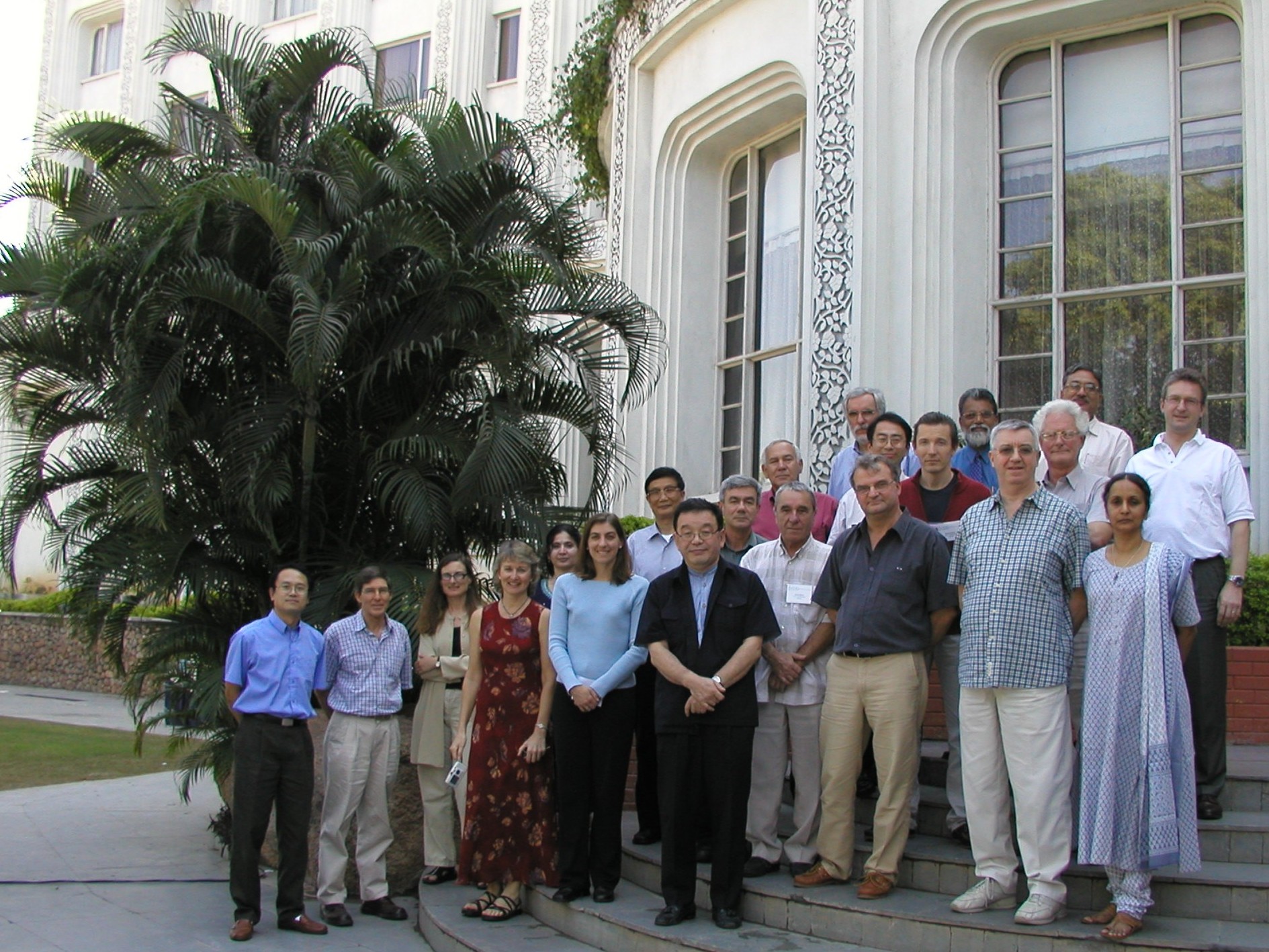
The 9th IOCCG Committee meeting took place at the Taj Residency Hotel in Hyderabad, India, from 15-17 January 2004. The meeting was attended by 25 participants (see Appendix I for list of participants).
1. Welcome Address and Logistics
The Chairman, Dr. Trevor Platt, warmly welcomed all participants and thanked them for attending the meeting. He noted that India has a very rigorous program in ocean colour, and that his first contact with their program was through Dr. Navalgund, who was the first member of the IOCCG Committee to represent the Indian Space Program. After rotating off the Committee, Dr. Navalgund became director of the National Remote Sensing Agency (NRSA), which has an office in Hyderabad.
Dr. Navalgund followed the Chairman with welcoming remarks, highlighting various IOCCG accomplishments over the past few years, including the training course in Ahmedabad. As an organisation, ISRO had benefited immensely through the IOCCG and Dr. Navalgund thanked the Chairman for making it possible. He noted that the NRSA Agency in Hyderabad was engaged in the reception of data from satellites, and also had facilities for data processing and data dissemination, and provided many other services. Dr. Navalgund undertook to organise a visit for participants to NRSA facilities and noted that it was a privilege to have the IOCCG meeting in Hyderabad.
The Chairman welcomed two new Committee members: Dr. Ray Barlow from South Africa and Dr. David Antoine from France. He also welcomed Dr. Howard Roe, Chairman of POGO, a relatively new Committee with considerable momentum. All participants were then asked to introduce themselves
2. Adoption of Agenda
The agenda was approved and adopted.
3. Record of the 8th Committee Meeting
The minutes of the 8th Committee meeting were taken as an appropriate record of the last meeting. Project Scientist, Venetia Stuart, summarised the status of the 8th Committee meeting action items, most of which had either been completed or were specifically being addressed in connection with 9th Committee meeting agenda items.
4. Progress of Current IOCCG Working Groups
4.1 Standardising the extraterrestrial solar-flux spectrum
>
Prof. Morel drew attention to the letter that had been sent to all Agencies encouraging them to provide information on the extraterrestrial solar-flux spectra implemented by their various sensors. Dr. Bontempi noted that she would follow up on the spectrum employed by the MODIS sensor and Dr. Rast agreed to provide the final table for MERIS by March 2004. According to Dr. Tanaka, JAXA had implemented the Thullier et al. 2001 spectrum. It was noted that IOCCG had received a formal reply from NOAA. Dr. Lynch pointed out that the International Radiation Commission had a working group examining the extraterrestrial solar flux, and he agreed to be the contact person, and keep IOCCG informed.
ACTION 9/0: DR. BONTEMPI TO ENQUIRE ABOUT SOLAR FLUX SPECTRA IMPLEMENTED BY MODIS AND DR. RAST TO PROVIDE FINAL TABLES FOR MERIS.
4.2 Calibration of ocean-colour sensors
Dr. Frouin reported that no progress had been made by the working group this year due to a lack of time. This activity had been going on for a number of years with no concrete results and he proposed officially closing the working group. Dr. Frouin briefly summarised the history of this working group, which was initiated in 1998 under the Chairmanship of Dr. Liferman, followed by Dr. Neumann and then Dr. Frouin. During this time there was a lack of consensus about the content of the report. He noted that several recent studies had underlined the importance of calibration of ocean-colour sensors.
The Chair expressed his concern that this important working group had not been brought to a conclusion, and that, regardless of the scope of the final report, there was a need for information by various user groups. He also stated that he would prefer to suspend the working group rather than close it. Dr. Lynch suggested that one approach would be to organise a workshop on calibration of ocean-colour sensors to attract the right people to review this issue, with strict timelines. Dr. Bontempi noted that, from NASA's perspective, there were problems with MODIS calibration, and that an internal workshop had been requested (February 2004), with a follow-up ocean-colour meeting in May 2004. IOCCG needed to have a bigger ocean-colour workshop with interpretation, not just a method review, and she proposed that Dr. Lynch implement a workshop in Perth at the end of the Ocean Optics XVII symposium. Dr. Lynch agreed to convene a one-day workshop on condition that Dr. Frouin would participate. He suggested that participants bring written documentation, which would be easier to publish, although Dr. Frouin thought it would be better to convene a session, and then a follow-up workshop to link presentations to a report. Dr. Rast brought attention to the fact that IVOS was planning an inter-comparison of all large-scale optical sensors, and that ocean colour would be an element of this exercise. Dr. Frouin proposed that the final IOCCG report address the advantages and disadvantages of various calibration methods and also include recommendations from the NASA workshop and the IVOS inter-comparison.
ACTION 9/1: DR. LYNCH, IN CONJUNCTION WITH DR. FROUIN, TO CONVENE A ONE-DAY CALIBRATION WORKSHOP AT THE OCEAN OPTICS SYMPOSIUM.
4.3 Co-ordination of merged data-sets
Dr. Bontempi gave a presentation on behalf of Dr. Trees who was unable to attend the meeting because of last minute travel complications. The objectives of the working group were to define data knowledge and requirements, to provide an assessment of methodology and to provide possible approaches with strengths and weaknesses for merging coincident ocean-colour data from multiple sensors. The group plans to hold a workshop in Washington, probably in conjunction with the Ocean-Colour Research team meeting. The meeting would be chaired by Dr. Watson Gregg of NASA. Possible topics for the report would include the benefits of merging (better coverage, improved accuracy), which missions are available, knowledge requirements for merging, output requirements, products to be merged (just chl, or Lwn, PAR etc.), a review of methodologies in use, and conclusions/recommendations.
Dr. Hoepffner recommended that Dr. Antoine's data-binning group also be represented at the meeting. Another suggestion was that merging data from different sensors e.g. temperature, also be addressed, as well as the problem of clouds. Dr. Bontempi agreed to convey this information to Dr. Gregg and to clarify his role in the working group.
ACTION 9/2: DR. BONTEMPI TO CONTACT DR. GREGG TO CLARIFY WHETHER HE IS TAKING OVER THE WORKING GROUP ON DATA-MERGING OR JUST CHAIRING THE MEETING. UPDATE LIST OF TOPICS TO BE ADDRESSED AT THE MEETING.
4.4 Comparison of atmospheric correction algorithms
Dr. Wang had submitted a written working group report. The key points were that some additional analyses of the performance of various algorithms needed to be carried out, and that the group hoped to meet sometime within this calendar year to complete the draft report, which should be submitted by the end of 2004.
Dr. Frouin pointed out that their assumptions about the water body could lead to inconsistencies, which would need to be resolved. Dr. Antoine noted that the issue of diffuse transmittance was one aspect which could result in a large difference in output. The Committee suggested that the report should document why the differences occur, and encouraged Dr. Wang to continue with this very important work,
4.5 Operational ocean colour
Dr. Brown had submitted a letter on the "Why Ocean Colour" report stating that a draft report would be submitted to the Committee by 12 October, 2004. Drs. Lynch and Nayak noted that they had recently submitted material for the report. The Committee encouraged Dr. Brown to communicate directly with the authors and to draw up a plan of action, with deadlines and a timetable, and to reach this goal.
ACTION 9/3: DR. BROWN TO SUBMIT A PLAN OF ACTION FOR THE OPERATIONAL WORKING GROUP, WITH SPECIFIC INSTRUCTIONS TO AUTHORS, DEADLINES, AND A TIMETABLE.
4.6 Ocean colour data-binning issues
Dr. Antoine gave his final report on this working group, outlining the rationale for setting up the working group and defining the terms of reference. It was envisaged that the two main uses of report would be for potential users of ocean-colour data to learn about the issues surrounding the binning of data, and for various Agencies to use the recommendations provided, if they decide to produce Level 3 data. A large variety of approaches is presently being used by various Agencies to produce water-leaving radiance, and different schemes are also being used for temporal averaging. However, there was some commonality in terms of spatial averaging of the data.
Dr. Antoine outlined the table of contents of the final report, and summarised the general recommendations:
- All Agencies should be encouraged to produce Level-3 data
- The arithmetic mean should be used to compute mean quantities
- The bi-directional character of the reflectance should be accounted for
- Daily fields should be produced as a minimum
- Equal angle projection
- Encourage studies that could improve the understanding of the spatial/temporal scales of ocean colour
- Advocate for reprocessing capabilities
- Agencies should provide tools for manipulation of Level-3 products.
In conclusion, a minimum binning scheme should be close to what has already been done for SeaWiFS/MODIS, and should be applied to chl, aerosol optical thickness (865 nm) and other products. An equal area grid should be used for the initial binning, with equal-angle (for ease of use). Daily and monthly fields should be produced and the arithmetic mean should be used.
Dr. Rast pointed out that although MERIS was not producing Level-3 products, ESA planned to do so in the near future. He requested that MERIS also be included in the report and agreed to provide Dr. Antoine with a page on MERIS for the front section of the report.
The final version of the report was expected by the end of March. It was important that Committee members provide comments on the report to Dr. Antoine by mid-February 2004. The Chairman commended Dr. Antoine on his excellent progress.
ACTION 9/4: DR. RAST TO SUBMIT A PAGE ON MERIS TO DR. ANTOINE FOR THE FRONT SECTION OF THE BINNING REPORT.
ACTION 9/5: IOCCG COMMITTEE MEMBERS TO PROVIDE COMMENTS ON BINNING REPORT TO DR. ANTOINE BY MID-FEBRUARY 2004.
4.7 Ocean-colour algorithm working group
Dr. Lee described some of the characteristics of the synthesised data set developed for the algorithm working group. It was not a Case 1 data set as it had a wide dynamic range, and tried to follow natural variations. Four components were used to model the absorption coefficient, three components were used to model to the backscattering coefficient, and independent phase functions were used for water, phytoplankton, and detritus/mineral scattering. All components varied independently, but in a range selected by the group. Examples of phytoplankton absorption spectra with different water constituents were given, as well as examples of simulated remote sensing spectra. This simulated database can be downloaded from the IOCCG webpage. Preliminary comparisons using a number of different inversion algorithms were also presented. The next step would be to introduce noise and test the algorithms again. The group plans to hold a meeting in Hawaii in February to discuss the preliminary results, and will hold a more formal workshop later this year. It is hoped that a draft report will be ready by end of this year.
Prof. Morel pointed out that one of the limitations of the exercise was that the data range was rather restricted, and apparently resembles that of highly perturbed Case 1 waters. Dr. Lee replied that he was trying to assemble a realistic database to test the algorithms, even if the simulated data certainly do not cover all possible natural waters, and do not necessarily match all natural situations. Dr. Sathyendranath suggested that, in order to make sense of the results of testing various algorithms, it was necessary to proceed in a systematic way. The logical first step would be to test the algorithms after all input inherent optical properties had been homogenised, in order to break down the various sources of error. The model could be applied to a case for which it was designed, and then extrapolated to regions for which it was not designed. Dr. Platt also queried whether all the algorithms used to retrieve optical properties were, in fact, intrinsically comparable, or were they being jeopardised by differences in parameterisations at the outset. The Committee expressed their appreciation for the large amount of work co-ordinated by Dr. Lee and the progress made so far. Dr. Lee agreed to address the Committee's concerns at the working group meeting in February, so that they could be clarified.
ACTION 9/6: DR. LEE TO RAISE THE IOCCG COMMITTEE'S CONCERNS WITH THE OCEAN COLOUR ALGORITHM GROUP SO THAT THEY CAN BE CLARIFIED.
4.8 Biogeographical methods
Dr. Sathyendranath outlined the history of this working group, which was proposed by Dr. Dowell at the last IOCCG meeting. At that time, the Committee was concerned that the working group would not focus on ocean colour, so the proposal was successfully revised to enhance ocean-colour studies. The group held a very fruitful meeting in Villefranche last October, and a detailed outline for the report was drafted. Another workshop will be held later this year, perhaps at JRC, in Ispra. Dr. Hoepffner pointed out that dividing the oceans into provinces was important from a political point of view, since governments often deal with regional aspects. The Terms of Reference for the group were defined as follows: i) to review the utility of ocean partitions as a tool for interpretation and application of ocean colour data, ii) to review the use of ocean colour as a tool for delineation of dynamic boundaries in the partition, iii) to review the application of ocean-colour partitions to oceanographic problems such as the ocean carbon cycle, climate change and resource management and iv) to write a monograph for the IOCCG series covering the material referred to above. The title of the working group had been changed to "WG on Global Ecological Provinces". The definition of boundaries, which are dynamic, would be dealt with in detail in the report.
5. Proposals for New IOCCG Working Groups
5.1 Sensor characterisation
At the last meeting, the possible formation of a working group on characterisation of sensors was discussed. This topic was of particular interest to Dr George Joseph, who was unfortunately unable to attend the meeting. Dr. Nayak reported that since Dr. Joseph had retired, he did not want to take on any new responsibilities, but he was willing to help. Dr. Nayak would try to find someone from SAC who might be willing to Chair this working group. ISPR had formed a working group on the same topic, although Prof. Morel pointed out that it was strongly oriented to land applications, which had a different vocabulary to ocean colour. The Chair encouraged Prof. Morel to work with Dr. Joseph on this initiative.
ACTION 9/7: DR. NAYAK TO ENQUIRE WHETHER ANYONE AT ISRO WOULD BE PREPARED TO CHAIR THE WORKING GROUP ON SENSOR CHARACTERISATION.
5.2 Requirements for an ocean-colour sensor for the coastal zone
Dr. Frouin reported that none of the existing or planned ocean-colour missions were adapted to observing the coastal zone. A high spatial resolution (100 m) was required, with adequate spectral bands and observations at least 6 times a day, covering the global coastal zone. One option would be a geostationary satellite, but this is not the only possibility. The various agencies represented at the meeting were then canvassed about their future plans. Dr. Rast informed the Committee that ESA had no plans for a dedicated coastal zone imager, although there was a strong interest in MERIS's capabilities in the coastal zone. Dr. Bontempi reported that NASA did not have a specific sensor planned, but that the coastal zone was one of two main components of their research program. NOAA was using Hyperion for coral reef research. Dr. Asanuma noted that JAXA planned to study the coastal zone with the S-GLI sensor, which would have coastal zone capabilities, and a resolution of 250 m. S-GLI was scheduled for launch around 2010, before the launch of NPOESS. Prof. Pan mentioned that China's Coastal Zone Imager (CZI) aboard HY-1 was adapted for the coastal zone. China is currently discussing the requirements for a second-generation ocean-colour satellite, which would focus on the inter-tidal boundary as well as the coastal zone. Lastly, Dr. Nayak reported that the coastal zone was very important to India, and that ISRO had recently launched the operational satellite, RESOURCESAT-I, for earth observation. This satellite has a unique combination of characteristics, with an emphasis on understanding the health of coastal waters. The three sensors on board (AWifs with 60 m resolution, LISS-III with 23.5 m resolution and LISS-IV with 5.8 m resolution,) can provide major information for the coastal zone and can also be used to study coral reefs. Other requirements for observation of the coastal zone will be met through the new OCM sensor, which will be launched in 2007 on board Oceansat-2. The requirement for understanding the beach profile will be met with a very high resolution (2.5 m) satellite to be launched this year. With these three satellites, India can meet most of the requirements for observing the coastal zone.
Dr. Frouin noted that although some agencies had plans, there was still not a sensor that would fit all the needs in terms of good spatial resolution and repetivity. He inquired whether the Agencies were interested in working together to define a satellite mission specifically adapted for the coastal zone. Dr. Nayak suggested that it might be easier to define a product rather than a mission. A single mission might not be able to provide everything, and a combination of satellites might be required. Prof. Morel pointed out that, by definition, the coastal zone is a national interest, and that it is not within the interest of an international group like IOCCG. The Chair noted that IOCCG Report Number 1 was widely consulted, and that Dr. Frouin might be driving at something similar, which could complement Report No. 3. In addition, there would be increasing societal pressure to have this type of information.
A lengthy discussion ensued as to the necessity for a dedicated sensor versus using available data, and whether it was more important to define the mission or the product. The consensus was that a dedicated coastal zone sensor was indeed an issue of importance from a political and societal point of view. Given the importance, the Committee approved the idea of a working group addressing this topic, in principle, and members agreed to enquire about a suitable chair. Dr. Frouin and Doerffer were tasked to list the potential terms of reference in draft.
ACTION 9/8: DRS. FROUIN AND DOERFFER TO DRAFT PROVISIONAL TERMS OF REFERENCE FOR AN IOCCG WORKING GROUP TO EXAMINE SPECIFICATIONS FOR AN OCEAN-COLOUR SENSOR FOR THE COASTAL ZONE.
5.3 Ideas for continuation of a SIMBIOS-type activity
Dr. Doerffer gave a presentation on a proposal for an International-SIMBIOS-like activity. He noted that the SIMBIOS Project had ended and that there was a need for something similar in the future. Remote sensing requires continuous validation, particularly in the coastal zone. Elements of a SIMBIOS-like activity could include the diagnostic sites, as there has been no co-ordinated work to bring this data together, as well as various campaigns (e.g. the European Revamp, COLOUR and COASTALOOC campaigns. Data could be made available via a website and an IOCCG working group could be formed to use this data and perform comparisons. The data bank could have access control, a user policy and strict data quality control (maintenance of standards and protocols). Mechanisms for funding for the website and databank would have to be discussed, and could perhaps be supported through the EU. Dr. Rast noted that an IOCCG working group of this type would go beyond the scope of an IOCCG report, and would ensure the continuation of SIMBIOS-type activities. There was some overlap with the algorithm and binning working groups. The working group could ensure continued cross-calibration over the diagnostic data sites and ensure the availability of ancillary data, perhaps via the framework of GMES (Global Monitoring of Environment and Security), a joint initiative of the European Commission and the European Space Agency.
Dr. Roe stated that the need for continuous validation had been made at the recent Earth Observation summit. Regarding the funding, Dr. Sathyendranath suggested revisiting the idea of a foundation, proposed at the last IOCCG meeting. The fees could be put towards a SIMBIOS analogue. Dr. Bontempi commented that, if there was some in-kind effort or contribution from other Agencies, NASA might be able to retain some people for SIMBIOS-type activities. Dr. Rast suggested that since IOCCG was a CEOS Affiliate, this issue could be tabled at the next CEOS meeting as a point of major concern. All CEOS partners would be requested to make data (including diagnostic data) available for validation, and the Agencies would be encouraged to support this type of activity by contributing funding or in-kind support (e.g. hosting database). POGO as a partnership could also be encouraged to be involved. Drs. Rast and Doerffer were tasked to draft a letter to CEOS to encourage Agencies to support a SIMBIOS-type activity. Dr. Platt to table this issue at the next CEOS meeting.
ACTION 9/9: DRS. RAST AND DOERFFER TO DRAFT A LETTER TO CEOS TO ENCOURAGE AGENCIES TO SUPPORT A SIMBIOS-TYPE ACTIVITY. DR. PLATT TO TABLE THIS ISSUE AT THE NEXT CEOS PLENARY.
6. Climate Quality Data Records for Ocean Colour
Dr. Bontempi led the discussion on climate quality data records. She noted that Climate Data Records (CDRs) were based on the mission of NASA's Earth Science Enterprise (ESE), to develop a scientific understanding of the Earth system and its response to natural and human-induced changes. Current research is focussed on how the Earth is changing, what are the consequences of such changes and how to predict future changes. Ocean colour falls under the ESE focus areas of Carbon Cycles and Climate Variability. ESE data requirements for climate research include looking at long-term time series (data from multiple missions) and using data of the highest possible quality. The data must not include significant sensor artefacts and trends, so sensor pre-orbit characterisation is critical. Data must be validated with highly accurate field data and all satellite data requires reprocessing capabilities. CDRs also require consistency between satellite data sets. Current ocean-colour accuracy goals are 5% absolute for radiometric calibration and water-leaving radiance and 35% for chlorophyll-a. There are a large number of ocean product suite parameters, of which chlorophyll-a, SST, aerosol optical thickness and angstrom exponent could be chosen for climate quality data records. NASA intends to focus on CZCS, OCTS, SeaWiFS and MODIS sensors for the climate data record.
Dr. Bontempi noted that ocean colour was not currently a climate data record, or even a parameter, and perhaps we should also be looking at other parameters, such as absorption. Dr. Sathyendranath pointed out that the most basic information measured through ocean-colour is radiance, and that this remains true regardless of reprocessing. Perhaps this should be the quantity that is saved as climate quality. Chlorophyll was required in the record, but we should not lose the basic quantity that allows us to reprocess later. Dr. Bontempi was interested in the other Agencies' opinions regarding creating a climate data record. Dr. Frouin suggested that defining a climate variable should come from the user community, although Agencies should be sensitised to this requirement. NASA will be holding a Town Hall meeting at the TOS/ASLO meeting in February, as well as the Ocean Colour Research Team meeting in April, to try and obtain scientific input from the user community. The Chairman suggested convening a working meeting with representatives from various Agencies to get their views on this issue, and agreed to discuss these issues further offline with Dr. Bontempi.
ACTION 9/10: DRS. PLATT AND BONTEMPI TO DISCUSS CONVENING A MEETING TO EXAMINE REQUIREMENTS FOR CLIMATE DATA RECORDS.
7. Status of Current Ocean-Colour Missions
7.1 SeaWiFS, MODIS-Terra and -Aqua
Dr. Bontempi briefed the Committee on the SeaWiFS mission, the strengths of which were its long-term, consistent data set that is being used to quantify the biological consequences of global change on land and in the ocean. The five main bands have maintained outstanding long-term stability. SeaWiFS has clearly been a successful model of government/ industry/community partnership and currently has over 2,200 users. SeaWiFS is capable of providing the stable measurements needed to help validate current and future Earth observation missions, but SeaWiFS data will be available from NASA only until 23 December 2004 (end of contract). The transition to MODIS will take place this year. The reason why SeaWiFS was continued for an additional year was to ensure continuity of the climate quality data set (MODIS water-leaving radiance still has considerable scatter). If there is no contribution from other groups, SeaWiFS will be cancelled at the end of 2004. Continuation of SeaWiFS is desirable to ensure continuity of the longest existing ocean-colour data set. In addition, there is no indication that the instrument is nearing the end of its scientifically useful life, and without SeaWiFS serving as 'truth', it is difficult to prove that MODIS is providing the long-term, well-calibrated global products that are needed.
The Committee recommended that the continuity of SeaWiFS be included in the letter to CEOS, and if possible, placed on the GEO agenda, stating that if SeaWiFS were to be discarded, the climate data record would end. The Chairman also suggested that IOCCG write a positive letter to Dr. Asrar regarding the latest extension of the SeaWiFS project (drafted by Drs. Frouin and Lynch).
ACTION 9/11: DRS. FROUIN AND LYNCH TO DRAFT A POSITIVE LETTER TO NASA (FROM IOCCG) REGARDING THE LATEST EXTENSION OF THE SEAWIFS PROJECT.
Dr. Bontempi also briefed the Committee on the two MODIS sensors. In November last year, the MODIS Oceans team prepared a comprehensive document on the calibration of MODIS Terra. There were four main calibration issues related to detector imbalances and instabilities. Even after the fourth reprocessing, there were still large deviations between SeaWiFS and MODIS water-leaving radiance ratios and chlorophyll ratios, with certain bands showing degraded consistency with SeaWiFS, and increased month-to month variability. Due to these calibration issues, there is a temporary hold on processing MODIS Terra oceans data (outside of SST) with a focus on MODIS Aqua oceans data which has improved instrument stability. NASA is moving from missions to measurements (no separate projects). The number of data products must be reduced, and this will be discussed at the Ocean-Colour Research Team meeting in April 2004. A robust calibration and validation program is also required, but this will probably be the last year for MOBY, which is managed by NOAA, but funded by NASA. All the ocean data products will be brought under one roof and distributed via a SeaWiFS-type interface.
Prof. Morel enquired whether ESA could contribute funding to the MOBY site, as it had been used extensively to validate MERIS data, and perhaps JAXA could do the same.
7.2 MERIS
Dr. Rast briefed the Committee on the MERIS sensor, which was launched on 1 March 2002. The validation phase stared in spring 2002 and a validation workshop was held in December 2002. Since 1 January 2004, there has been a routine rolling out of Level 2 products for atmosphere, oceans and land. The first reprocessing will take place at the end of March 2004 and will also include Level 3 products. MERIS has a sophisticated on-board calibration device and the instrument is exceptionally stable. During the course of a year, degradation was less than 0.3% in the blue. Various validation exercises have been carried out including the BENECAL cruise off South Africa, the BOUSSLE site and the MOBY site, which provided several good match ups. The excellent quality and high resolution of MERIS data shows good potential for coastal water remote sensing, including sediment transport effects, erosion and coral reef monitoring. There is a rolling Announcement of Opportunity on the web for PI's to apply for MERIS data for scientific purposes. Specialised software allows users to visualise and process MERIS data. MERIS currently provides global 1-km data free of charge. The Chair proposed that the Committee send a letter to ESA expressing appreciation for the beautiful data provided by MERIS. Dr. Rast suggested adding the Committees' concern about continuity.
ACTION 9/12: IOCCG TO WRITE A LETTER TO ESA EXPRESSING APPRECIATION OF THE HIGH QUALITY DATA FROM MERIS, AND ALSO EXPRESSING CONCERN ABOUT CONTINUITY.
7.3 OCM
Dr. Nayak reported that the OCM sensor on IRS-P4 was now 4.5 years old, and was still doing well, apart from the Multi-frequency Scanning Microwave Radiometer, which had been switched off. There were four ground stations located in India, USA, North Korea and Germany. OCM provided standard Level 2 products and was generating Level 3 products on a trail basis (weekly and monthly averages of chlorophyll, suspended sediments, diffuse attenuation coefficient and aerosol optical depth). Level 1 and 2 data for coverage around India can be acquired by users directly from NRSA on payment. Sensor inter-comparison with SeaWiFS resulted in good matches with chlorophyll. Atmospheric correction procedures developed by SAC also compared well with the SeaDAS output, but Case 2 water-mask thresholds were different for SAC software.
7.4 OSMI
Dr. Kim submitted a brief report stating that OSMI was still in normal operation, and that the data were used for monitoring yellow dust, forest fires, red tides and typhoons. The Cal/Val program had made little progress because of limited funding. Specifications were given for the proposed Korean Geostationary Ocean Colour Imager (KGOCI), which will have a spatial resolution of 500 m. The proposed launch date will be around ~2008. Dr. Bontempi noted that, in principle, there was some bi-lateral communication with NASA. Prof. Pan reported that China was also considering a geostationary sensor to acquire more cloud-free data.
7.5 Chinese Ocean Colour Program (CMODIS, COCTS, CZI)
Prof. Pan reported that the first Chinese ocean-colour satellite, HY-1, was launched in May 2002. The HY-1 payload was the Chinese Ocean Colour and Temperature Scanner (COCTS) and the Coastal Zone Imager (CZI). The CZI sensor stopped working on 1 December 2003, after 17 months of operation, because of power problems. Calibration and validation data were available for COCTS and comparisons were carried out with SeaWiFS. Results indicated that the COCTS sensor was still working, but some bands had serious degradation problems. The Chinese CMODIS sensor, on board the SZ-3 satellite stopped operation in September 2002, after 6 months of operation.
Ocean colour activities for 2003 included looking at atmospheric correction over Case 2 waters in the Yellow Sea and East China Sea, and examining sediment loads. NASA's ocean optics protocols were followed for quality assurance, and pre-and post-cruise calibrations were performed. In addition, independent in situ measurements were obtained from several experienced groups. It was found that simple NIR iterations were effective for moderate and low-turbidity waters, although the relationship was unstable. Highly turbid waters required visible-band relationships. Future work will include optimisation and neural-network techniques, as these may be more suitable for atmospheric correction over complex Case-II waters. The Chinese government is starting to build the HY-IB satellite which will carry another coastal zone sensor, to be launched in 2005.
7.6 GLI
Dr. Tanaka informed the Committee of the unfortunate termination of the ADEOS-II mission on 25 October 2003, after 10 months of operation, due to failure of the solar panel. Because of failures in two other missions, the management of JAXA is considering major changes within the organisation.
Dr. Asanuma presented an overview of GLI ocean products along with examples of chlorophyll, CDOM and SST maps. The East China Sea was a difficult region to work in as there was not much in situ data. Validation work was being carried out on normalised water-leaving radiance, aerosols and Angström exponents using match-up data-from around the world. Many data sources were available for vicarious calibration, all of which showed similar tendencies. A limited number of match-ups of in-water products was available for validation by ground observations. Generally speaking, there was a good agreement for comparisons with SeaWiFS monthly means, but more comparisons were required. JAXA is trying to generate geophysical products which will be distributed.
The Chairman suggested that IOCCG write a letter addressed to the president of JAXA (Dr. Yamanouchi), thanking JAXA for what they have done so far in the field of ocean colour, and urging them not give up because of unforeseen hazards.
ACTION 9/13: IOCCG TO WRITE TO DR. YAMANOUCHI OF JAXA THANKING THEM FOR WHAT THEY HAVE DONE SO FAR IN THE OCEAN-COLOUR ARENA, AND URGING THEM NOT GIVE UP BECAUSE OF UNFORESEEN HAZARDS.
7.7 POLDER-II
Dr. Thouvenot submitted a report to IOCCG on ocean-colour activities at CNES. The POLDER-II sensor was lost in December 2003 due to the failure of ADEOS-II, but since the sensor performed so well, CNES has decided to complete validation activities and process all available data. CNES plans to launch a micro-satellite called PARASOL at the end of 2004, which will carry an instrument very similar to POLDER-II. The mission is mainly focussed on characterisation of clouds and aerosols, but CNES is considering using it for ocean-colour activities, as a follow-on to POLDER-II. The IOCCG Committee expressed support for the PARASOL mission and its use for ocean-colour activities.
ACTION 9/14: IOCCG TO WRITE TO CNES INDICATING SUPPORT FOR THE PARASOL MISSION FOR OCEAN-COLOUR ACTIVITIES.
7.8 Production of Level-3 products for ocean colour
Prof. Morel informed the Committee that the most useful ocean-colour product for scientific purposes was Level 3, and he encouraged all Agencies to make Level 3 products. He pointed out that many Agencies are not producing Level 3 products because the decision had not been taken within the Agency. Prof. Morel agreed to draft a letter to the Agencies encouraging them to produce Level 3 products, listing the desired geophysical parameters as recommended in the data-binnng report.
ACTION 9/15A: PROF. MOREL TO DRAFT A LETTER TO ALL AGENCIES (COPY TO NASA AND ESA) ENCOURAGING THEM TO PRODUCE LEVEL-3 PRODUCTS. ADDENDUM TO LETTER SHOULD SPECIFY GEOPHYSICAL PARAMETERS.
Dr. Rast reported that ESA had tentatively agreed to produce Level 3 products and Dr. Nayak noted that ISRO was also considering producing Level 3 products on a demonstration basis. Dr. Doerffer mentioned that merging information from different sensors could give additional useful information. The data would have to be interpolated on the same grid, which was possible to do from a technical point of view. Dr. Hoepffner pointed out that the European MERCATOR project plans to assimilate data from a number of different satellites and re-map it on the same grid to model circulation and biogeochemistry. Agencies should be encouraged to do the same thing. Drs. Doerffer and Hoepffner agreed to draft a letter to Agencies to encourage merging information from different sensors, and producing higher level data.
ACTION 9/15B: DRS. DOERFFER AND HOEPFFNER TO DRAFT A LETTER TO AGENCIES REGARDING MERGING INFORMATION FROM DIFFERENT SENSORS (GENERATION OF HIGHER LEVEL PRODUCTS.
8. Future Ocean-Colour Missions
8.1 S-GLI
Dr. Tanaka reported that research was being carried out on the specifications for the S-GLI sensor, and the most suitable platform to carry the sensor (G-COM, ADEOS or another satellite). There was also some debate about whether the oceans group should combine with the atmosphere group. The IFOV for the visible bands of S-GLI would be 250 m (other bands 1 km). It would be a technical challenge to keep the higher spatial resolution. The planned launch date was still under debate, but might be before NPOESS.
8.2 OCM on IRS-P7 (Oceansat-II)
Dr. Nayak reported that the Oceansat-II satellite was scheduled for launch in 2007, and would carry an OCM sensor similar to that on IRS-P4 (8 spectral bands from 400-900 nm). The new sensor would have on-board recording for global coverage (1-4 km), with repeat coverage every 2 days. Data should be available to PI's free of charge, and the data policy would be in place by 2006, as well as an Announcement of Opportunity.
Several calibration/validation sites are planned in the Arabian Sea. Currently, the accuracy for chlorophyll is ~28% with a planned accuracy of ~20%. Two sites have been proposed: one in Case 1 waters near Kavaratti Island, which will have a 3 m platform buoy with various sensors, and one in Case 2 waters, near Goa (not yet finalised). An optical buoy would be deployed, attached to the main buoy. Plans have been made for periodic calibration and maintenance of the instruments as well as quality control of the data, which will be stored in a data archive.
8.3 NPP and NPOESS
Dr. Bontempi briefed the committee on NASA's NPP and NPOESS projects. The NASA team for NPP (NPOESS Preparatory Project) is evaluating the planned NPP Environmental Data Record product algorithms for use as Climate Data Records (CDRs), and will assist in defining the required data system. Not all EOS products are necessarily CDRs. Good candidates will have good calibration, good transitions between satellites, good user bases, and meaningful significance in terms of climate change. NASA's goal is to provide Climate Data Record continuity from EOS to NPOESS. NPP is scheduled for launch in late 2006, with a possible delay till early 2007.
NPOESS (National Polar-orbiting Operational Environmental Satellite System) is a partnership between NASA and NOAA. It is an operational mission with a data turn around of 20-30 minutes. The NPOESS satellite will carry 13 different sensors including the VIIRS ocean-colour sensor. VIIRS will produce 25 different EDRs including ocean colour/chlorophyll. NPOESS is scheduled for launch in 2010 and will consist of a system of satellites and ground stations. No reprocessing has been scheduled, and a new satellite will be launched approximately every 2 years until 2020.
9. Operational Applications of OCM for Fishery Forecast in India
Dr. Radhakrishnan gave a presentation on the operational applications of ocean colour in India, focussing on the use of OCM data to predict Potential Fishing Zones (PFZ). An institute called INCOIS had been established in Hyderabad to provide information to society, government agencies and the scientific community. The Potential Fishing Zone Advisory Service provides short term forecasts (2-4 d) of areas with likely abundance of fish stocks, based on chlorophyll and SST derived from satellite data (Oceansat-1 and NOAA). This information is disseminated by INCOIS to the entire coast of India three times a week, in local languages, and helps to reduce search time and effort and increase catch per unit effort. PFZ interpretation keys include eddies, rings, meanders, upwelling features and thermal fronts.
10. Workshop on "Chlorophyll: An Operational, Biogeochemical Variable"
Dr. Sathyendranath briefed the committee on the revised POGO/IOCCG joint-proposal to host this international workshop. The proposal had emerged from POGO's second last meeting, where they discussed the need for biological oceanography, especially chlorophyll, to go operational. It was proposed to hold a workshop to help establish primary and secondary standards for the biological community. There were several ways of measuring chlorophyll (fluorescence, ocean colour etc.) but not all measured the same thing. Protocols had been drawn up for individual measurements, but what is lacking is a comprehensive statement on how to interpret and inter-compare the data. The Committee reviewed the revised proposal and made a number of recommendations i.e. to include discussions on chlorophyll as a CDR, to look at isocratic HPLC (isolating chlorophyll from other interfering pigments), addressing the issue of accuracy as measured from space and including a debate on other pigments. Dr. Sathyendranath pointed out that it was clear that the problem was so large that a single workshop could not solve all the issues, but that the workshop would be the first step in addressing this task.
11. Training Courses and Workshop Reports
11.1 IOCCG-sponsored Workshop held in Mar del Plata, Argentina 7-11 July 2003
Dr. Lutz reported that the idea for this workshop was originally proposed during the IOCCG/POGO training course in Concepción, 2002. The workshop took place in Mar del Plata, Argentina in July last year. The main objectives of the workshop were to establish a South American network to study long-term changes in coastal ecosystems to distinguish natural variability from external perturbations, and to set up a data base of satellite and in situ observations for scientific, educational, and management purposes. The main outcomes from the workshop were the definition of the main goals and specific objectives of such a network, called ANTARES, and the draft of a Small Grant Proposal (SPG). The proposal was submitted to IAI and was recently approved. The objectives of the SGP were to implement a web-based application and analysis tool to facilitate access to field and satellite data around South America, linking satellite-derived products from five existing ground stations, and to generate continental-scale, high-resolution maps of chlorophyll and sea-surface temperature at weekly intervals. Four computer experts from South America will travel to the USA to learn data processing at the Institute of Marine Remote Sensing (IMaRS), University of South Florida.
Dr. Sathyendranath noted that the ANTARES network was also in line with the goals of POGO and that POGO might sponsor the next meeting of the ANTARES network. The Chairman pointed out that once the group had gained credibility with their first proposal, they would be able to go to other bodies for funding. It was a nice example of the beneficial effects of the initial IOCCG training courses, and he hoped it would go from strength to strength.
11.2 IOCCG training course in Bali, Indonesia 1-5 September 2003
Dr. Tanaka reported that this was the third time that an ocean-colour training course had been co-ordinated by IOCCG in Asia. This course coincided with the inauguration of CreSOS (Center for Remote Sensing and Ocean Science). There was a strong need for remote sensing capacity building in Asia. IOCCG sponsored 8 trainees from outside Indonesia as well as two lecturers, Prof. Pan Delu and Dr Dwerdi (from India). Thirteen other trainees from Indonesia attended the course. The students learnt to process ocean-colour data from OCTS, GLI and SeaWiFS sensors using SeaDAS software. Remote sensing of ocean colour in SE Asia is not as widely used as remote sensing for land use, so it was important to continue training in this area.
11.3 Ocean Remote Sensing Capacity Building Workshop, Australia, 30 September - 3 October, 2003 Dr. Lynch reported on the workshop for South Pacific nations, which was held in Brisbane last year. Several aspects were encouraging, including the number of sponsoring agencies (IOC, SOPAC, University of Queensland, IOCCG to name a few) and also the number of people that volunteered their time. Dr. Frouin had been supported by IOCCG to lecture at the workshop. Topics covered included coral reefs and fisheries management, with several case studies and presentations from delegates. There was an expertise base in GIS, but little knowledge in ocean science. It was proposed to offer an ongoing web-based program, with tutorials, to elevate their knowledge of oceanography. An interest was shown in assimilating remote-sensing data into ecological models. A report on the workshop would be submitted to the IOCCG Project Office for the webpage.
ACTION 9/16: DR. LYNCH TO SUBMIT A REPORT ON BRISBANE WORKSHOP TO IOCCG PROJECT OFFICE.
11.4 JAMSTEC BEAGLE 2003 cruise for on-board training
Dr. Sathyendranath briefed the Committee on the training component of the BEAGLE 2003 expedition, organised by JAMSTEC. The priority of the expedition was reoccupation of the WOCE lines, but POGO requested incorporating a small bio-optical program. Scientists from seven different institutes participated in this program, and there was also a strong commitment from the IOCCG. The bio-optical program included light measurements, pigment analyses, phytoplankton absorption and photosynthesis-irradiance measurements.
Training became an important aspect of the program. JAMSTEC allowed 2-3 berths for trainees on each leg of the expedition, and POGO, IOCCG and IOC offered fellowships for on-board training. Over 100 applications were received and 17 trainees were selected. Trainees received on-board training and submitted detailed reports with preliminary results after each leg (reports available on IOCCG homepage). Dr. Sathyendranath expressed thanks to JAMSTEC for their initiative in organising this expedition, which addressed a truly global issue, and noted that the trainees would benefit if an opportunity were provided for training in analysis and use of data collected. POGO had approved such an action at the last meeting, and Dr. Sathyendranath enquired whether IOCCG would consider supporting such an initiative. The Chairman agreed to discuss this new training initiative at the Executive meeting, and agreed to write a letter of thanks to JAMSTEC, on behalf of the Committee.
ACTION ITEM 9/17: CHAIRMAN TO WRITE A LETTER TO JAMSTEC (ON BEHALF OF IOCCG COMMITTEE) THANKING THEM FOR PROVIDING TRAINING OPPORTUNITIES ON BEAGLE 2003.
11.5 IOCCG Fellowship Programme
Dr. Stuart reported that three Fellowship students, from Brazil, China and Korea, had been sponsored by IOCCG last year. These students received hands-on training at a foreign institute for 2-3 months. The Chairman noted that the IOCCG fellowship programme was very successful, but was based on surplus funding, which dictated the number of students sponsored.
12. Proposals for New Training Initiatives
12.1 Workshop in Uruguay to help set up a multi-disciplinary curriculum for bio-optics
Dr. Frouin reported that he had interacted with Dr. Vizziano from Montevideo last year, and noted that she had received a contract to run a programme using remote sensing of ocean colour to study chlorophyll concentrations in the region, involving a number of cruises. This was a new activity, and they wanted to develop a formal curriculum, at the graduate level, to train new people in the field.. They would like to start the programme this year (end of November) and would like to have the activity endorsed by IOCCG. Dr. Frouin had been asked to teach, and he requested participation from other experts, to run a series of courses, perhaps with sponsorship from IOCCG.
The Chairman noted that in the last 5 years, two training courses had been held in the region. No applicants from Uruguay attended the first course, and only one attended the second course, suggesting that they were not taking advantage of what was available. He cautioned Dr. Frouin to find out more about the numbers and backgrounds of potential attendees before organizing a big effort. The Chairman noted that IOCCG could only endorse the course if it was open to other countries. He also volunteered to teach in the course at the end of the year, but would like to discuss some of the context beforehand.
ACTION 9/18A: CHAIRMAN TO WRITE TO DR. VIZZIANO REGARDING PROPOSED REMOTE-SENSING COURSE IN URUGUAY.
12.2 Fellowships for follow-up data analysis from BEAGLE expedition
The Committee agreed that IOCCG should consider supporting follow-up Fellowships, if funds were permitting.
12.3 Workshop on Ocean Colour at ISPRS Congress,12-23 July 2004, Istanbul
Dr. Nayak informed the Committee about the International Society for Photogrammetry and Remote Sensing (ISPRS), a non-governmental organization with 103 participating countries, mostly involved in land applications. Activities are conducted through a number of Technical Commissions, each of which forms working groups. Commission VII is headed by India. ISPRS organises a congress every four years, and this year the congress will be held in Istanbul, Turkey (12-23 July, 2004). Dr. Nayak suggested that IOCCG (and POGO) help support a two day workshop before the congress, entitled "Workshop On Ocean Colour: Techniques And Applications". The main emphasis would be on applications of ocean-colour, and would include modelling primary production, estimation of carbon flux, assessment of marine fisheries and coastal processes.
The Chair enquired whether anyone was committed to this meeting, and Dr. Hopeffner offered to help. Dr. Tanaka noted that although JAXA had no specific contribution to this type of capacity building activity, he would nevertheless make enquiries. Dr. Roe suggested that Dr. Nayak write to Dr. Sathyendranath if they would like to request POGO support. The Chairman noted that due to budget constraints it was not possible to give clear answer immediately, but this would be taken up at the Executive meeting.
12.4 Workshop on Ocean Colour preceding Ocean Optics XXVII, Perth 25-29 October 2004
Dr. Lynch reported that the next Ocean Optics meeting would take place near Perth from 25-29 October 2004. He had been approached by Dr. Ackleson to arrange a training workshop prior to the meeting, to train students and professionals in the fundamentals of ocean colour. He noted that it would not be a problem to get interested contributors, but he enquired whether IOCCG would be interested in sponsoring the workshop and providing some resources. Additional support would be requested from the IOC regional office in Perth. The Chairman indicated that this proposal would be discussed during the Executive meeting.
13. Items of Information
13.1 Primary Productivity Algorithm Round Robin 3 (PPARR3)
Dr. Asanuma briefed the Committee on the third Primary Productivity Algorithm Round Robin, the aim of which is to compare models or algorithms that estimate marine primary production from satellite measurements of ocean colour. The group is currently working on Part 3 (comparing model output to in situ measurements of 14C uptake), using data from MODIS. They were also working on wavelength integrated models.
13.2 Fourth Assessment Report (AR4) of the Intergovernmental Panel on Climate Change (IPCC)
Dr. Asanuma informed the Committee about the activities of the Intergovernmental Panel on Climate Change. The major activity of the IPCC is to prepare comprehensive reports of information relative to the understanding of human-induced climate change. JAMSTEC is contributing to the fourth Assessment Report (to be completed in 2007) through Working Group I. One of the chapters of this report will deal with couplings between climate change and biogeochemistry, and Dr. Asanuma suggested that IOCCG could contribute indirectly to this section. The Chairman noted that the IOCCG Committee was informed of the forthcoming assessment, and was ready to cooperate, as and when required, to the extend that ocean-colour could contribute to the understanding of climate change and global warming. Dr. Bontempi was responsible for submitting the names for people to help draft the report, and she would let the Committee know when the preliminary drafts are posted. Dr. Hoepffner would be contributing to the ocean section.
14. Any Other Business
14.1 Liaison with POGO and information on ad hoc Group on Earth Observations (GEO)
Dr. Sathyendranath reported that the Group on Earth Observations (GEO) had been established at the Earth Observation Summit in Washington (July 2003), to develop a 10-year implementation plan. The summit represented a high level governmental/political commitment to move toward a comprehensive, coordinated, global network. Five sub-groups had been established within GEO to carry out implementation. POGO was recognised as a participating organisation and is a member of three of these sub-groups (capacity building, data utilisation and architecture). POGO presented the Yokohama declaration at the second Earth observation summit, to encourage more in situ observations. POGO can contribute to the kind of elements that are required for an ocean observation system, including ocean colour.
14.2 Liaison with CEOS
Dr. Stuart reported on the 17th CEOS plenary, held last November in Colorado Springs. There were four main areas that related to activities of the IOCCG, including enhanced utilisation of EO satellite data, activities of the Working Group on Education, IGOS activities, and the activities of the Working Group on Calibration and Validation. IOCCG strongly supported the motion presented by WGCV recommending use of the refined solar reference spectrum of Thullier et al. (2003) for all sensors. In addition, IOCCG's recommendation in this regard (that each Agency publish a detailed list of the F0( ) values adopted), was tabled as an action item.
14.3 AMRS
The Chairman informed the Committee that the Alliance for Marine Remote Sensing group was located in Halifax under a new Executive Director (Bob Chisholm). IOCCG is a member of AMRS, and all Committee members receive copies of their magazine. They had approached IOCCG to help them reinforce their presence at Oceanology International in the UK (March 2004). In addition, they requested a member from IOCCG to serve on their Board of Directors. Dr. Hoepffner volunteered to represent IOCCG on the board.
14.3 Ocean-colour session at Ocean Optics XVII
Dr. Lynch informed the Committee that he had the opportunity to contribute to the OOXXVII program and inquired whether IOCCG were interested in promoting a session to capture the interest of young scientists. Invited speakers could talk about the challenges and big questions to be answered, as well as translating science into public benefit e.g. fisheries management, ecological models. This cluster of presentations could perhaps be published in a monograph. The Chairman suggested that Dr. Brown be approached to organise a session based in part on the list of authors for the "Why Ocean Colour" report. Dr. Lynch would first approach Steve Ackleson in this regard.
ACTION 9/18B: PROF. LYNCH TO APPROACH STEVE ACKLESON REGARDING AN OCEAN-COLOUR SESSION AT OCEAN OPTICS XXVII
14.4 Brochure for IOCCG
The Committee was shown an example of a brochure for the IOCCG. General comments were that the brochure should be more flashy and have more pictures. It was also suggested that the more physics should be included in the sections on significance and applications of ocean colour. Dr. Doerffer noted that he was preparing a DVD on ocean-colour (in German) and could make an English version. Dr. Hoepffner suggested that JRC could perhaps design the brochure, and Dr. Rast suggested that ESA could perhaps print it.
ACTION 9/19: DR. HOEPFFNER TO LOOK INTO DESIGNING AN IOCCG BROCHURE AT JRC.
14.5 Request from Canadian Space Agency
The Chairman briefed the Committee on an enquiry from CSA, requesting that IOCCG write a report on utilisation of ocean colour for Canada (IOCCG would be reimbursed). The Chairman recommended that since IOCCG was an international committee, it would be better if it were done by a consultant within Canada. Dr. Bontempi noted that it was not a trivial report to write, and Prof. Morel was of the opinion that the initiative must come from Canadian scientists.
15. Membership Rotation
The Chairman noted that nominations for potential new Committee members were now being accepted. This would continue the 3-year rotation of the Committee, as required by SCOR. Currently, three members were coming to the end of their nominal terms: Drs. Lynch, Pan and Kim. Membership was nominally three years, but there was provision for second term.
16. Time and Place of Next Meeting
Proposals for a venue for the next meeting were discussed. Possible locations included Europe (Dr. Rast), Cape Town (Dr. Barlow), Ispra (Dr. Hoepffner) and Noumea (Dr. Frouin). Subsequently, at the Executive meeting, it was proposed to hold the meeting in Venezuela, during the second or third weeks of January 2005.
9th IOCCG Meeting, Hyderabad, India (15-17 January 2004)
| IOCCG Members | Affiliation |
| Antoine, David | LOV, Villefranche, France |
| Asanuma, Ichio | JAMSTEC, Japan |
| Barlow, Ray | MCM, Cape Town, South Africa |
| Bontempi, Paula | NASA HQ, USA |
| Frouin, Robert | Scripps Institution of Oceanography, USA |
| Doerffer, Roland | GKSS, Germany |
| Hoepffner, Nicholas | JRC, Italy |
| Lutz, Vivian | INIDEP, Argentina |
| Lynch, Mervyn | Curtin University, Australia |
| Nayak, Shailesh | ISRO, India |
| Pan, Delu | State Oceanic Administration, China |
| Platt, Trevor | Bedford Institute of Oceanography, Canada |
| Rast, Michael | ESA/ESTEC, Netherlands |
| Tanaka, Tasuku | NASDA, Japan |
| Associate Members | Affiliation |
| Morel, André | LOV, France |
| Sathyendranath, Shubha | POGO Secretariat, BIO, Canada |
| Invited Participants | Affiliation |
| Lee, ZhongPing | Naval Research Laboratory, USA |
| Navalgund, Ranganth | Director, NRSA, Hyderabad, India |
| Radhakrishnan, K | INCOIS, Hyderabad, India |
| Raman, Mini | ISRO, Ahmedabad, India |
| Rao, Hanumantha | NRSA, Hyderabad, India |
| Roe, Howard | Southampton Oceanography Center, UK |
| Stuart, Venetia | IOCCG Project Office, BIO, Canada |
| Apologies | Affiliation |
| Brown, Chris | NOAA-NESDIS, USA |
| Davis, Curtiss | Naval Research Laboratory, USA |
| Dowell, Mark | University of New Hampshire, USA |
| Gross, Elizabeth | SCOR, USA |
| Hood, Maria | IOC, Paris |
| Joseph, George | Space Applications Center, India |
| Kim, Yongseung | KARI, Korea |
| Robinson, Ian | University of Southampton, UK |
| Schlittenhardt, Peter | JRC, Italy |
| Thouvenot, Eric | CNES, France |
| Trees, Chuck | NASA HQ, USA |
| Wang, Menghua | University of Maryland, USA |
| Zaneveld, Ron | Oregon State University, USA |