IOCCG Training Course in South Africa
Provided by the SeaWiFS Project,NASA/Goddard Space Flight Center, and ORBIMAGE
The IOCCG is pleased to announce that it will be coordinating and co-sponsoring another advanced training course on ocean-colour in Cape Town, South Africa from 3 -13 December, 2001. The course entitled "Remote Sensing of Ocean Colour: Analysis and Applications" will focus on coastal upwelling off the west coast of Africa, with an emphasis on analyzing SeaWiFS ocean-colour data from the area. The course is open to young scientists and post-graduate students from Africa who are interested in ocean colour and its applications. A limited number of scholarships will be available (submission deadline 15 August, 2001). Please consult the IOCCG Training & Education page for further details on the training course.
Envisat launch fast approaching !
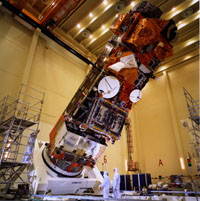
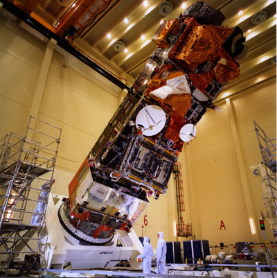
Envisat in the clean room at ESA's test facilities at ESTEC, Noordwijk,spring 2001
Last month the European Space Agency's new Earth-observing satellite, Envisat, was transported from the European Space Research and Technology Center (ESTEC) in Noordwijk, The Netherlands, to Europe's spaceport in Kourou, French Guiana (South America) on board an Antonov 124 - the only transport aircraft large enough to accommodate the 10-meter tall, 8-tonne satellite! Engineers are now busy preparing the satellite for launch (tentatively scheduled for 2 October, 2001) aboard an Ariane-5 rocket. Envisat is the biggest and most complex Earth observation satellite ever built, with a unique combination of sensors that will vastly improve the range and accuracy of scientific measurements of the atmosphere, oceans, land surface and ice. Among the satellite's ten highly sophisticated instruments is a new Medium Resolution Imaging Spectrometer (MERIS) for monitoring ocean colour and vegetation. Data gathered from the satellite's ten instruments will be transmitted down to ESA's ground stations and will become available to the general scientific and research community after an initial six month commissioning phase.
KDD Services at the GES DAAC
 The Goddard Earth Sciences (GES) Distributed Active Archive Center (DAAC) have recently developed a technique known as "knowledge discovery from data bases" (KDD) to extract subsets of data from large satellite data sets in order to reduce the volume of shipped data. This is especially useful for researchers who would like to search the archived data for specific phenomena or where researchers would like to supply their own KDD algorithms. A prototype system was developed and tested with cooperation and funding from the TRMM (Tropical Rainfall Measuring Mission) Program using a variety of algorithms from several investigators. The data volume reduction factors ranged from a factor of 3 to about 40. According to Steve Kempler, Head of the Goddard Earth Sciences Data and Information Services Center, the present KDD system is a prototype and is expected to improve and also to expand to accommodate MODIS data. Inquiries about future KDD efforts for MODIS Level 1 and Ocean and Atmospheric science products should be sent to Bruce Vollmer (vollmer@daac.gsfc.nasa.gov)
MODIS Data Support

Level 4 Oceans Data. Four new MODIS Level 4 'Ocean' products were recently released by the DAAC (Level 4 products are model outputs or results from analyses of lower level data i.e. variables derived from multiple measurements). These include:
- binned 4.6 km weekly (8-day) ocean productivity indices in the Integerized Sinusoidal Equal Area projection
- mapped 4.6 km semi-analytical weekly ocean primary production in the Cylindrical Equidistant projection
- mapped 36 km semi-analytical weekly ocean primary production in the Cylindrical Equidistant projection
- mapped 1 degree semi-analytical weekly ocean primary production in the Cylindrical Equidistant projection
For more information on the above products please visit the DAAC MODIS data information and access site.
Workshops & Conferences
- Pan Ocean Remote Sensing Conference - PORSEC 2002
3 - 6 September, 2002, Bali Island, Indonesia.
Please consult the First Announcement for more information on the conference.
- Underwater Optics 6
9th October 2001, The Institute of Physics, London, UK
Please consult the First Announcement and Call for Papers for more information on the workshop.
|
|
Aqua launch update
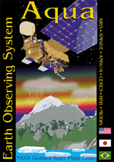 NASA's Earth Observing System (EOS) launch review committee recently announced that the launch of Aqua, originally scheduled for July 12, 2001, would take place no earlier than January 30, 2002. The focus for the Aqua Project is the multi-disciplinary study of the Earth's Interrelated Processes (atmosphere, oceans, and land surface) and their relationship to earth system changes. One of the six instruments to be carried onboard Aqua is a another MODIS ocean-colour sensor which will measure ocean colour as well as cloud and aerosol properties, vegetation dynamics, land and sea surface temperature; fire occurrence and snow cover etc. The MODIS data support team will begin production of merged MODIS-Terra and MODIS-Aqua daily products six to nine months following the launch of Aqua. NASA's Earth Observing System (EOS) launch review committee recently announced that the launch of Aqua, originally scheduled for July 12, 2001, would take place no earlier than January 30, 2002. The focus for the Aqua Project is the multi-disciplinary study of the Earth's Interrelated Processes (atmosphere, oceans, and land surface) and their relationship to earth system changes. One of the six instruments to be carried onboard Aqua is a another MODIS ocean-colour sensor which will measure ocean colour as well as cloud and aerosol properties, vegetation dynamics, land and sea surface temperature; fire occurrence and snow cover etc. The MODIS data support team will begin production of merged MODIS-Terra and MODIS-Aqua daily products six to nine months following the launch of Aqua.
HY-1 launch
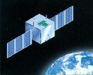 The launch of the Chinese HY-1 satellite (HaiYang 1) carrying the Chinese Ocean Colour and Temperature Scanner, originally scheduled for May this year, has been delayed by a few months to September, 2001. The launch of the Chinese HY-1 satellite (HaiYang 1) carrying the Chinese Ocean Colour and Temperature Scanner, originally scheduled for May this year, has been delayed by a few months to September, 2001.
SeaWiFS Science Focus Pages
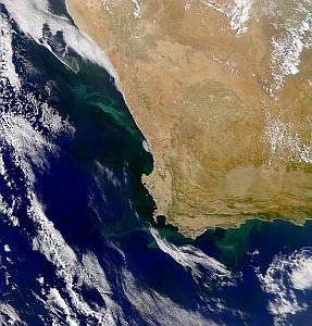
 The SeaWiFS "Science Focus" pages, produced by the Goddard DAAC Ocean Color Data Support Team, highlight notable events or remarkable SeaWiFS images and provide a brief discussion on the underlying scientific principles that create or are illustrated by the observed phenomena. The latest volume of the Science Focus series (Volume III) features an excellent article by James Acker on SeaWiFS data analysis from Level 1A to Level 2 using flags and masks to look for particular conditions. The article entitled 'More than Meets the Eye' is not intended to provide a complete tutorial on SeaWiFS data processing and data analysis, but rather to demonstrate that researchers can gain a much improved understanding of the oceanic environment using data from a sophisticated remote sensing instrument in combination with data analysis tools. Volume III also features spectacular images of Ethiopia, The Red Sea and the Nile River, as well as an article on SeaWiFS and Global Warming. To view these, and other articles please consult the Science Focus page on the Goddard DAAC website or write to James Acker at acker@daac.gsfc.nasa.gov. The SeaWiFS "Science Focus" pages, produced by the Goddard DAAC Ocean Color Data Support Team, highlight notable events or remarkable SeaWiFS images and provide a brief discussion on the underlying scientific principles that create or are illustrated by the observed phenomena. The latest volume of the Science Focus series (Volume III) features an excellent article by James Acker on SeaWiFS data analysis from Level 1A to Level 2 using flags and masks to look for particular conditions. The article entitled 'More than Meets the Eye' is not intended to provide a complete tutorial on SeaWiFS data processing and data analysis, but rather to demonstrate that researchers can gain a much improved understanding of the oceanic environment using data from a sophisticated remote sensing instrument in combination with data analysis tools. Volume III also features spectacular images of Ethiopia, The Red Sea and the Nile River, as well as an article on SeaWiFS and Global Warming. To view these, and other articles please consult the Science Focus page on the Goddard DAAC website or write to James Acker at acker@daac.gsfc.nasa.gov.
More from the SeaWiFS Project.....
- New Receiving Sations
The SeaWIFS Project recently reported that several new SeaWIFS receiving stations have been established including one in the Azores, Israel, and Bahrain; work continues on establishing one in the Galapagos Islands in collaboration with the Charles Darwin Foundation.
- PAR Validated
The new SeaWiFS evaluation PAR product (photosynthetically available radiation) has been validated through the efforts of the staff members from the SeaWiFS and SIMBIOS Projects and Dr. Robert Frouin from Scripps. These products now being sent to the Goddard DAAC for archiving and distribution.
- OCTS data processed by SeaWiFS
Operational processing of the global OCTS data set is now possible using SeaWiFS processing methods. The eight months of OCTS data (November 1997 through June
1998) will eventually be distributed and archived at the Goddard DAAC.
News from the SIMBIOS Project
- OSMI
Significant progress has been made on the calibration of the Korean Ocean Scanning
Multispectral Imager (OSMI), with the development of an OSMI to SeaWIFS vicarious intercalibration. The next steps will be to resolve the issue of aerosol model selection, and to evaluate the stability of the calibration at other times and locations. The SIMBIOS project will meet with Dr. Paik, director of the Korean Aerospace Research Institute (KARI) to maximize the OSMI global data collection.
- MOS
SeaWiFS-MOS matchups from 1998-March 2001 were regenerated. A preliminary comparison of reflectances shows no substantial trends between the two sensors; however, bands 2, 4, and 5 were slightly lower in MOS and band 3 was slightly higher. Scripts and procedures were developed to invert the atmospheric correction process to show the MOS-to-SeaWiFS comparison in terms of top-of-the-atmosphere intercalibration gain over time. This work was presented at the 4th MOS Workshop in Berlin on Ocean Remote Sensing (May 2001).
Employment opportunities
Two new employment opportunities are available at NASA's Goddard Space Flight Center, plus a post-doctoral research fellowship at the US Geological Survey (USGS). Please see our Employment Page for further details.
Visitors to IOCCG web site
A record number of 3,547 visitors accessed the IOCCG web site in May this year!
|