|
|
|
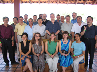
The 10th annual IOCCG Committee meeting took place on Margarita Island, Venezuela from 19-21 January 2005 and was attended by 25 participants, representing various Space Agencies and Research Institutes. The final minutes of the meeting will be posted on the IOCCG website in due course. Activities of the six current IOCCG working groups (see
Another issue that arose during the meeting was the use of the term "ocean colour" as a descriptor for our area of science. Many Committee members were of the opinion that it differed from the terms applied in other areas of ocean remote sensing (such as SST, SSH) in that it is rather vague and is not immediately recognisable as a quantitative entity. After much discussion, the Committee proposed a new name for ocean colour: Sea Spectral Reflectance (SSR). Subsequently, a survey was carried out to solicit comments from the ocean-colour community. The results of the survey were rather interesting: 43% of respondents were in favour of the new name, while 19% were opposed and 38% preferred alternative acronyms. It was brought to our attention that SSR was already used by many in the remote sensing field to mean Sea Surface Roughness, as associated with SAR data. It was also noted that "reflectance" is an intermediate product, and not a geophysical product recognizable by other scientists. Several repondents suggested the term "Water Spectral Reflectance" (WSR) to accommodate inland waters. Other proposals for new names included: Chlorophyll, Ocean Chlorophyll, Quantitative Ocean Colour (QOC), Quantitative Water Colour (QWC), Sea Surface Radiance (SSR), Sea Surface Reflectance (SSR), Sea Surface Spectral Reflectance (SSSR), Sea Surface Colour (SSC), Sea Surface Biology (SSB), Sea Surface Optical Properties (SSOP), Sea Optical Properties (SOP), Ocean Visible Radiance (OVR), Optical Remote Sensing of Estuarine and Marine Environments (ORSEME) and USSR (Upwelling Sea Spectral Reflectance), to mention but a few! These proposals will be addressed by the IOCCG Committee at a later stage.
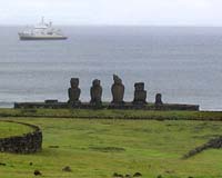
A second ANTARES workshop recently took place on Margarita Island, Venezuela from 11-15 January 2005. The workshop was co-sponsored by IOCCG, and was attended by 17 participants from Latin America. ANTARES is a collaborative network in South America, established in 2003 with IOCCG support. The goal of the network is to study long-term changes in coastal ecosystems, to distinguish those due to natural variability from those due to external perturbations (climate change and anthropogenic effects). An integrated database of field measurements and ocean-colour satellite images from the entire South American coastal zone is being developed by the group. Measurements carried out at a number of existing time-series stations around South America are being standardized, and an interactive database of existing satellite ocean-colour imagery is being developed through the CESAR project. Discussions at the second workshop focussed on the CESAR project, as well as on updates from the various time-series stations around South America. In addition, protocols and instrumentation used at the various time-series stations were discussed, and major long-term scientific objectives of the ANTARES network were revised.
The IOCCG working group on "Coordination of Merged Data Sets", co-chaired by Drs. Watson Gregg and Paula Bontempi of NASA, will hold a workshop on 10-11 May 2005 in Washington DC. The group will meet to define data and knowledge requirements, assessment methodology, and possible approaches (with strengths and weaknesses) for merging coincident ocean-colour data from multiple sensors. The working group also intends to prepare an IOCCG report on data-merging, the various chapters of which will be discussed at the workshop. The report will cover a number of topics, including the benefits of merging data from different missions, what missions are available and overlapping, knowledge requirements for merging, output requirements, products to be merged (just chl or also nLw, PAR etc.), a survey of possible methodologies, and what is needed to achieve success that is not being done.
The IOCCG Fellowship Programme is aimed at providing young scientists from developing countries with the opportunity for gaining valuable training experience in the field of satellite ocean colour. Funds are provided for recipients to travel to an institute outside their home country to work with experts in the field. Four Fellowships were awared for the 2004/2005 period, and the first student to take up the Fellowship was Caiyun Zhang from Xiamen University, China. She is currently working with Dr. Chuanmin Hu at the Institute for Marine Remote Sensing, Univeristy of South Florida, USA studying the interannual and decadal variability of coastal upwelling in the South China Sea using data from the CZCS, SeaWiFS and MODIS sensors. The next student to take up an IOCCG Fellowship will be Gustavo Martínez from Nacional de Recursos Acuaticos in Montevideo, Uruguay. He will be working with Dr. Robert Frouin at the Scripps Institution of Oceanography, California in April to process radiometric data collected during the BEAGLE 2003 cruise.
Around 60 nations and more than 40 international organisations participated in the Third Earth Observation summit on 16 February 2005 in Brussels. The EO Summit took place within the context of Earth and Space Week, a major EU-ESA sponsored event. Assembled delegates at the summit formally agreed on a ten-year plan to implement a Global Earth Observation System of |
Systems (GEOSS). The plan summarises the steps that need to be taken to put a Global Earth Observation System of Systems in place. Building a GEOSS means bringing together numerous EO sources and datasets and creating a sustainable network for the distribution of data and information products and services. GEOSS aims to increase responsiveness to user needs and improve information delivery to users. The creation of a single, comprehensive and sustained system for Earth Observation could help countries to identify and address global environmental and economic challenges, including climate change and natural disasters.

A number of events were organised by the European Commission (EC) in collaboration with ESA to celebrate Europe's Earth and Space week, including a session on the joint initiative of the EC and ESA known as Global Monitoring for Environment and Security (GMES). This project is intended to provide an independent European capability for global environmental monitoring by combining all available ground and space data sources. GMES will be the European contribution to GEOSS and will make better use of satellites that already exist, blending the data together, and along with numerical models, will enable forecasting. ESA currently has 12 GMES services up and running and the next step will be developing a series of dedicated spacecraft known as Sentinels to ensure long-term data continuity. Five Sentinels are currently planned: the first one radar-based, the second hyperspectral, the third dedicated to ocean monitoring and the final two for atmospheric monitoring. Sentinel-3 will carry the VIRI sensor (operating in the visible to infrared) which will be the follow-on to the MERIS mission. The sentinel missions will be classed as 'operational' as opposed to scientific, comparable in status to weather satellites.
CNES's PARASOL micro satellite was launched on 18 December 2004 on-board an ArianeV launcher. The satellite, its instruments and the ground-based systems are working well, and the first images were obtained on 6 January 2005. PARASOL is carrying an instrument similar to the POLDER-II ocean-colour sensor. The mission will focus on characterisation of radiative and microphysical properties of clouds and aerosols, and will also be used for ocean-colour observations. The satellite has been in routine acquisition mode since 10 January, and the commissioning phase, associated with the first cal/val period, will last until early March 2005.
The Ocean Biology Processing Group (OBPG) recently completed the MODIS/Aqua reprocessing in a record time of one week for the entire mission (July 2002 - present). Changes include updated instrument calibration, updated atmospheric tables and minor enhancements to the atmospheric algorithms, as well as modifications to the definition of normalized water leaving radiance (nLw). Several new products have been incorporated into the Multi-Sensor Level-1 to Level-2 (MSL12) processing code, including chlorophyll fluorescence and supporting products. All the Level-2 and daily Level-3 products are now available for browse and order from the oceancolor web, apart from the remaining higher level (weekly and up) Level-3 products, which should be available on the browser over the next couple of days. A new feature has also been added to the level-1/2 browser on the oceancolor web for data collected starting on Saturday, 19 February 2005. A true colour browse image is now provided along with the chlorophyll and SST browse file to help the user better understand why certain portions of the image did not produce valid geophysical retrievals.
The French vessel L'Atalante recently completed the BIOSOPE (Biogeochemistry and Optics South Pacific Experiment) research cruise through the heart of the South Pacific Ocean, one of the most oligotrophic areas of the world ocean. The cruise set off from Tahiti in mid October 2004, and travelled across the Pacific, reaching Concepción (Chile) in mid-December. An international team of 45 researchers investigated the biogeochemical and optical properties of different trophic regimes of the South East Pacific ocean, and especially the oligotrophic area associated to the central part of the South Pacific Gyre (SPG). Within this gyre, surface chlorophyll concentrations are generally less than 0.03 mg m-3. These waters are among the clearest in the world ocean, with high reflectance in the shortest wavelength of the spectrum, including the near ultraviolet. Samples for the third SeaWiFS HPLC Analysis Round Robin Exercise (SeaHARRE-3) were also collected during the cruise to test applications to extremely low chlorophyll-a concentrations. The expedition used daily ocean-colour composite images from the MERIS and MODIS sensors to facilitate accurate selection of sampling stations. The images were also helpful in deciding the ship's course. Scientists measured the bio-optical properties of water down to a variety of depths, along with atmospheric conditions, timing their observations with overpasses of the ocean-colour satellites, in support of calibration and validation activities. By better determining the relationship between chlorophyll and marine optical properties, BIOSOPE results promise to improve the quality of future ocean-colour algorithms.
Several new job opportunities in the field of ocean colour have been posted on the IOCCG Empolyment Opportunities webpage, including a 3-year Research Assistant & Assistant Project Manager position at Laboratoire d'Océanographie de Villefranche (LOV) in France, within the BOUSSOLE Project. The main goals of this project are fundamental bio-optics research and calibration/validation activities for satellite ocean-colour sensors, centered around the development, deployment, and maintenance of a deep-sea mooring. |
|
|
Material for possible inclusion in the IOCCG Newsletter should be submitted to the Project Scientist. Subscription to the IOCCG Mailing List.
|
|
|
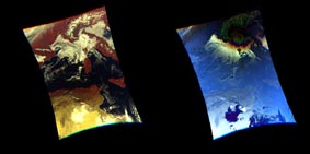 Images acquired by PARASOL on 12 January 2005, in the area of Italy (raw data). Credit: CNES