
|
|
|
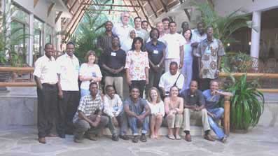
The EU Joint Research Centre (Italy) recently conducted a very successful ocean-colour training course in Mombasa, Kenya for 18 students from various countries in Africa and western Indian Ocean Islands. A number of international organisations provided sponsorship for the course, including the IOCCG who sponsored two students (Kwame Agyekum from Ghana, Lisl Robertson from South Africa).
The course consisted of a series of lectures given by R. Doerffer, S. Bernard, A. Bricaud, M. Dowell, N. Hoepffner, M. Kyewalyanga, N. Hardman-Mountford, S. Andrefouet, L. Scott and S. Djavidnia as well as practical sessions using image processing software such as Envisat-BEAM (trainer: R. Doerffer, GKSS, Germany), BILKO (trainer: V. Byfield, SOC, UK), and SeaDAS (trainer: C. Whittle, UCT, South Africa). Students also conducted ‘mini-projects’ to apply their recently gained knowledge to various themes related to oceanographic issues of their home country (e.g. Influence of river discharges on coastal waters along Ivory Coast). A full report of the training course can be found at:
A new IOCCG working group, chaired by Dr. Hervé Claustre (LOV, France) was recently formed to evaluate the feasibility of equipping Argo floats with bio-optical sensors. The international Argo project currently has an array of about 3,000 floats deployed in the world ocean, and has proven to be an invaluable tool in modern physical oceanography by providing systematic measurements of the temperature and salinity of the upper ocean. Argo is playing a key role in ocean monitoring and forecasting systems, as well as water mass circulation. Discussions are now underway to implement Argo floats with small bio-optical sensors to measure chlorophyll, Kd etc. These floats would be able to provide 3-D information not attainable by satellite platforms, and would also be able to determine near-surface properties when observations from space are impeded by cloud cover. Furthermore, these measurements could be used for validation of ocean-colour satellite sensors and for the interpretation of optical properties in terms of relevant biogeochemical parameters. The BIO-Argo working group will consist of about 8 international members from France, USA, Italy, Chile, South Africa and Japan. The first meeting of the group is scheduled to take place from 7-9 February 2008, in Villefranche, France. Further information on the group can be found at: http://www.ioccg.org/groups/argo.html.
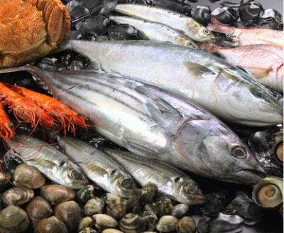
Applications of Remote Sensing to Fisheries
Remote sensing of ocean colour is emerging as an important tool for application to problems in fisheries research and management. In recognition of this, the Group on Earth Observations (GEO) has established Task AG-06-02 to identify opportunities for enhanced utilization of Earth observations in fisheries and aquaculture. A new element of the Task is the project SAFARI (Societal Applications in Fisheries and Aquaculture using Remote Sensing Imagery) under the leadership of Dr. Trevor Platt (DFO, Canada) and funded by the Canadian Space Agency. The first activity of SAFARI will be a workshop, to be held in Halifax, Canada from 26-28 March 2008. The purpose of the workshop is to review progress in the applications of ocean-colour remote sensing to fisheries, to develop new initiatives on the topic, to facilitate international collaboration and to plan the writing of a monograph on ocean colour and fisheries that will be published by the IOCCG. It is expected that this will be a milestone meeting. For more information please contract Dr. Trevor Platt (tplatt@dal.ca). A website for the project is currently under contstuction (see http://www.geosafari.org)
Several new positions have been added to the Employment Opportunities section of the IOCCG web page, including a Research Scientist position at CSIRO (Australia), and an ocean colour position at NIWA (New Zealand). |
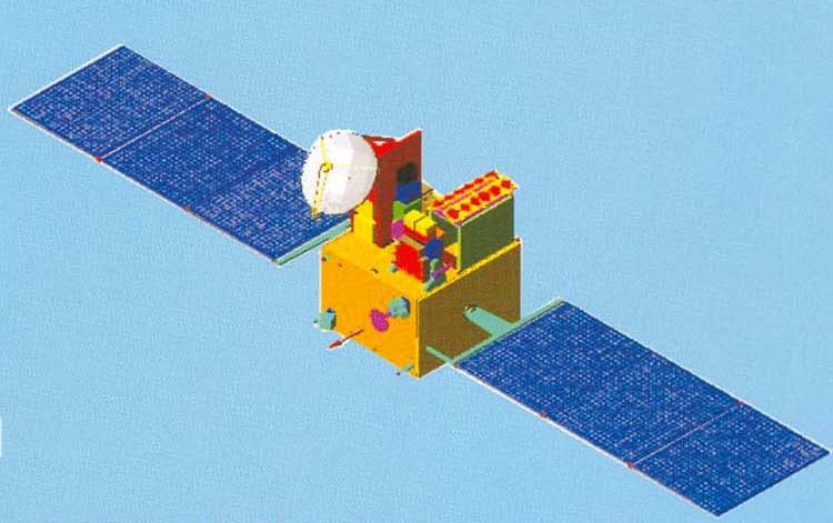
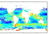
In May 1999 the Indian Space Research Organisation (ISRO) launched its first dedicated mission for applications of ocean studies and meteorology, called IRS-P4 (Oceansat-1). One of the payloads was the Ocean Colour Monitor (OCM) which is still being used routinely, and very successfully, for identification of Potential Fishing Zones (PFZ) in the Arabian Sea and Bay of Bengal. The Oceansat-2 mission, scheduled for launch in early 2008 with a mission life of at least 5 years, will provide in-orbit replacement for Oceansat-1 and will carry three payloads i.e. an Ocean Colour Monitor (OCM), a Ku-band Scatterometer (SCAT), and a Radio Occultation Sounder for Atmospheric studies (ROSA). The configuration of the OCM payload on Oceansat-2 (an 8-band multi-spectral camera with a swath of 1,420 km) is identical to the one flown on IRS-P4 except for Bands 6 and 7. For Band-6, the central wavelength is shifted from 670 nm to 620 nm to take advantage of the improved reflectance from suspended sediments, and for Band-7, the central wavelength is shifted from 760 to 740 nm to avoid oxygen absorption. Oceansat-2 will provide two types of data: Local Area Coverage (LAC) at 360 m resolution and Global Area Coverage (GAC) at 1-km and 4-km resolution. It is envisaged that the 4-km GAC data will be provided over the internet, while the 1-km GAC data will be provided on a selective basis to the users. For further information on the Oceansat-2 mission, please see Oceansat-2 brochure.
A study is being conducted to compare models that estimate primary productivity (PP), either from ocean-colour based models or from biogeochemical ocean circulation models, with funding from NASA’s Ocean Biology and Biogeochemistry Program. This project continues previous Primary Production Algorithm Round Robins (PPARR). The third round-robin study, PPARR3, included over 30 investigators running ~20 distinct satellite-based PP models, or model variants, and 9 coupled biogeochemical ocean circulation models. The fourth round robin study (PPARR4) includes comparisons to high quality in situ primary productivity data, including HNLC conditions, intense bloom dynamics, oligotrophy, coastal dynamics, micronutrient limitation, and high latitude systems. This broad array of environmental conditions will allow a comprehensive assessment of model estimates of PP, and their associated uncertainties. For further information on PPARR4 project please view full announcement, or write to Marjy Friedrichs (marjy@vims.edu).
The authors found that turbidity could be estimated with a simple algorithm that is relatively stable from year to year, and possibly site-independent under certain circumstances. The MODIS data provided an improved representation of the monthly “mean” state of turbidity across Tampa Bay, as well as of seasonal and inter-annual variability. Water clarity was estimated using a two-step process: first Kd(490) was computed from SeaWiFS data using a semi-analytical algorithm, and then Secchi Disk Depth (SDD) was calculated using an empirical relationship with Kd(490). Overall, SeaWiFS SDD estimates were consistent with in situ SDD, although the former showed more pronounced seasonal and interannual variability that is not captured by the in situ SDD, which was only sampled once per month. Both studies concluded that satellite data from sensors such SeaWiFS and MODIS are important complements of traditional in situ water quality surveys, because of the repeated, frequent, and synoptic coverage provided by satellite data. The authors recommended incorporation of satellite data for operational monitoring of water quality in coastal regions and estuarine waters, to help manage these resources more effectively. |
|
|
Material for possible inclusion in the IOCCG Newsletter should be submitted to the Project Scientist. Subscription to the IOCCG Mailing List.Participants receive a brief summary of the IOCCG Newsletter by e-mail (quarterly), as well as hard copies of IOCCG Reports as, and when, they become available.
|
|
|
 Several new references have been added to the